It’s been another great day and much more laid back. Probably covered less than 100 miles today, largely in Custer State Park. We got another early start and really appreciated heated gear and handgrips this morning. The smoke haze was noticably worse today and photography was limited, but traffic was lighter and the ride was fantastic.
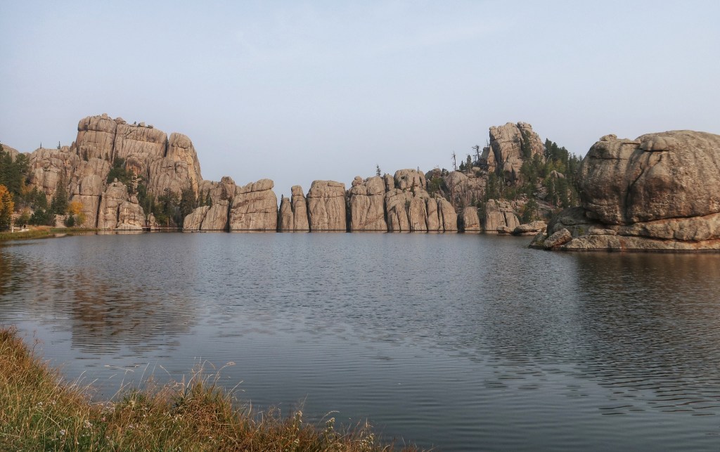
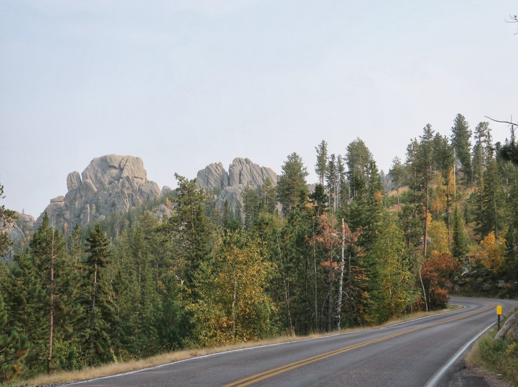
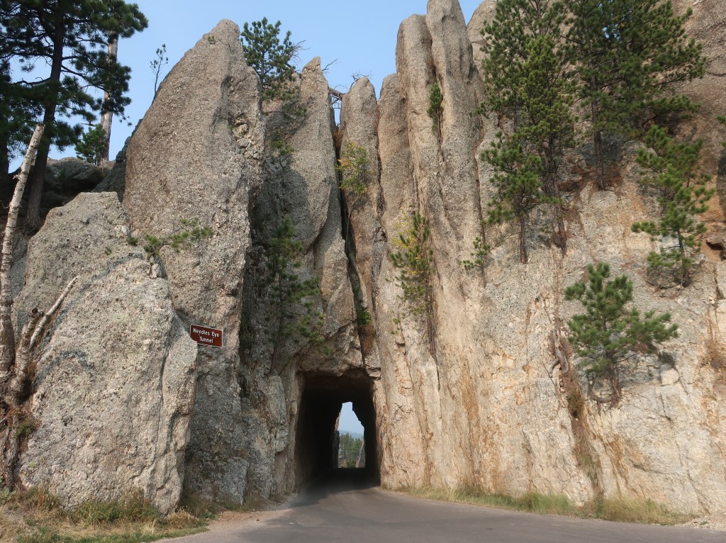
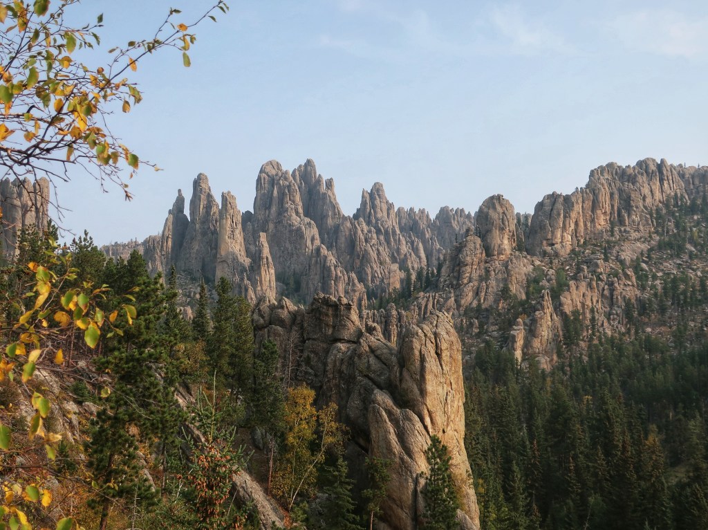
Went by Sylvan Lake and entered the park on the Needles Highway. The road snakes it’s way through the granite spires and rock formations covering this area. There are three tight one-lane tunnels to pass through thus “threading the eye of the needle”. I did break out the GoPro so I hope to be able to post some video later. The road is unbelievable!
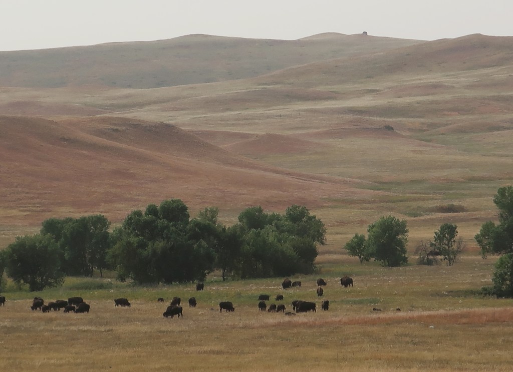
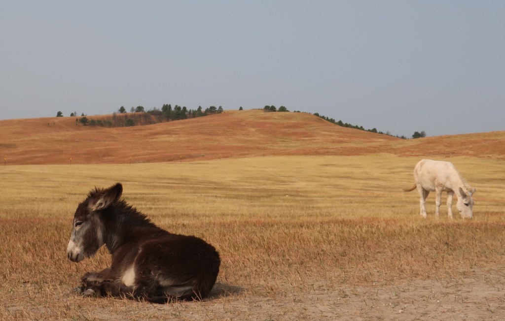
From Needles, we caught the wildlife loop through Custer State Park. Saw one of the buffalo herds, the wild burros (they actually aren’t very wild anymore), and pronghorn antelope. The burros actually we’re poking their heads in people’s cars looking for food. Two little ones were sacked out flat on the ground while people walked around them taking pictures. The buffalo herd was well off the road, but we have encountered lone bulls three times now on roads in the general park.
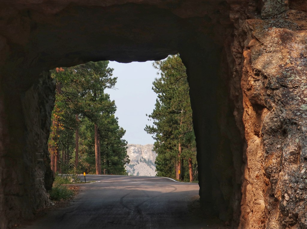
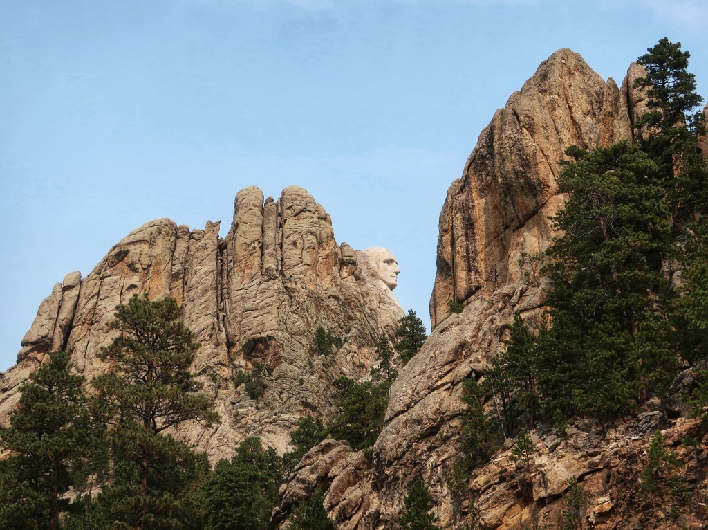
We ran over Iron Mountain Road, another fantastic road and I believe my favorite. It has a nice sinuous flow and a few tunnels of it’s own. Our most recent encounter with a bison bull came on this road. I swooped around a blind curve and was staring at one massive butt in the middle of my lane! Fortunately we had time to stop as I’m sure his wrath would have hurt worse than the initial impact. He gradually meandered off the opposite side and we eased on by. The road leaves the park and heads towards Mount Rushmore. You are looking straight on at the famous heads going through two of the three tunnels. The other thing Iron Mountain Road is famous for is the pigtail bridges. These are basically 360 degree spiral wood trussle bridges to drop the road elevation while disturbing the landscape as little as possible. I couldn’t safely get a picture of one so try Google if you are curious.
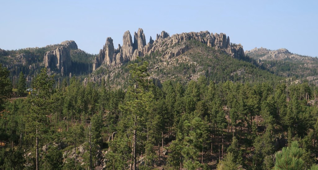
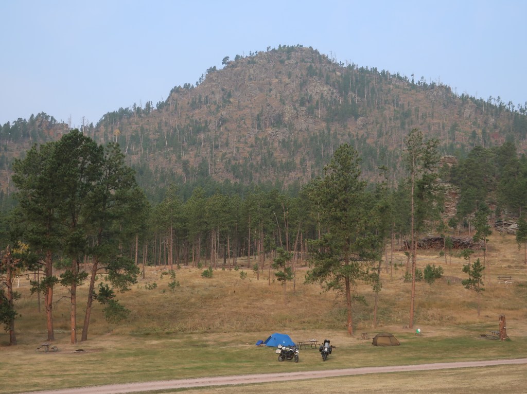
Made it back to camp early and enjoyed our final evening in the Black Hills. The Black Hills are not actually black. The name comes from the Lakota. Due to the thick growth of pine trees, the hills look very dark from a distance and in stark contrast to the surrounding landscape. Also, these are not really hills but mountains. Black Elk Peak has an elevation of 7,244 feet making it the highest point east of the Rockies.

Great pictures!! Enjoying being able to tag along.. Sue W.
LikeLike