We spent most of the day in Iowa, a little in Missouri, and we are in Jacksonville Illinois tonight. As we head east, the sky seams to be shrinking and we’re losing daylight riding against the sun.
A replica of the keelboat used on the Lewis and Clark expedition. Much larger than I imagined at 85 feet in length. No one knows what became of the original. This is at the Lewis and Clark State Park in Onawa Iowa at the edge of the Omaha reservation. Unfortunately, the museum/visitor center was closed for renovations.
The day started pretty but the afternoon was very wet, cold, and lasted too long. On the up side, a big bald eagle came flying up the road above us while we were riding towards a rainbow. That doesn’t happen every day!
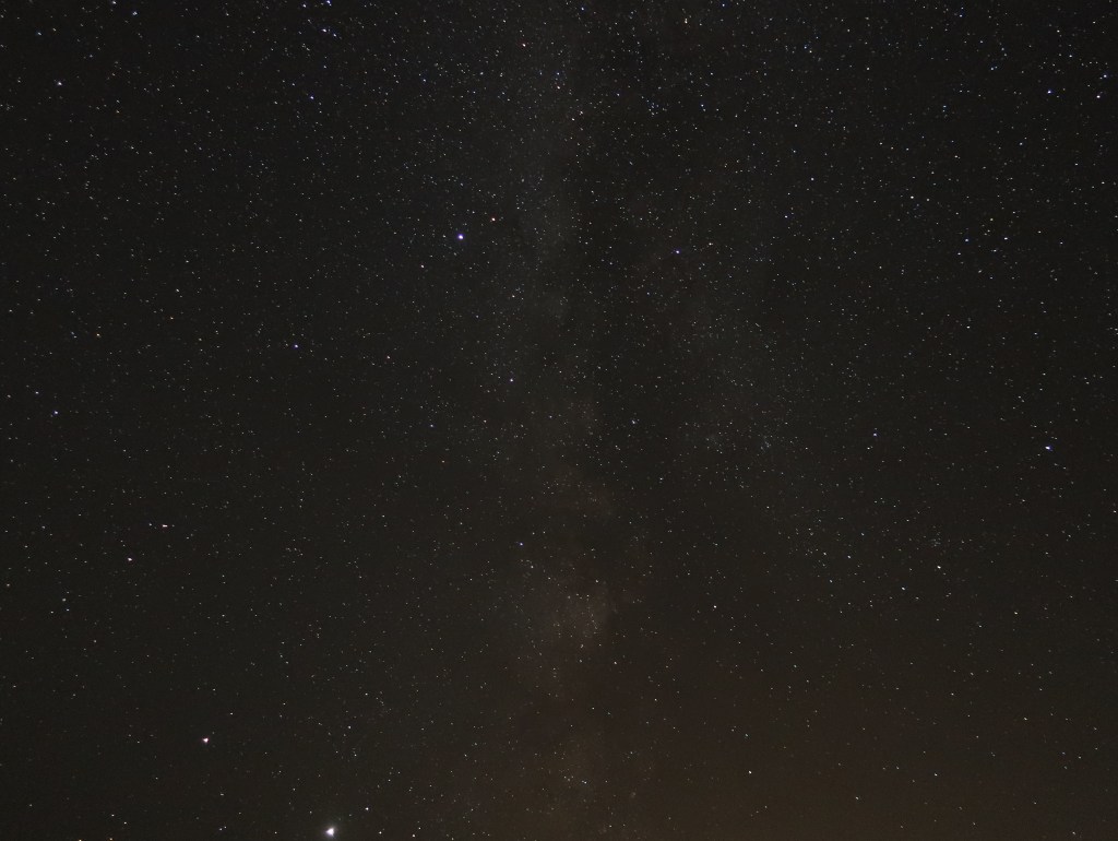
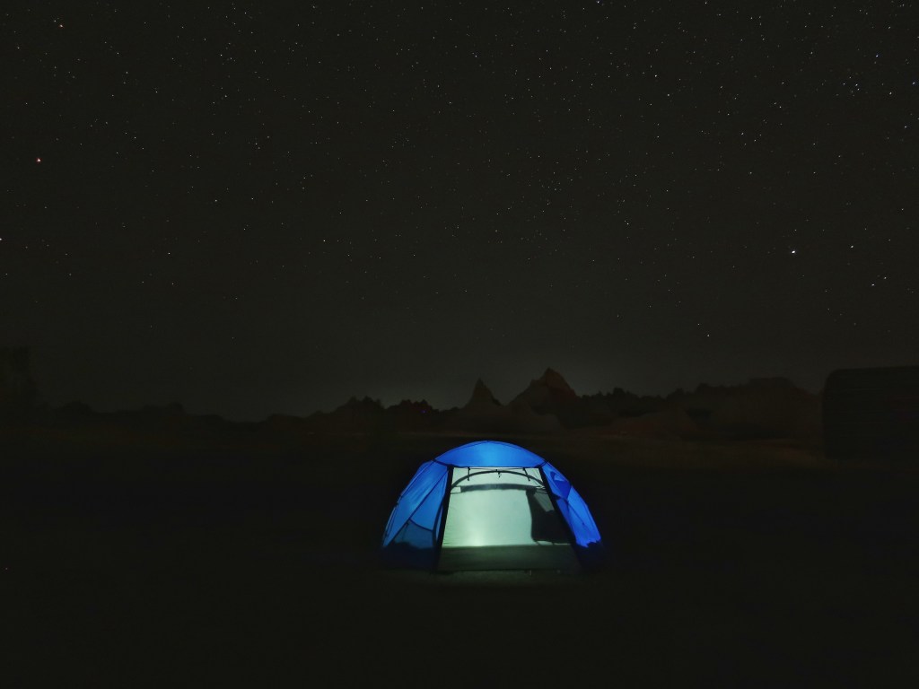
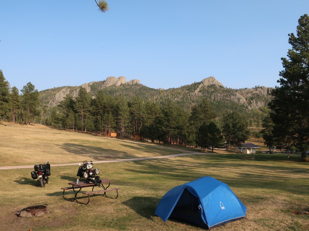
The night sky in the Black Hills was fantastic. We still have decent visibility at home, but nothing like here. Here are a few that I took outside my tent Tuesday night.
The Milky Way was very easy to spot. This is looking the same direction as my closing photo on Day 3’s blog post. The very bright object is Jupiter.And the same view but with star trails over a two hour period before the battery died. Again, the bright one is Jupiter.
Well, the trip is winding down. We should be home Sunday afternoon. Hate to see it end, but the last couple of days have worn on us.
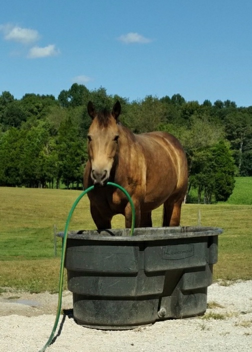
Buster, my newest ride, is helping Shelly with the chores while I’m away. For some reason, she doesn’t seem to appreciate the help especially when filling the water trough.
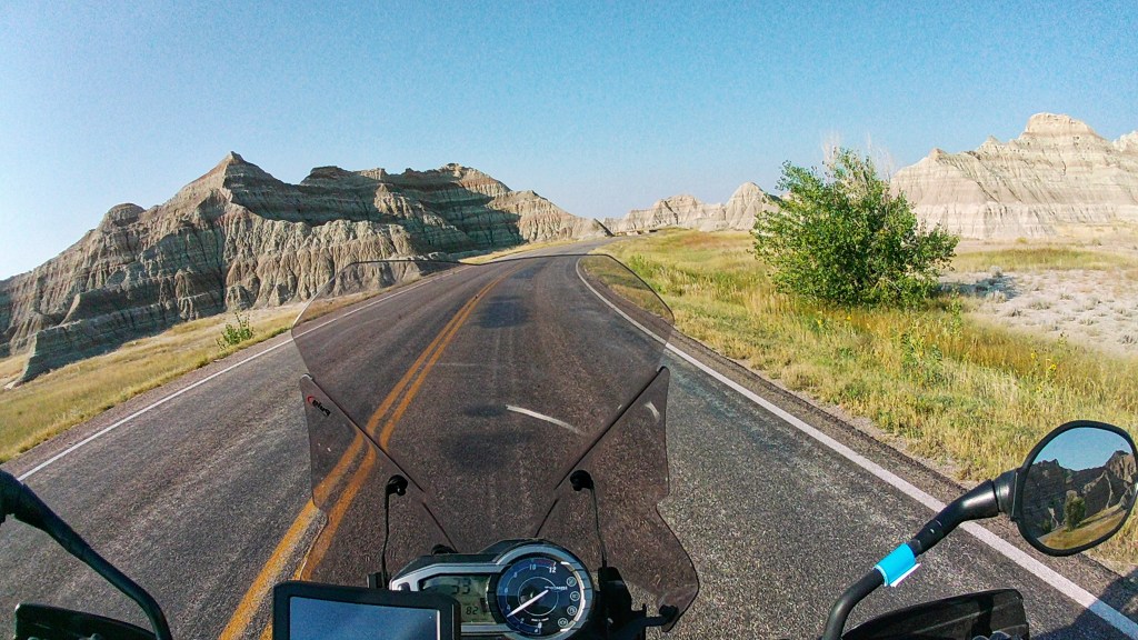
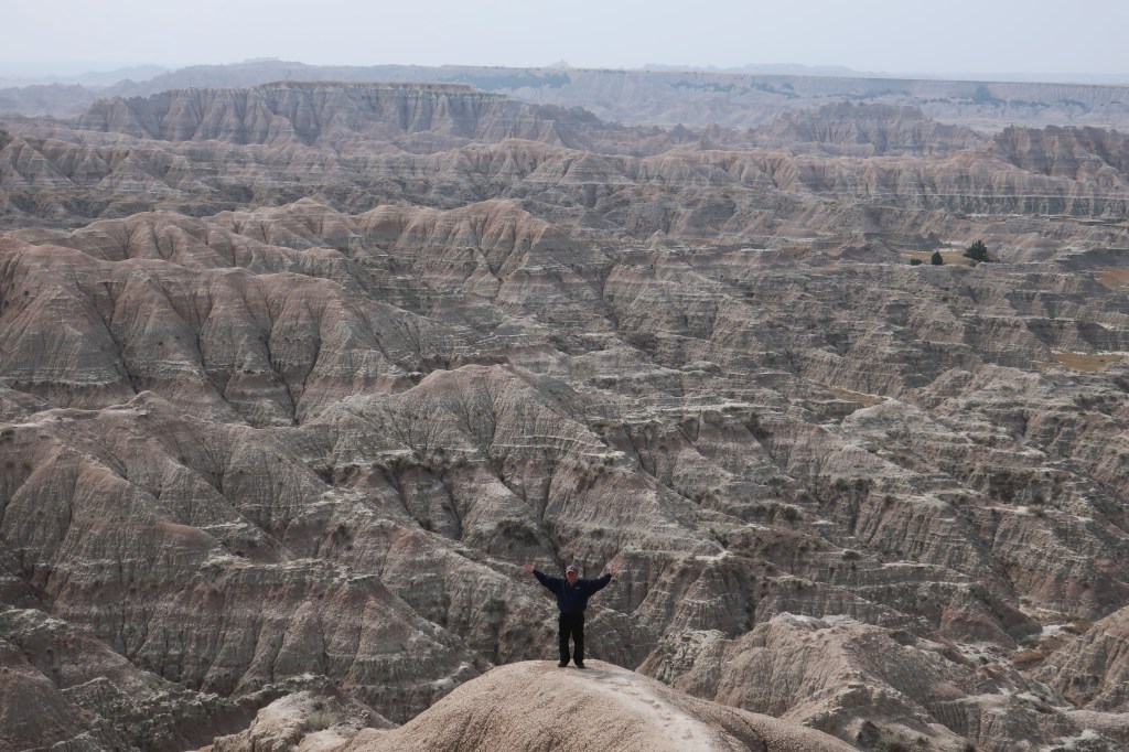
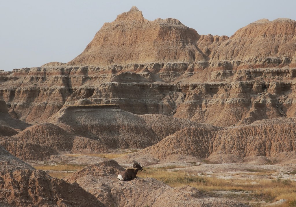
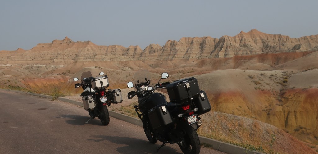
We awoke to clear skies today. Yeah! Spent a few hours in the Badlands before breaking camp and starting east. The Badlands are still one of my and Don’s favorite places. It is just so unworldly and unique. I didn’t charge my helmet cam since I wasn’t going to take many photos and I missed a couple of great shots. We idled through a small flock of bighorn sheep meandering in the road. I could have reached out and touched one. Then a half mile later were 3 beautiful big rams grazing the edge of the road. Extremely close and had a panoramic view of the Badlands behind them.
Before the camera died.
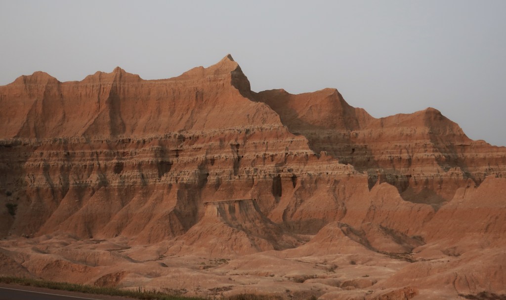
The Badlands are special. But if you visit, do plan on a morning and/or late afternoon-evening here. They are still amazing with the sun high in the sky, but it’s the changing light and shadows that really bring out the magic of this place.
We cut across the lower side of South Dakota on the two-lanes. The vastness and emptiness of parts of the West is just mind boggling. If you live east of the Mississippi and have never traveled the western plains, It is truly hard to comprehend just how open this land is. And such few people or towns. After six hard hours of running almost due east at 70 mph, we are still in South Dakota tonight, although just barely. North Sioux City is in South Dakota. Sioux City proper is Iowa. And now I’ll try to get some sleep with that Tom Petty song still in my head.
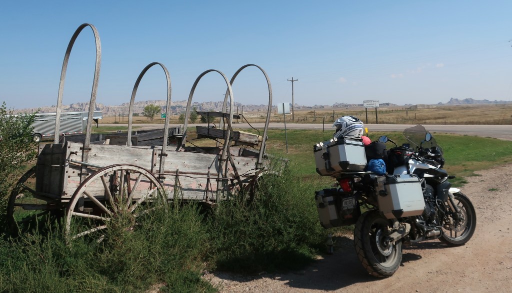
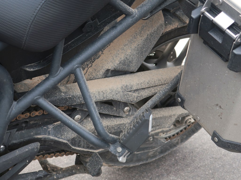
Looking like a true adventure bike now! I’m just not going to tell anyone it got that way on a highway.
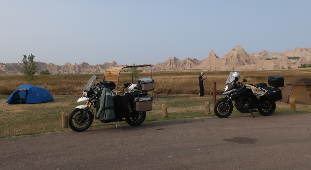
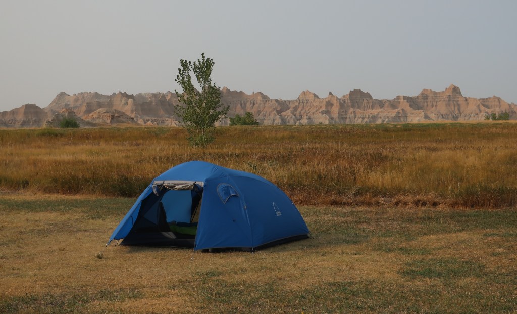
We are in Badlands National Park for the night. Didn’t get much sleep last night as the thunder and lightning made sleeping on the ground in a cloth bag somewhat unsettling. Heavy rains washed out the camp driveway making our departure from Horsethief a bit sketchy, especially for Don and the Battlestar Galactica as he refers to his 700 pound Honda. Don’t worry, he still has the VStrom, just chose the ST for this trip. We ran into road construction a few miles from the Badlands National Park too. The asphalt was gone and it was mostly dirt with a little gravel for a mile or so. Rained all night and was still raining today so it was kind of muddy. Don and the big Honda soldiered through. We are camped at Cedar Pass in the park and the weather is starting to clear a bit.
The bighorn may jump out in the picture but we almost walked by him without noticing. The Badlands are like no other place.
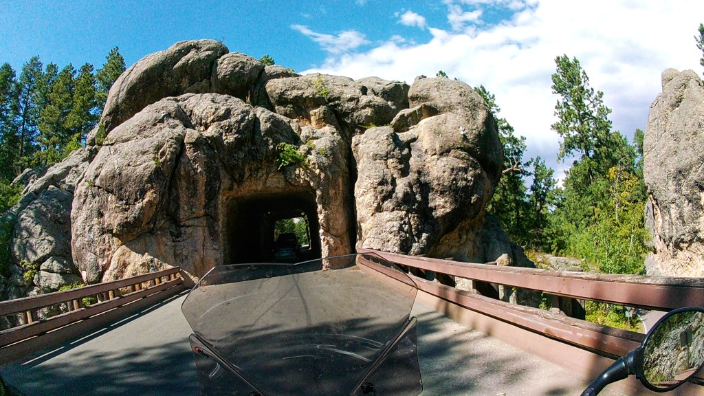
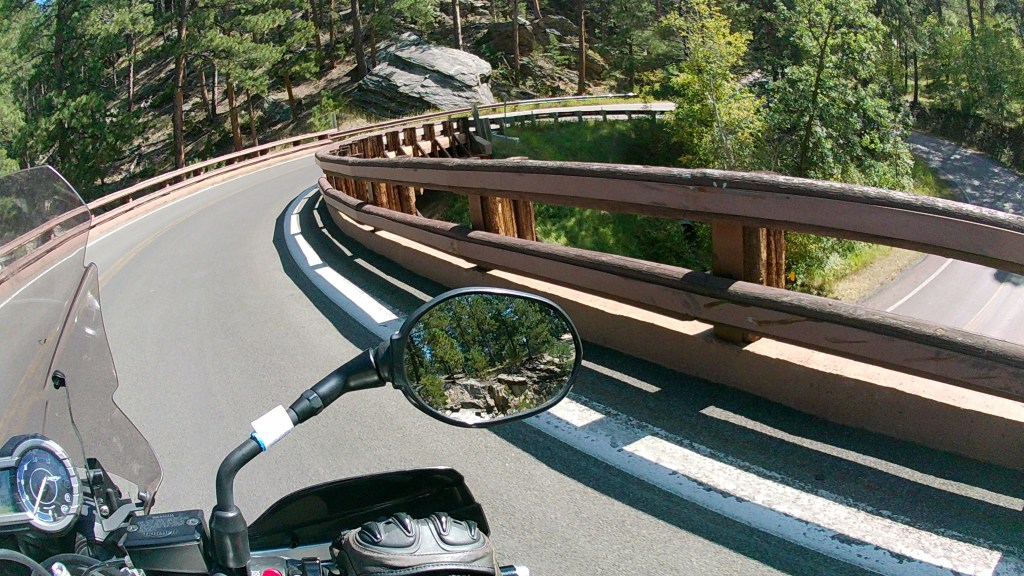
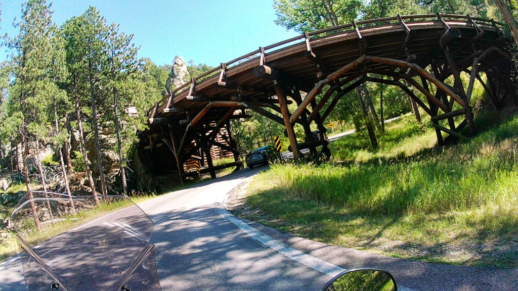
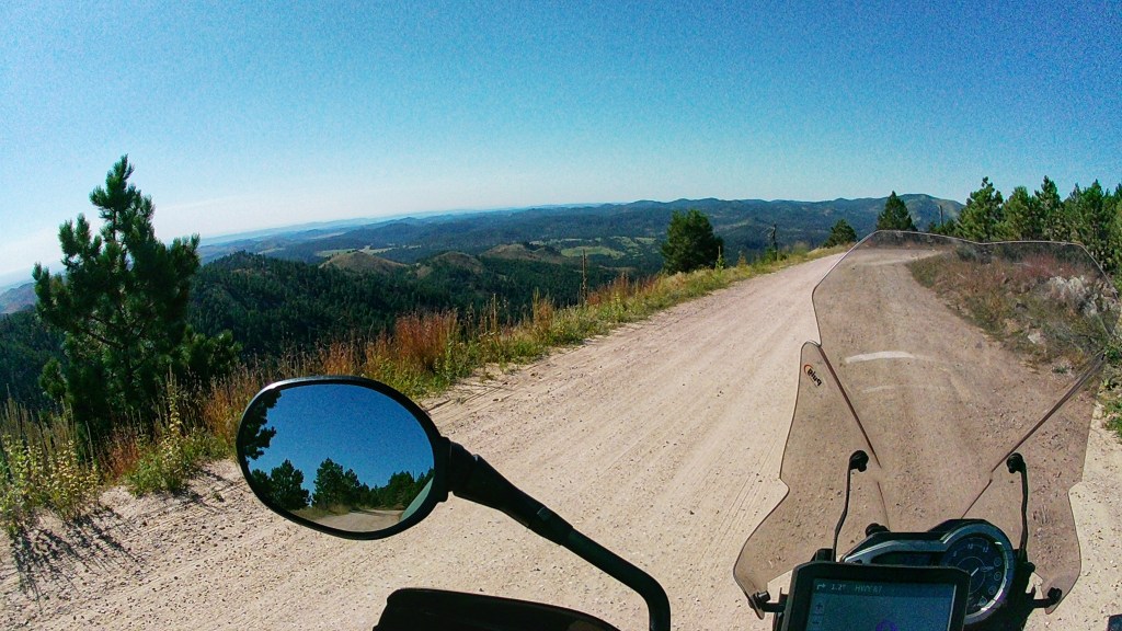
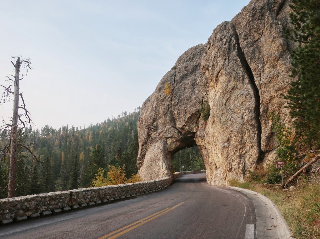
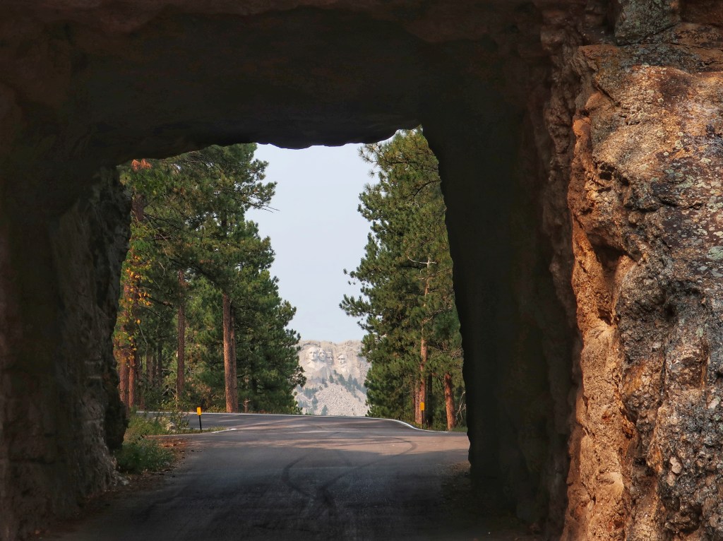
So, back to Iron Mountain Road and the pigtail bridges. If you remember from our previous trip, this road was constructed with the goal of disturbing this incredible landscape as little as possible. There’s several tunnels, lanes that separate to go through rock features before rejoining, and also many views of the Mount Rushmore monument in the distance. The purpose of the pigtail is to drop the road down the mountain with the smallest footprint needed. Thus they built a few of these wooden spirals to quickly drop elevation. I couldn’t get any pictures last time as there is no where to pull over. Got pics this trip!
One of the tunnels on Iron Mountain Road that frames Mount Rushmore.The pigtail bridge…I feel like I’m on a life-size Hot Wheels track!These things really are cool!
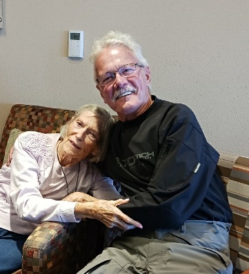
And about yesterday, Don and I did not ride together that morning. Don’s Aunt Marilyn is in assisted living in Rapid City, about 30 miles from our campground. Don’s mother passed away suddenly many years ago at age 43. Her sister Marilyn composed herself and gave a moving eulogy at the service when the rest of the family couldn’t. Don hadn’t seen his aunt in maybe 30 years and, as he put it, it had been weighing heavily on his heart and mind in recent months to visit her. And then we found ourselves in South Dakota. He reached out to her family and set up a visit. It has been an emotional couple of days for Don. I’ve learned a lot about Don the past few days that I didn’t know. Perhaps this is exactly where we were supposed to be this week.
We are going to spend Friday morning in the Badlands. As I mentioned in the previous trip, you really need to spend a sunset and sunrise in this place. We’ll start drifting east tomorrow afternoon. I’ll post any cool pics I get tomorrow and get the starry night photos up from a couple of days ago.
Good night from the Badlands! Based on this sunset tomorrow should be stellar.
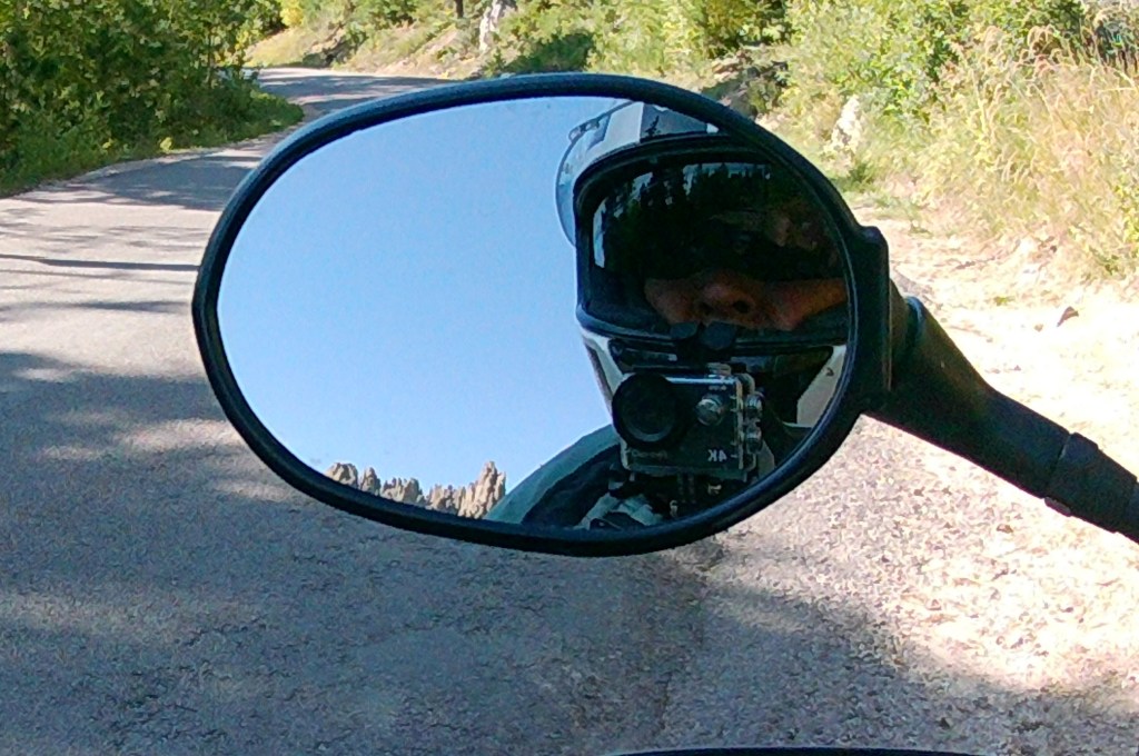
Had a great day of riding and the helmet cam worked well. It is mounted on the chin bar of my helmet with a remote located within reach of my thumb. I did manage to get some good shots of those pigtail bridges on Iron Mountain Road that eluded me last time. The day started with Needles Highway….
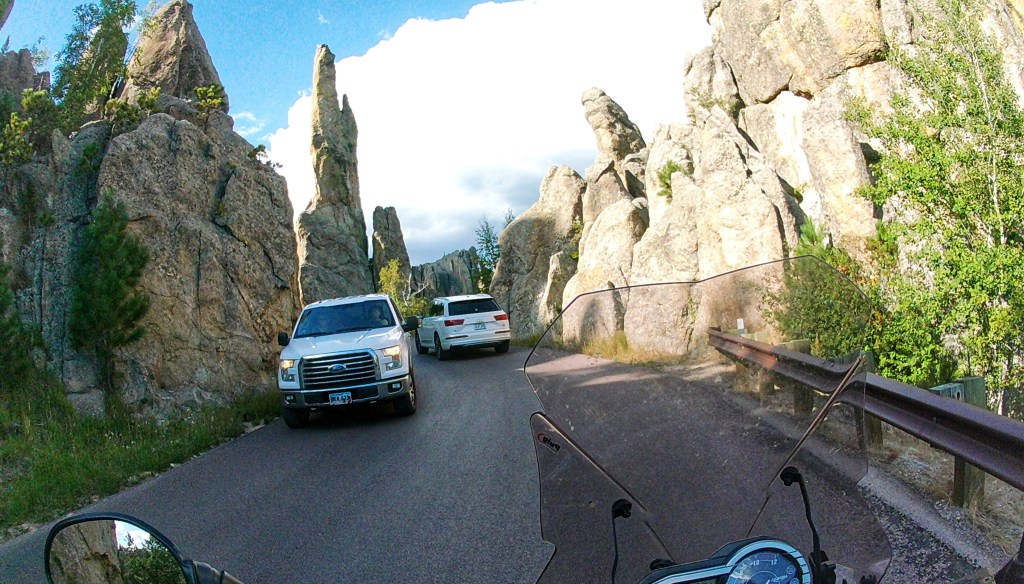
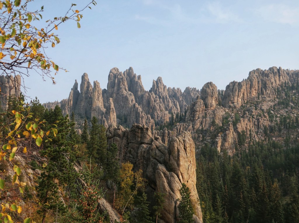
Things get a little tight on Needles, but what an incredible road.Nearly every tunnel is single lane and there’s always people taking pictures at the end 😂
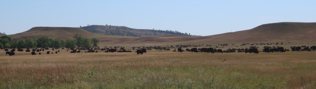
Custer State Park and the wildlife loop is a must do. The bison herd was absolutely huge and close to the road. I did not however meet one in the middle of the road in a blind curve this time.
This wasn’t quite all of them but was all I could fit on the camera. Had to be hundreds.An early sign of the encroaching weather.Fun little gravel road up to a stone fire tower. It was a bit nerve-racking and not for everyone or every kind of bike. Don wasn’t with me on his big ST1300. Oops, looks like I still have a turn signal on by the green light on the dash.Amazing view but these long distance vistas always disappoint in photos.
Well, this is a lot of pictures. I’ll save Iron Mountain Road and the pigtail bridges for tomorrow. And it’s not always sunny in the Black Hills. Got a good thunderstorm raging right now. I am waiting it out in the little laundry room at the campground. Don finished before me and headed to the tent before it started pouring. Hopefully tomorrow will be better as we move on to Badlands National Park.
Turned out to be an impressive storm with lots of lightning. Not as high as we were going to be in Colorado, but this camp is still over 4,000 feet in elevation.
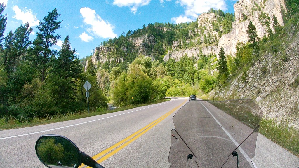
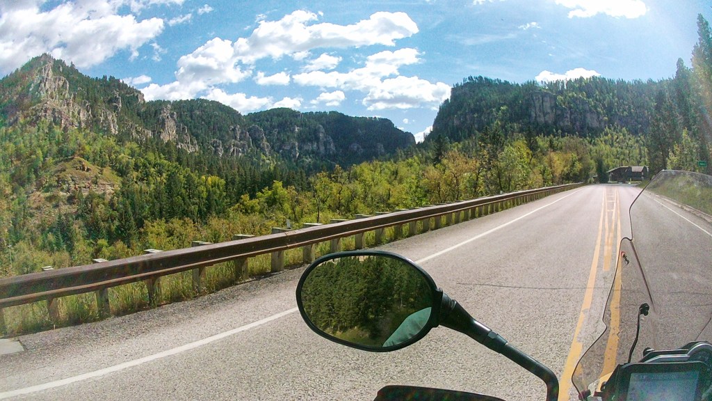
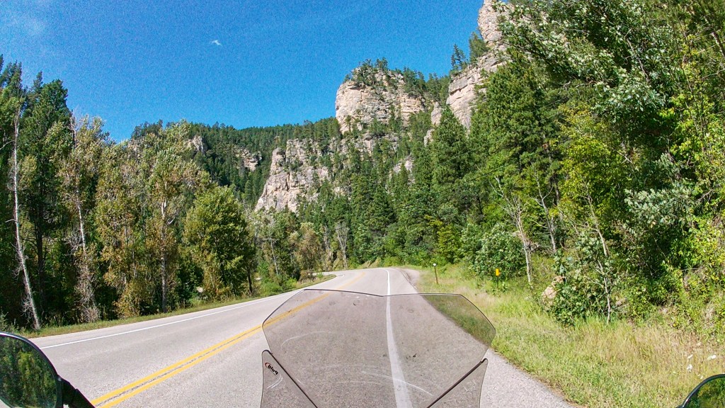
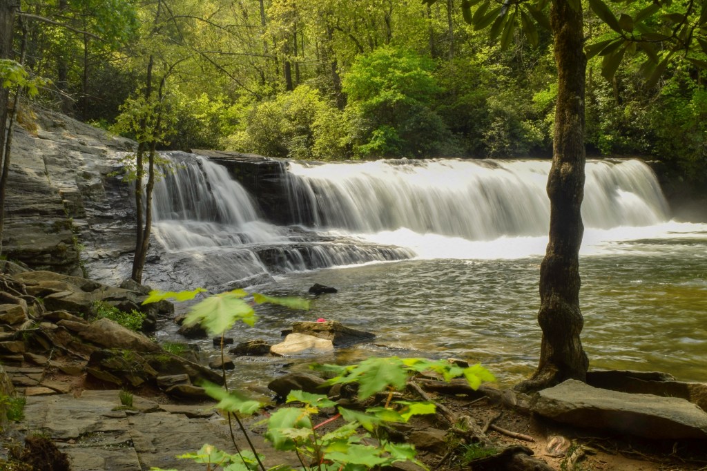
Well, I’m still posting (which means something entirely different in the horse world). It was a gorgeous day and you just can’t go wrong with the Black Hills. Not nearly as crowded as the last time Don and I were here when the COVID restrictions were first lifted. I don’t know if my pictures are spectacular but I’ll put a few up anyway. I bought a helmet camera for Colorado’s Million Dollar Highway that sadly didn’t get used for it’s intended purpose. So I tried it out today. The following shots are from Spearfish Canyon.
Spearfish Canyon is quite the tourist attraction although Don and I don’t know why. It is pretty but not any more so than all the other roads around here. I’ll try the helmet cam tomorrow in Custer State Park and if I almost hit a bison again, maybe I can get a picture before he gores me.
The Homestake Mining Company shaft ore hoist gear. It was in service from 1950 to 1994 and hoisted 7.4 million tons of rock from the 5000 level of the mine. It is 12 feet in diameter and weighs 16 tons. The ring in the background is a surviving segment of 100,000 gallon water tank that was built at the 4850 level in 1965 by Dr Ray Davis. He studied neutrinos for 3 decades using this underground tank and won the Nobel Prize in physics in 2002. The top of the old open mine is visible in the background. I posted pictures of it in the 2020 blog. The shear size of it is incredible.
Well, we made it into Rocky Mountain National Park this morning. It was still overcast and drizzling at the hotel, but radar looked like the sky was clearing to the west. So we bundled up and left Loveland. The ride between Loveland and Estes Park is quite beautiful with the road built along a mountain stream deep in a narrow canyon. We actually saw a few peeks of sunshine. About half a mile from the entrance to RMNP there was a sign saying Trail Ridge Road temporarily closed. Now there’s only one road through the park… Highway 34 aka Trail Ridge Road. Turns out overnight snow and ice shut down the road on both the east and west. The majority of the park was inaccessible and may be till noon or later. We could either go in and wait in queue or circle around and back out the gate. That was the final straw for Colorado so we turned around and headed for sunnier latitudes. We passed our hotel again two and a half hours after leaving that morning and jumped on I-25 North to Wyoming.
Big sky country and 77 empty miles to the next town! Wyoming is our least populated state.
We ran up to Cheyenne and caught Highway 85 heading to the Black Hills of South Dakota. It didn’t take long for the skies to gradually start clearing once north of Colorado. The drive through Wyoming was great and, as always, the pictures just do not do justice to what we saw. The sky was stunning and there were rocks and bluffs everywhere.
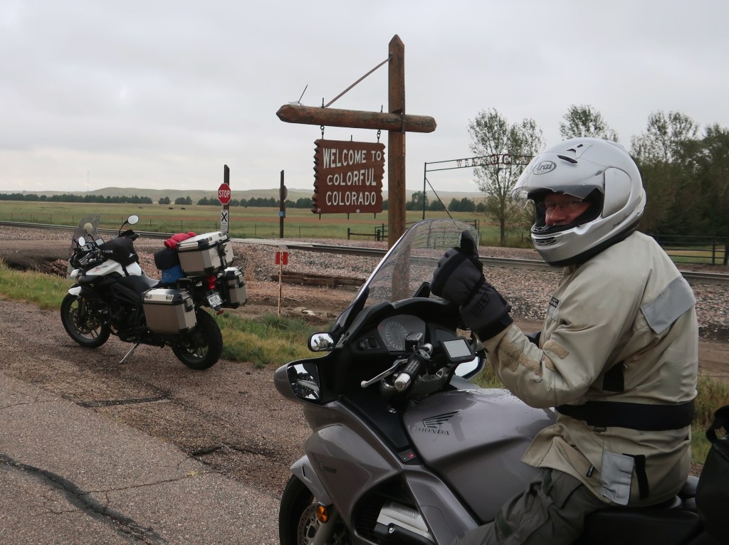
It was pretty frustrating abandoning this long planned Colorado trip but it just wasn’t to be. As Rocky Mountain National Park reminded us this morning, bad weather at this time of year at the altitude we would be camping should not be taken lightly. Seams like our motorcycle and horse trips are increasingly canceled do to weather in recent years. Didn’t use to be this way. So we find ourselves in South Dakota after the long way here via Kansas and Colorado. And we know this area and have a favorite campground. And the scenery is absolutely stunning. I did blog about the Black Hills and Badlands two or three years ago so I may not post anymore this trip unless we get some spectacular photos. I will update when we’re home. Thanks all for taking the time to follow and thanks for all the comments.
A slightly damp and chilled Don showing his approval for finally getting out of Kansas.
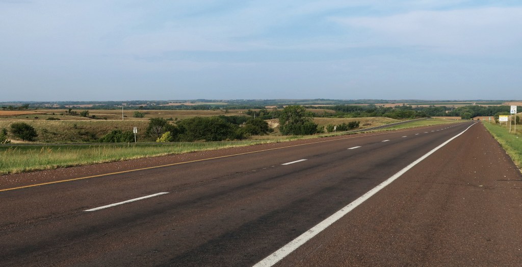
We’re not in Kansas anymore….yeah! Actually, Kansas gets a bit of a bum rap. It’s really kind of pretty in a lot of areas, especially the east. The biggest problem, other than straight roads of course, is that it just last too long. The western portion flattens out and gets to be monotonous.
It’s hard to tell in the picture, but Eastern Kansas is open, rolling, and fairly pretty. 65 mph speed limits and almost no traffic.
It has been a long hard day. We rolled out of the hotel with sunshine and had a great ride crossing Eastern Kansas, but we eventually caught the rain before the morning was over. And once it started, it rarely stopped. Usually not heavy rain, but continuous with temps dropping into the 50’s and had a pretty nasty side wind for a while.
Another bad thing about Kansas….you get to look at the approaching storm for a long time before hitting it. Plenty of time to think about what’s coming.
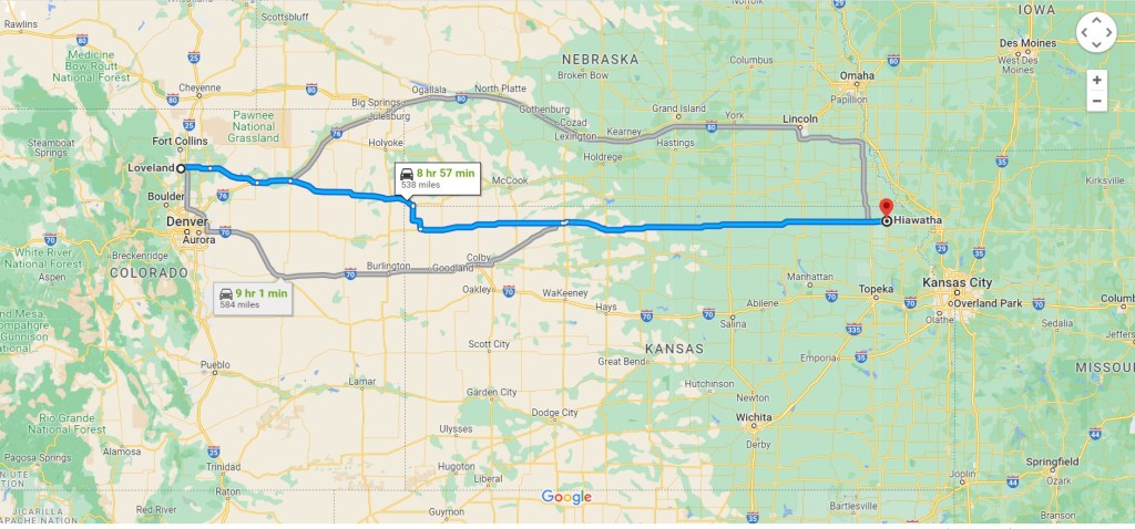
We are in Loveland Colorado tonight. Just shy of 1200 miles since leaving home yesterday morning. Unfortunately the weather is still looking bad for the week. We hope to see Rocky Mountain National Park in the morning if the weather breaks but probably going to cancel the rest of our Colorado plans. We had enough cold and wet weather today. Plus the majority of our plans this week would keep us at 7500 to 12000 feet elevation, including open desert camping. That’s just not very feasible with frequent heavy rain and low temps. Not sure what Plan B is yet…stay tuned.
Don and I are on the road again. I finally had all I could take of my government job, so I took an early retirement and ran! My federal job put a damper on my work-life balance for quite a while and made longer trips impossible to plan. But no more. Yeah, this is a little early to completely retire and someday I will need to find at least part-time work. But not today! Today, I am moving through the wind with the sun on my back, heading towards the spectacular American West!
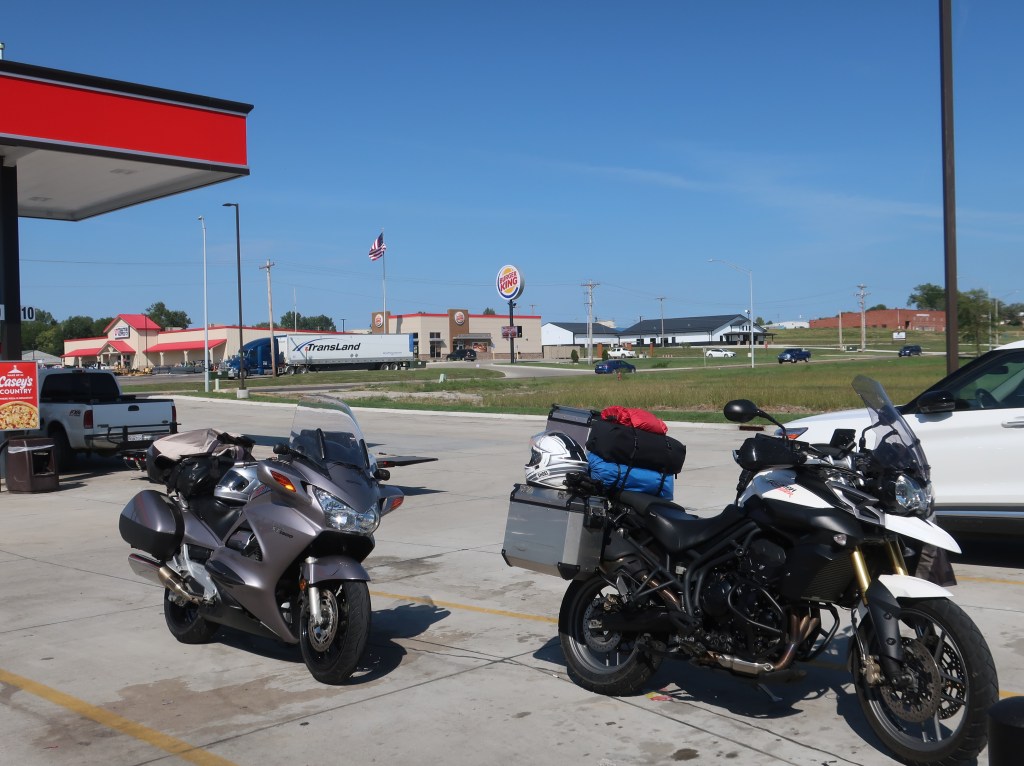
Sorry. No spectacular photos when you’re just racking up miles crossing Illinois, Missouri, and Kansas.
The itinerary, we hope, is a fly by of Rocky Mountain National Park, and then on to the Black Canyon of the Gunnison, the Million Dollar Highway, and Great Sand Dunes National Park. Unfortunately the weather forecast is taking a nosedive. Sunny Colorado with over 300 days of sunshine per year is looking like a very high chance of rain just about the entire week. Uhg! We may have to adjust plans a bit.
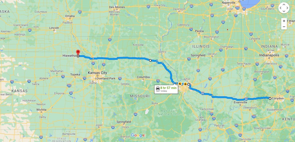
I’ll try to include maps this time unless we scrap the itinerary. It was a long day but pleasant once we got around St Louis and got off the interstate. Still mostly divided 4-lane with high speed limits. Bedded down in Hiawatha Kansas for the night. We’ll see what tomorrow brings.
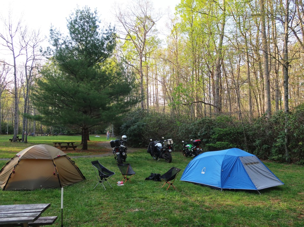
Welcome to 2022. Don and I are on the road again for our annual spring run to the mountains. Our beloved Haywood County North Carolina needs more time to recover from last year’s devastating flood so we are in Virginia this trip at the Willville Motorcycle Camp in Meadows of Dan. We have my nephew Jordan along again and hopefully he will be able to join us on some extended trips in the future.
Lovers Leap on Hwy 58 between Meadows of Dan and Stuart.
What a past few years!?!? We keep hoping for a return to normalcy, but turmoil, pandemics, natural disasters just keep coming. On top of that, my work has decided to detail me out of town on a hard-to-predict schedule that has largely eliminated any weeklong trips out west as I am no longer guaranteed more than a stretch of 7 days off including weekends. At any rate, this won’t last forever and Don and I are already planning some epic journeys so please stay tuned.
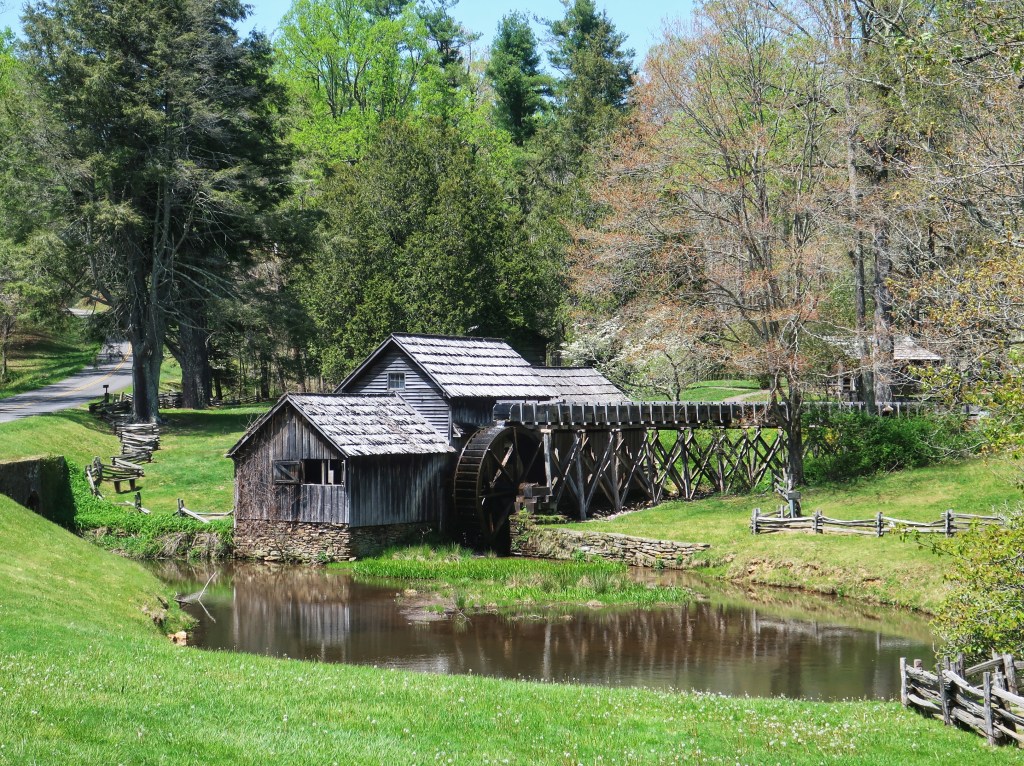
Mabry Mill is ran by the National Park Service and may be the most photographed attraction on the Blue Ridge Parkway. It was built in 1903 as a blacksmith and wheelwright shop and then became a sawmill. The gristmill operation began around 1905.
Don has gone back to work at least part-time in the security alarm business. He also spent a couple of months in Alabama at his dream job, a professional motorcyclist! A friend of a friend had a contract with a major tire manufacturer bringing a new tire to market and needed real-world testing against the competitors. Don got paid to ride a bike all day six days a week. Come on, we all know he does that anyway! Hopefully this will turn into future opportunities to get paid for riding.
Don reliving the ride with Jordan at Rocky Knob on the Blue Ridge Parkway.
Meadows of Dan Virginia sits on the Blue Ridge Parkway in the southern part of the state. The name was given by the early English settlers for the beautiful meadows near the Dan River.
New River Gorge Bridge
The New River Gorge Bridge was completed on October 22, 1977. At the time of completion, it was the longest steel arch bridge in the world, a title it held until 2003 with the construction of China’s Shanghai’s Lupu Bridge. It is currently the longest single-span steel arch bridge in the United States and the third highest bridge in the country. The bridge spans 3,030 feet, the arch is 1,700 feet, and is 876 feet above the gorge. Every year, it is closed for a day in June for people to base jump from it.
Enjoying our final evening at Willville campground.
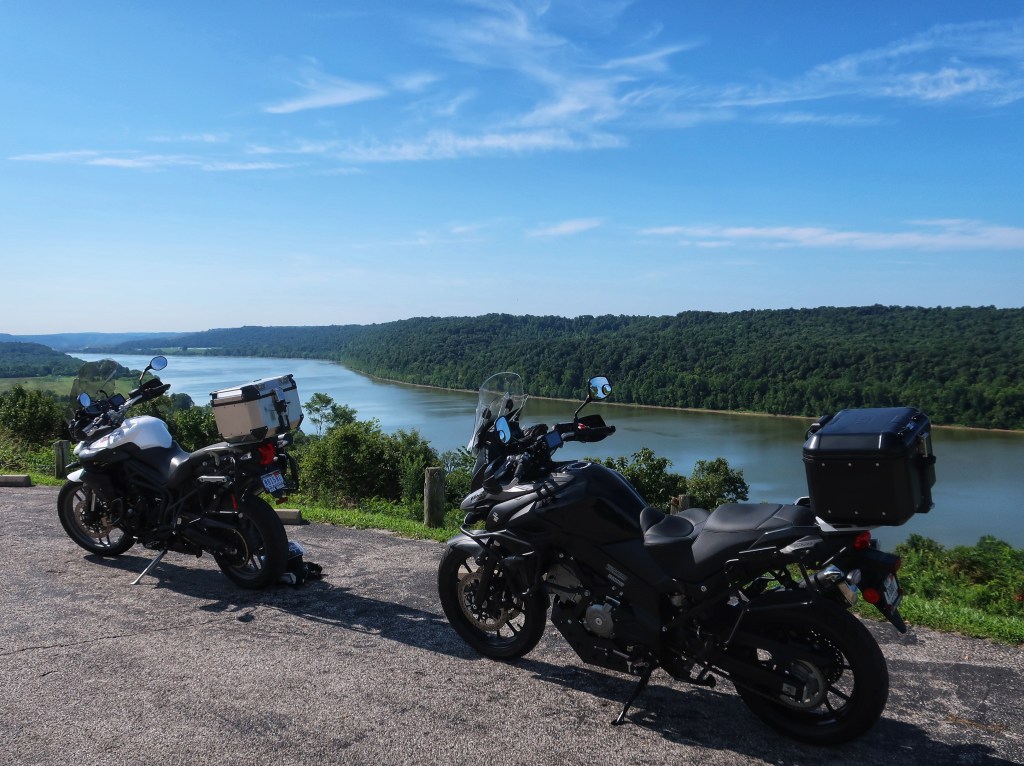
Overlooking the Ohio River in Leavenworth Indiana.
Well, no big trip this year. With Covid, hurricanes, wildfires, and a major house remodel turning into a bit of a nightmare, Don and I have put the Colorado trip on hold. Plan B was to spend a week venturing from southeastern Ohio to Virginia to North Carolina. The flooding in Haywood county NC the week before washed our beloved Blue Ridge Motorcycle Camp down Pigeon River, sadly along with a few lives in the area. Plan C was limited to Ohio and Virginia….the remnants of hurricane Ida cut our days back on that too. On to Plan D, we finally got a short trip in to southeastern Ohio.
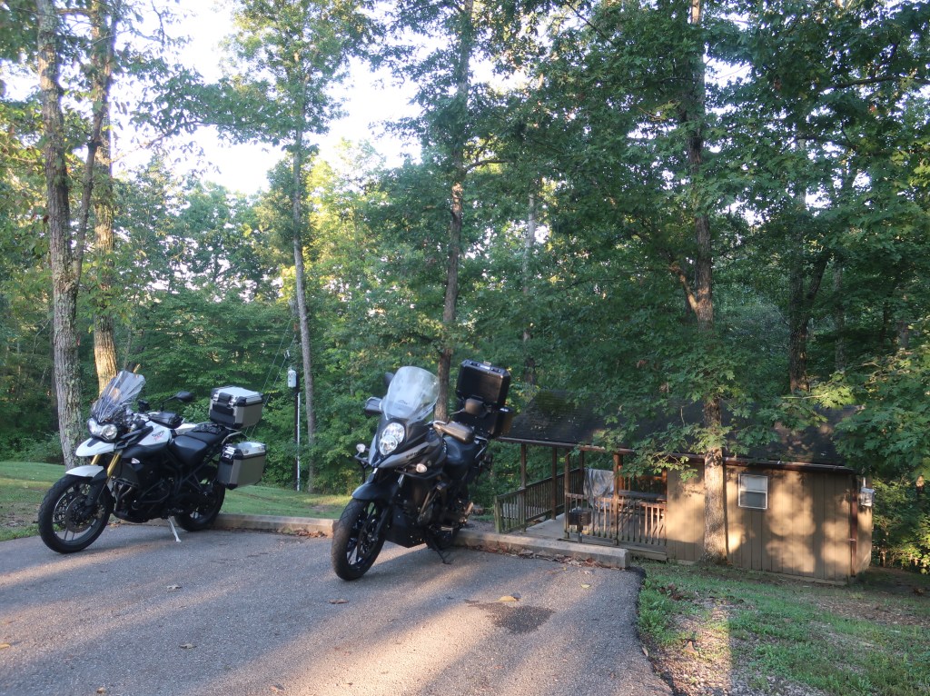
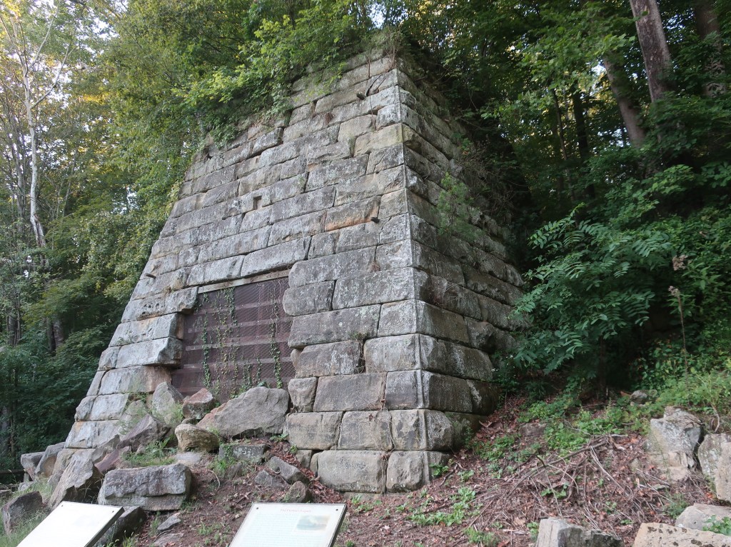
Our sleeper cabin at Lake Hope State Park campground. A/C and a mini fridge for $35 a night…hard to beat.The Hope iron furnace was one of 69 charcoal fired furnaces in the area. It was operational from 1854 to 1874. The Hanging Rock Iron region of southern Ohio was a world leader in iron production in the mid-nineteenth century.
This may not sound too exciting for most of you but that area is well known for fantastic motorcycle roads! And it’s scenic too. Heavily forested, rolling farm land, extensive rock formations, and very curvy roads with the most dramatic and constant elevation changes of any highways we’ve ever ridden. Maybe the curves aren’t quite as tight as North Carolina, but there is hardly a straight stretch to be found. But it’s the abrupt and continuous ups and downs that set the place apart. Even in the mountains, you generally go up for a while and then drop back down for a while. On Ohio’s triple nickel, highway 555, one curve will be at the top of a hill, the next at the bottom, and then right back up to the next one. An absolute roller coaster of a ride.
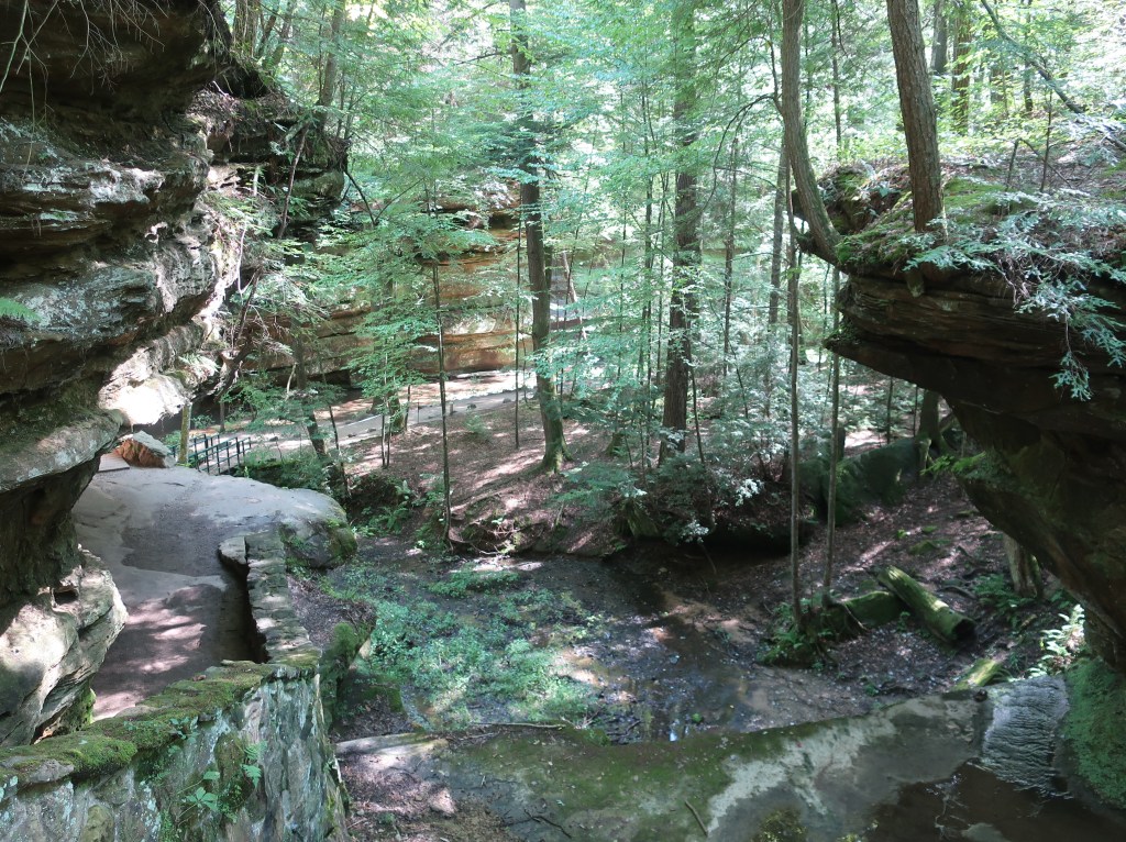
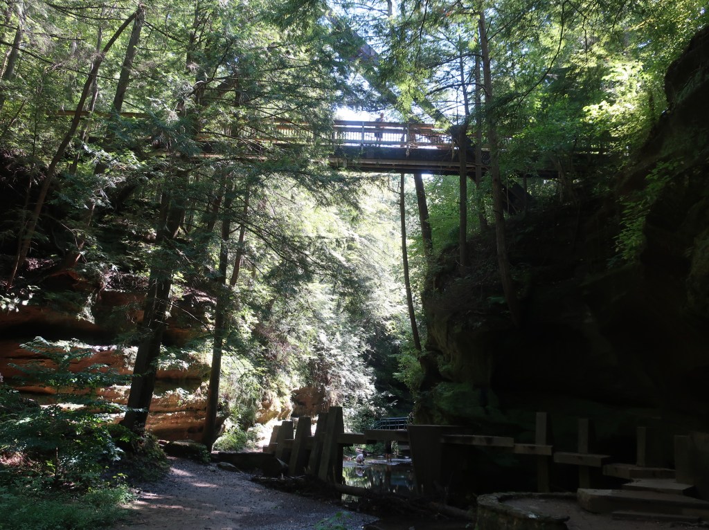
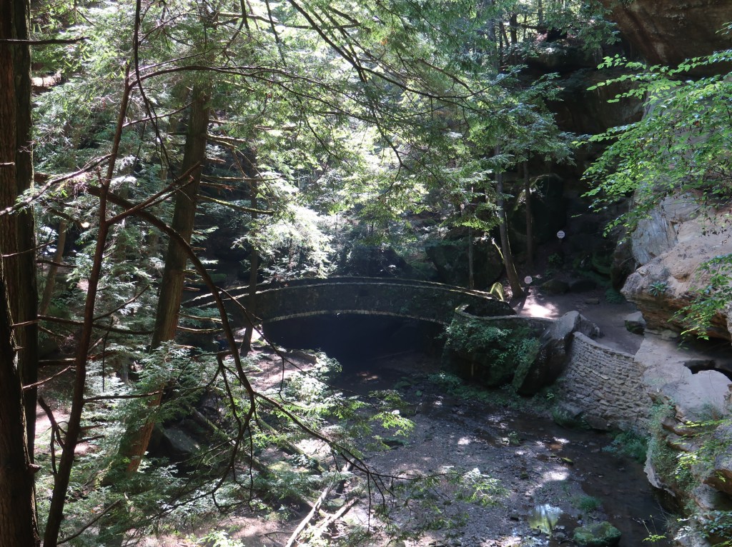
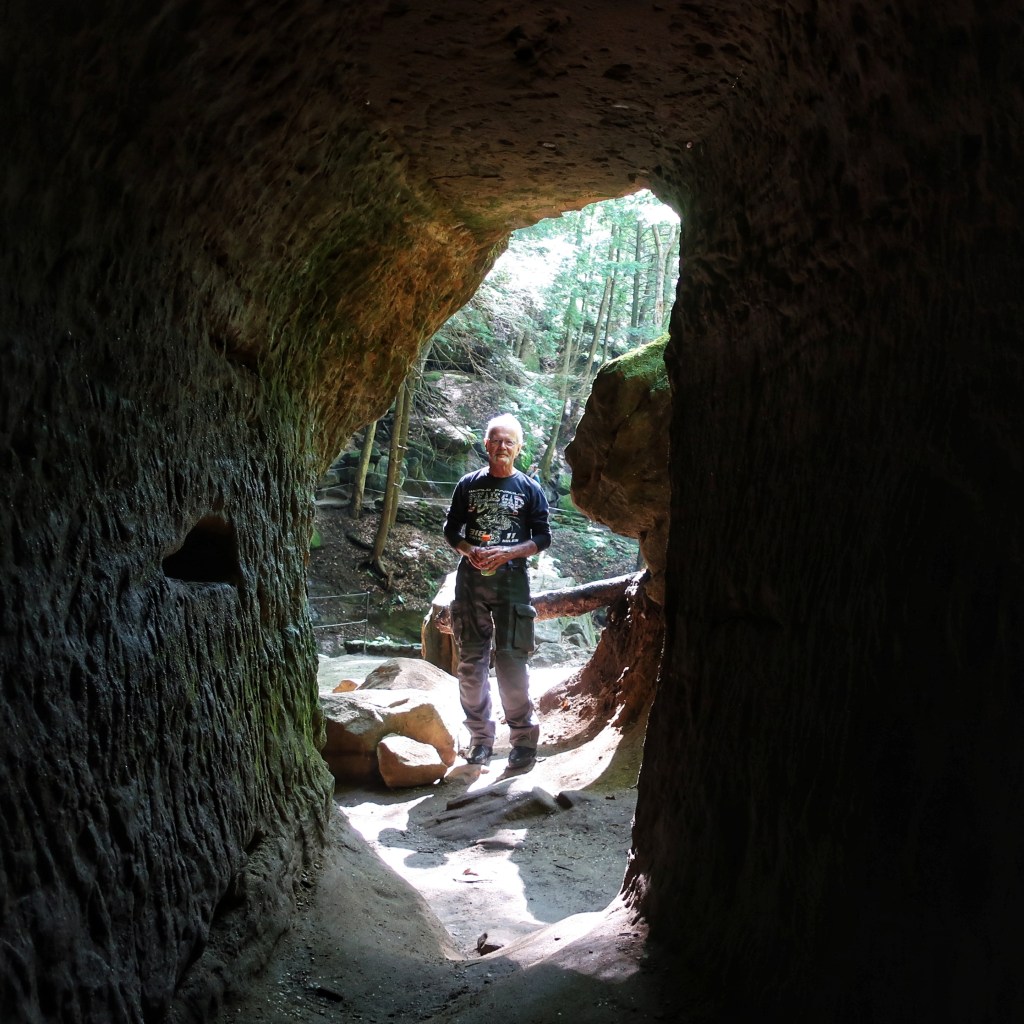
The enchanting forest of Hocking Hills State Park.
If the roads don’t appeal to you, and they probably don’t if you are driving a car, we did spend part of an afternoon at Hocking Hills State Park. Absolutely spectacular! Don and I did a brief hike and wished we had planned an entire day there. The few pictures I took just don’t do it justice. Just Google it for some incredible photos, especially the rock house trail. There will definitely be a return visit. Just be forewarned, the park is very popular and quite busy at times so plan a visit carefully.
The Hocking name comes from the bottle-shaped gorge formed by the upper falls just north of Lancaster and is derived from the Delaware language. Although they never formed permanent villages here, the Delaware and powerful Shawnee nations frequently hunted and traveled through the Hocking Hills region.
Well, this is likely the last post for the year. Hope everyone is staying safe and healthy. Maybe next year will be better, although I think that’s what everyone hoped for 2021. Anyway, take care and tune in next spring.
Hmm…these two pictures just seem to go together 😄.
I hope this post finds everyone healthy and safe. What a crazy 14 months it has been. Don and I are alive and well and early into another riding season. Not much has changed in our lives since last year. We are fortunate that the pandemic has largely just been an incovenience for us and our families. I know it has been much more than that to many. We are looking forward to another trip late this summer, most likely to southwestern Colorado with the Black Canyon of the Gunnison and the Million Dollar Highway. My wife and I are planning an adventure in Utah soon. I am debating whether to post about it. Should be some spectacular scenery, but it would be a departure from the general theme of the blog. It will involve saddletime of an entirely different variety.
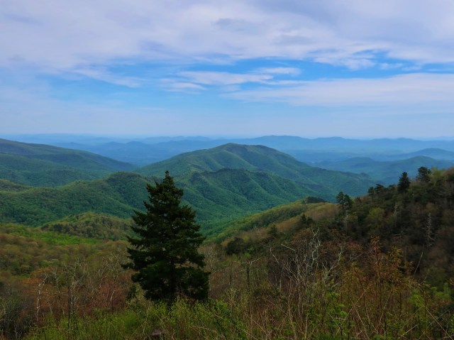
A never ending sea of mountains on the Blue Ridge Parkway.
In the meantime, Don and I are currently on our annual spring pilgramige to the mountains of North Carolina. Excited to have my nephew Jordan along this year. We have ridden together here before, but it has been a couple of years. This area is just spectacular and probably the best riding anywhere. We have had two great days chasing the curves. We covered around 300 miles yesterday with approximately 90 percent of them leaned over in a curve. 300 miles of mountain riding is a very full day! Motorcycling has been called the lazy man’s zen. Riding these tight and technical roads at a spirited pace takes total concentration. Rolling back into camp physically and mentally exhausted, you have thought of absolutely nothing all day but the road in front of you. It really does become a form of meditation and clears the mind.
Table Top Rock, South Carolina.Hooker Falls, Dupont State Forest (photo by Jordan)
Well, Don and I are seasoned travelers, but we can’t plan for everything. Seems that someone hacked the computer system of a pipeline we’ve never heard of and suddenly there was virtually no fuel in our immediate area. We did eventually get all three bikes filled up but it took multiple gas stations and waiting in line. I was hoping 2021 would be a better year than last, but it so far it has been crazy too! We cut our stay in North Carolina short and headed to Tennessee where gas was more readily available. The riding and weather were still great and we spent the night with some very special friends in the area. The fuel crisis actually turned out to be a blessing. In travel, as in life, sometimes you just have to be flexible and go where the road leads.
Home again safe and sound. Today was a great travel day with cooler temps and light traffic (other than the craziness that is St Louis). Covered 600 plus miles, 3200 for the week. And it was a spectacular trip. Scenery was fantastic! We met some incredible people too! A surprising number of them had ties to southern Indiana or Louisville. Got to know two couples from very different walks of life and at very different points of life. People we probably would not have spent time with had it not been for the motorcycle connection. But it’s things like that which turns a great trip into something more. And thank you for following along again. There are a lot of incredible places to visit even if you never venture beyond our lower 48 states. So, get out there.
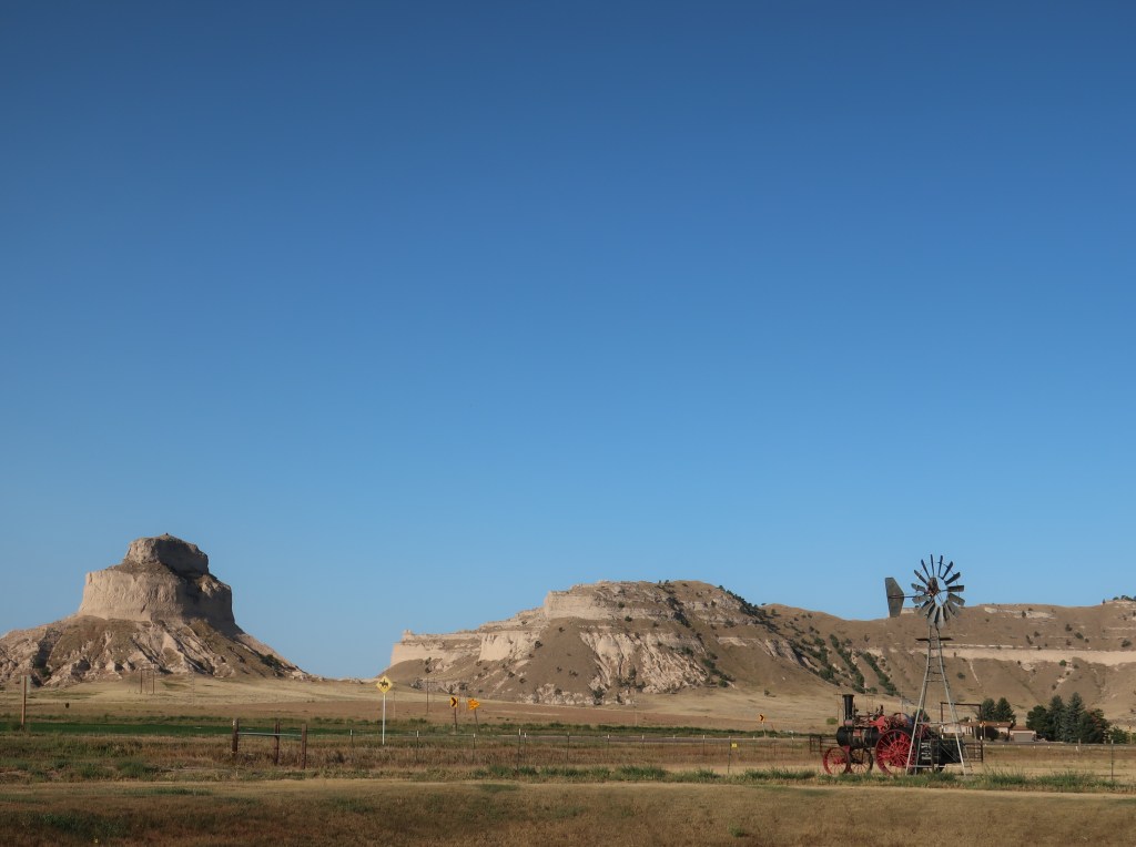
Scotts Bluff
Scotts Bluff surprised us. It’s worth spending a day, especially if you have an interest in that period of history. If traveling to/from the Black Hills, catch Fort Robinson and the Agate Fossil Beds.
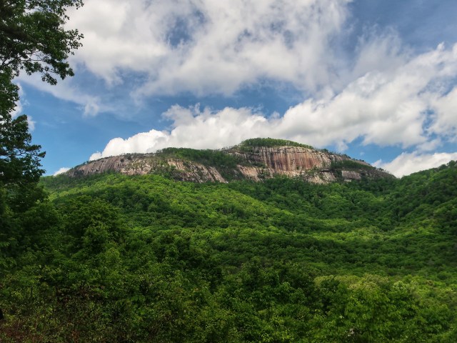
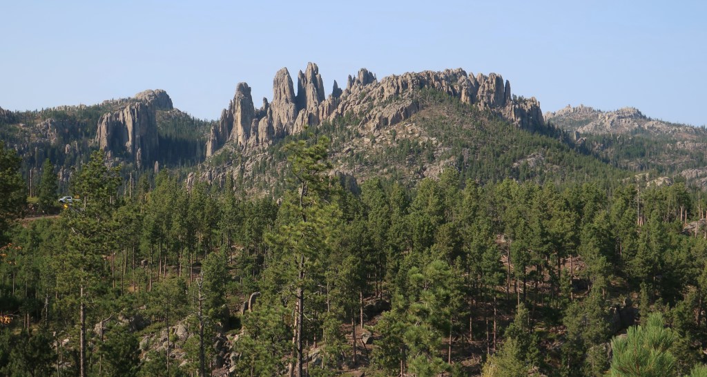
The Black Hills
The Black Hills and Custer State Park are phenomenal. We highly recommend. Be forewarned though that the entire area is heavily commercialized for tourism. Every town seems to be a little Gatlinburg with a western theme. Crowds will be big and food often difficult to find without long waits. Fast food and national chains generally don’t exist here. Despite all this, it is worth it!
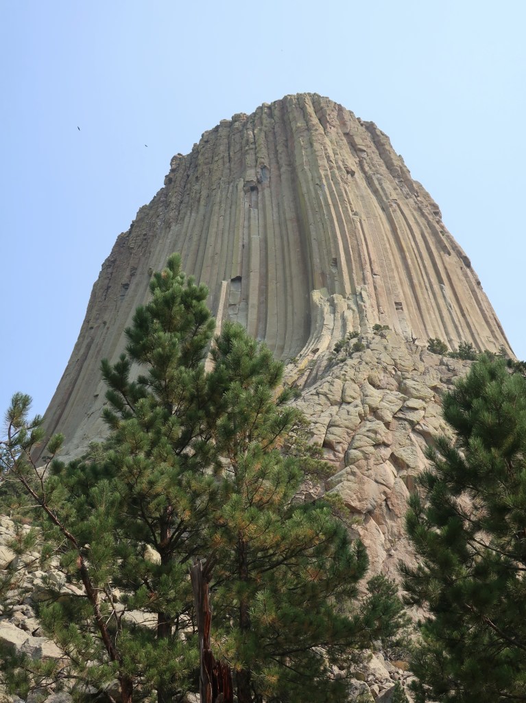
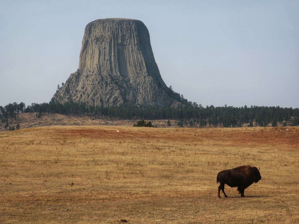
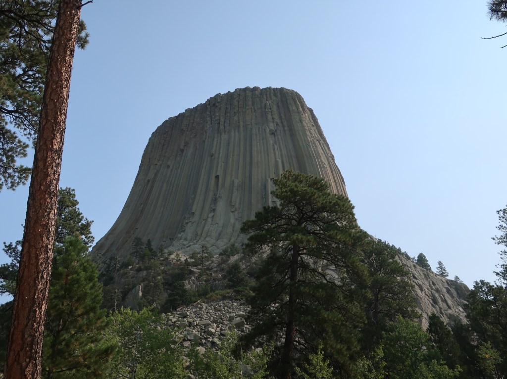
Devils Tower
If you’re in the area, you have to visit Devil’s Tower. It’s just too strange not to and quite impressive close up. The drive through eastern Wyoming is good too.
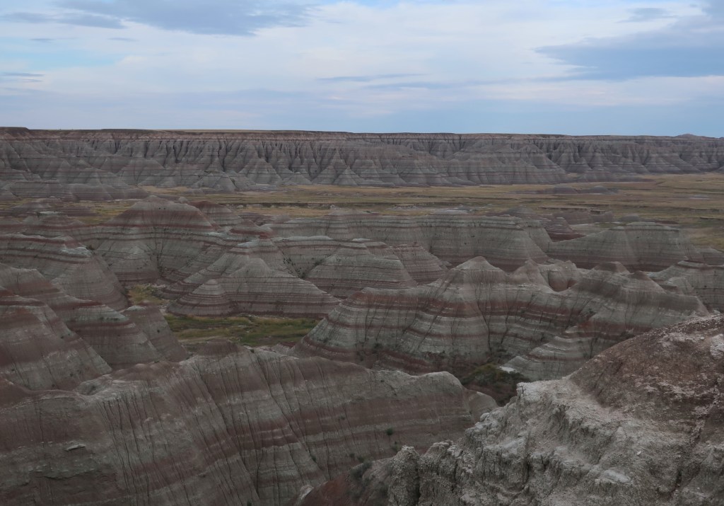
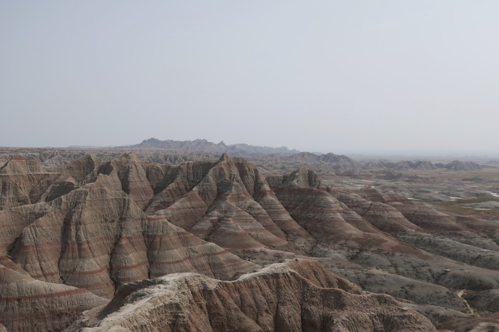
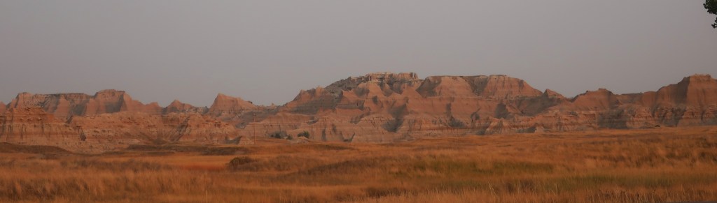
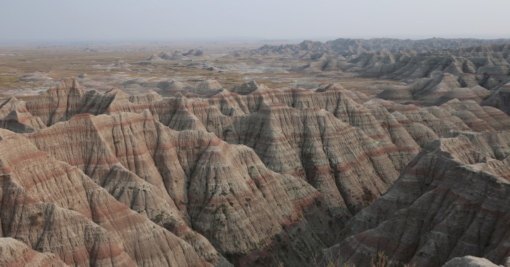
The Badlands
The Badlands are spectacular! You need to see them. Do plan on spending at least 24 hours. The changing light transforms them continuously.
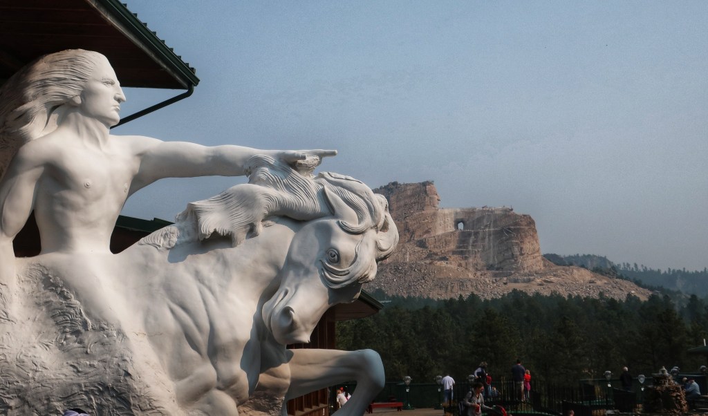
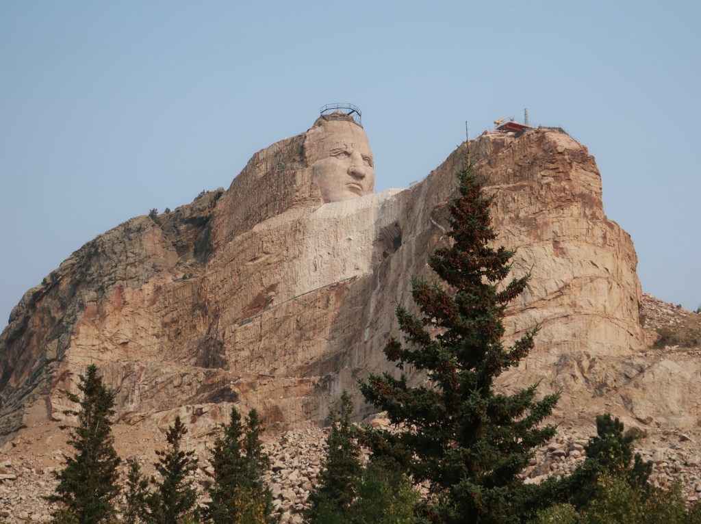
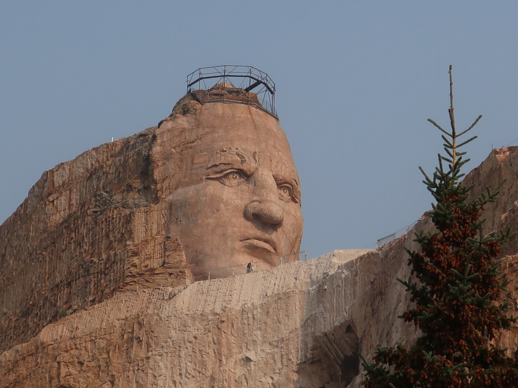
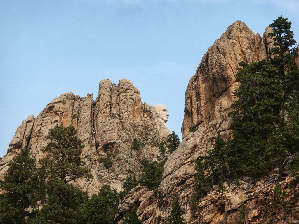
Mount Rushmore and The Crazy Horse monument
We did not actually visit Mount Rushmore this trip but it is visible from several vantage points. The night show is supposed to be fantastic and quite patriotic. The Crazy Horse Monument is spectacular in size. It’s not much money to go in and the museum has a fair collection of artifacts and art.
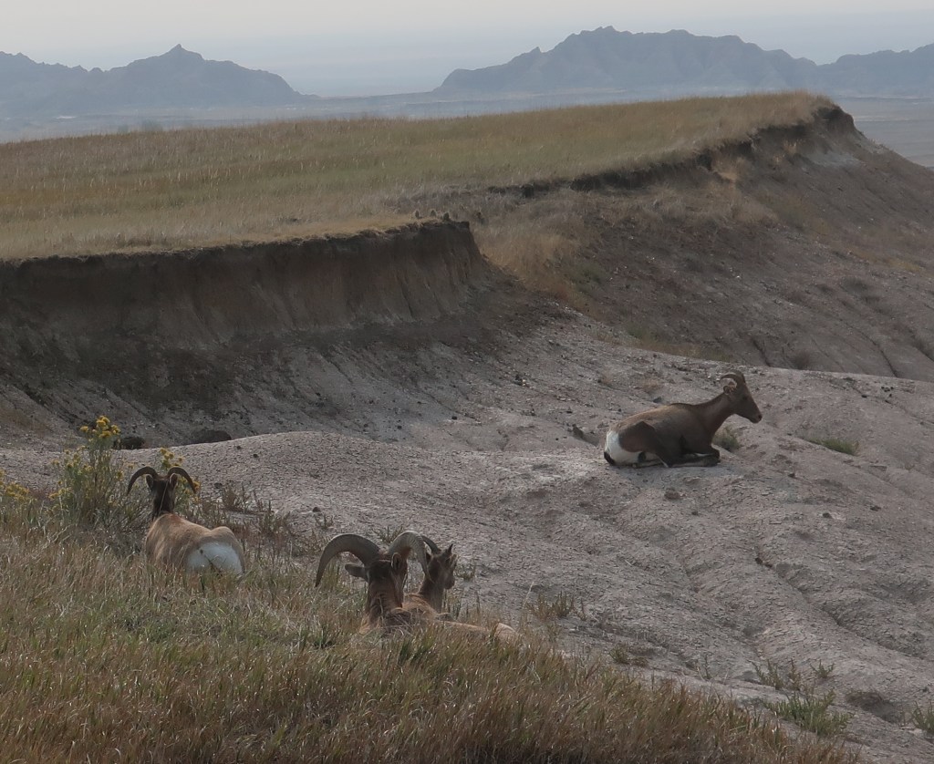
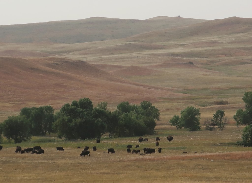
Lots of wildlifeAnd some not so wild
I believe we saw more wildlife on this trip than any other. And it doesn’t take much effort, it’s everywhere! Just watch out for it on the road.
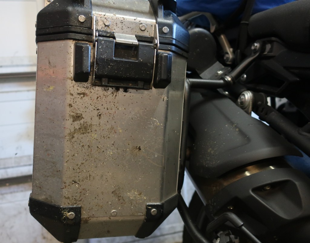
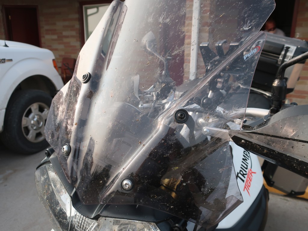
Front of right pannier. Lots of bugs of course, but both bikes had quite a splattering of cow or buffalo manure.
Our last night in the Badlands turned out to be very hazy. I was hoping to have a star trail picture, but between the haze and the occasional passing headlights, it just wasn’t to be. I did get a couple of stills though.
I think car headlights on the park road created the glow behind the formations.The Milky Way
We packed up camp early and we’re rolling just after sunup. It was a very hazy day but very pretty for the first couple of hours. By mid-morning, the prairie winds picked up with a vengence. Continuous 30-35 mile per hour gusts battered us most of the day. It was difficult to keep lane position on the 2-lanes at 70 mph (most highways are posted 65 or 70 out here) so we decided to forego the interstate entirely today. Turned into a hard 11 and 1/2 hour day. The last couple of hours were pleasant once we started getting into some trees and hills to break the wind in Iowa. We ended up back at the same hotel from exactly one week ago. The push for home tomorrow.
I hate to sound like a broken record, but it’s been another stellar day. I still don’t know how to describe the Badlands….. bizarre, rugged, beautiful, unique, ever-changing, fill dirt with a lot of gravel….. they all apply. It’s a landscape that seems surreal. If you ever visit here, you must spend a full day at least. The Badlands look different from morning, to mid-day, to sunset. And the night sky is amazing, even with the smoke haze.
Morning from our campsite.Mule deer have some big ears!
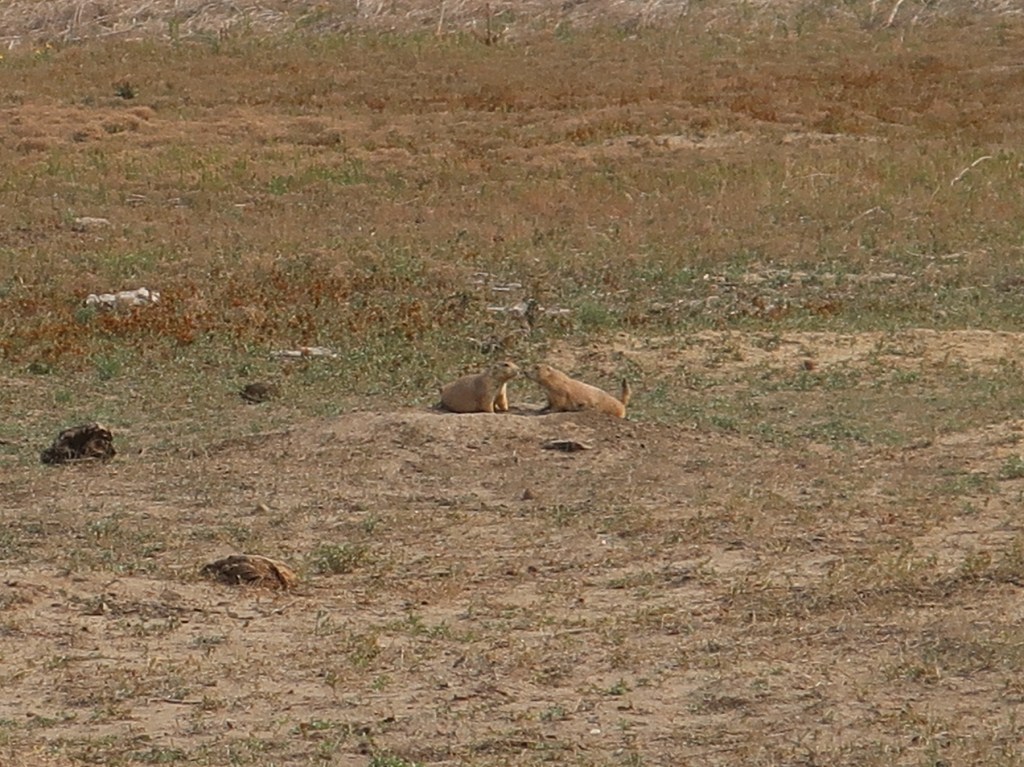
This was our coldest morning so far, but the wildlife was out! Mule deer, prarie dogs, lots of bighorn sheep, buffalo, pronghorns, magpies, and one coyote all made a showing today.
Don spotted this guy. We didn’t know he was only the first of many.Your breath smells. Have you been eating buffalo chips again?
We covered just about the entire park each direction following the changing light. Finally got in a little gravel road riding too and took a short hike this evening. Don and I have both enjoyed the Badlands more than we expected. We highly recommend them. It’s like no place else.
We plan to break camp at first light and start our drone back to Indiana. I will be heading outside as soon as I finish this post and try to get some night sky photos to post tomorrow.
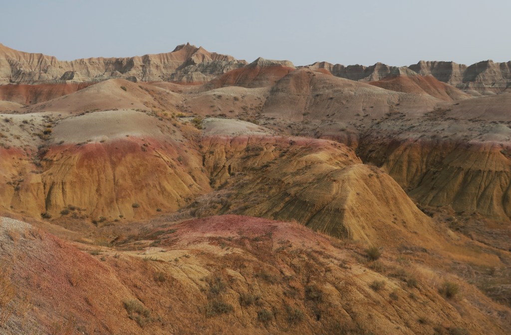
The colors don’t look real, do they? I promise the photo is untouched.Check out this banding!What a landscape to ride through!
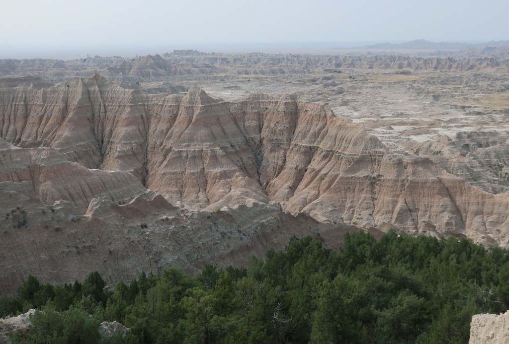
The Badlands are the result of two natural processes, deposition and erosion. Over the course of millions of years, multiple layers were slowly stacked on top of each other. Natural forces from shallow seas, rivers, wind, even volcanic ash contributed to the accumulation of the layers. The erosion began fairly recently, about 500,000 years ago as the Cheyenne and White Rivers carved through the landscape. They are eroding at a rate of one inch per year, which is fast in geoligical time. Scientists estimate that in another 500,000 years, the Badlands will have eroded completely. Better visit while you can!
The trees are really starting to change. The aspens and cottonwoods seem to be ahead of the rest.
Its been another great day, other than the smoke haze. Packed up camp this morning and ran over to the Crazy Horse monument. This thing is huge! Crazy Horse was a Sioux war chief that was very successful against the U.S. calvery. In fact his battle tactics were (and maybe still are) taught at West Point. At any rate, he was killed under questionable circumstances while in peace talks at Fort Robinson. After the Mount Rushmore project started, some of the Lakota wanted to show that they had great heroes too.
The model in the foreground will be the completed monument.The face alone is over 87 feet tall. The outstretched arm is 263 feet.The likeness is based on descriptions. There are no photos of Crazy Horse.
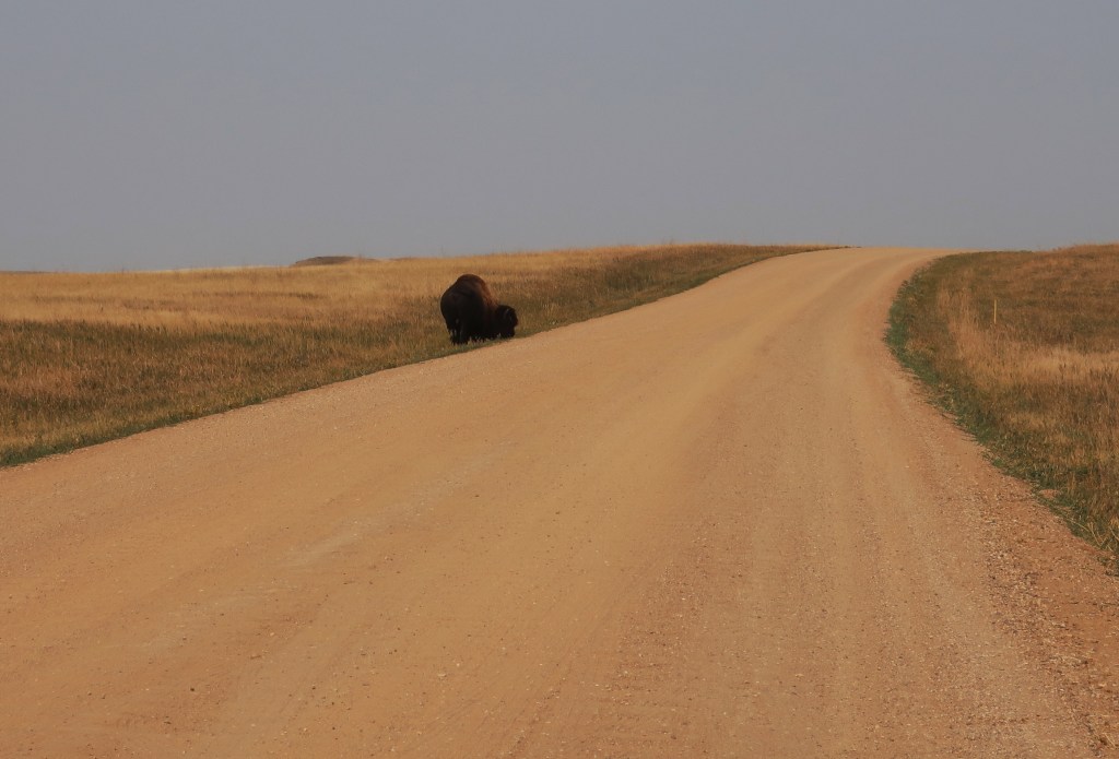
We had one final crossing of Custer State Park leaving the Black Hills. Saw more buffalo, but this time they were off the road. It’s incredible to think that there were tens of millions in North America when European settlers arrived and then hunted to near extinction. Once the railroad made it possible to ship hides back east, buffalo were killed at a rate of 5,000 per day for 2-3 years. Most were skinned and the carcasses left to rot. It decimated the Native American’s way of life.
The Badlands are only a hundred miles from the Black Hills but the landscape changes dramatically and quickly. Pine and granite gives way to open rolling prarie with hardly any trees. And so far, I don’t know how to describe the Badlands. Otherworldly comes to mind. But we are here and camped for the next day or two.
The Lakota or Sioux fought the United States army in the Wyoming and Montana territories from 1866-1868 in what is known as Red Cloud’s War. The Sioux won the war which ended with the Treaty of Fort Laramie giving them exclusive rights to the area forever, including the Black Hills. Of course forever didn’t last long and the government broke the terms of the treaty following the Black Hills Gold Rush and an expedition into the area by George Armstrong Custer. The U.S. kept modifying the treaty and seized the Black Hills in 1877. The subsequent fighting led to Custer’s demise at Little Big Horn and this second war effectively ended with the Wounded Knee massacre.
The Sioux Nation sued the U.S. government in 1980. The Supreme Court ruled that the Black Hills were illegally taken and the federal government was ordered to pay renumeration of the initial offering price plus interest. The Lakota refused payment as they wanted the Black Hills returned to them. The money still sits in an interest-bearing account and has grown to well over one billion.
Yeah, it’s a tough life but someone’s gotta do it!
It’s been another great day and much more laid back. Probably covered less than 100 miles today, largely in Custer State Park. We got another early start and really appreciated heated gear and handgrips this morning. The smoke haze was noticably worse today and photography was limited, but traffic was lighter and the ride was fantastic.
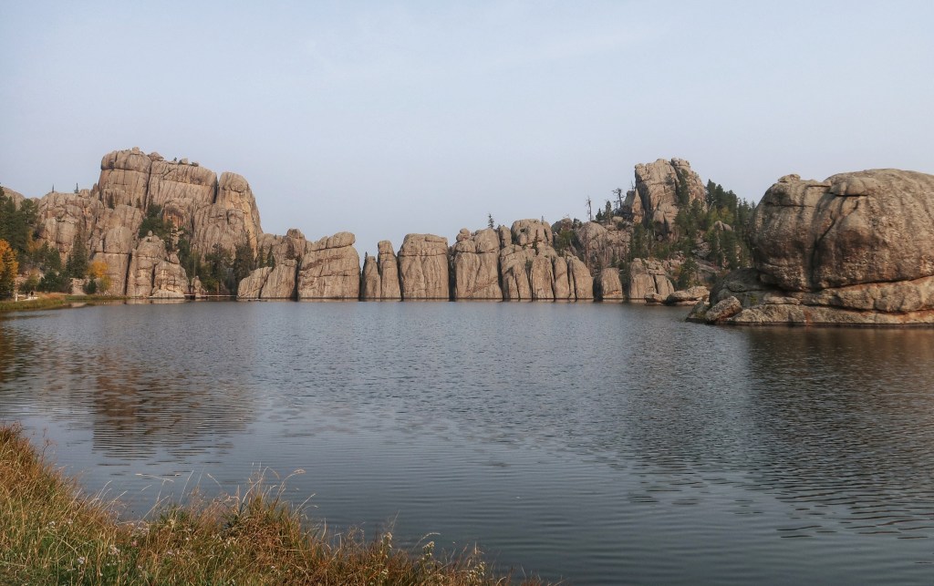
Sylvan LakeThe color doesn’t pop because of hazy sunshine,but the Aspen’s are really turning gold and yellow.
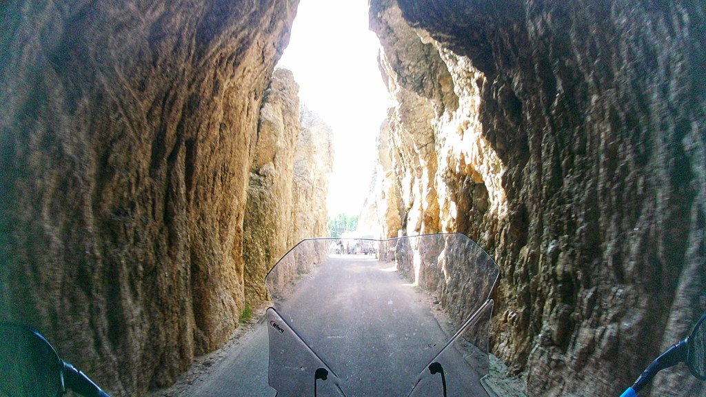
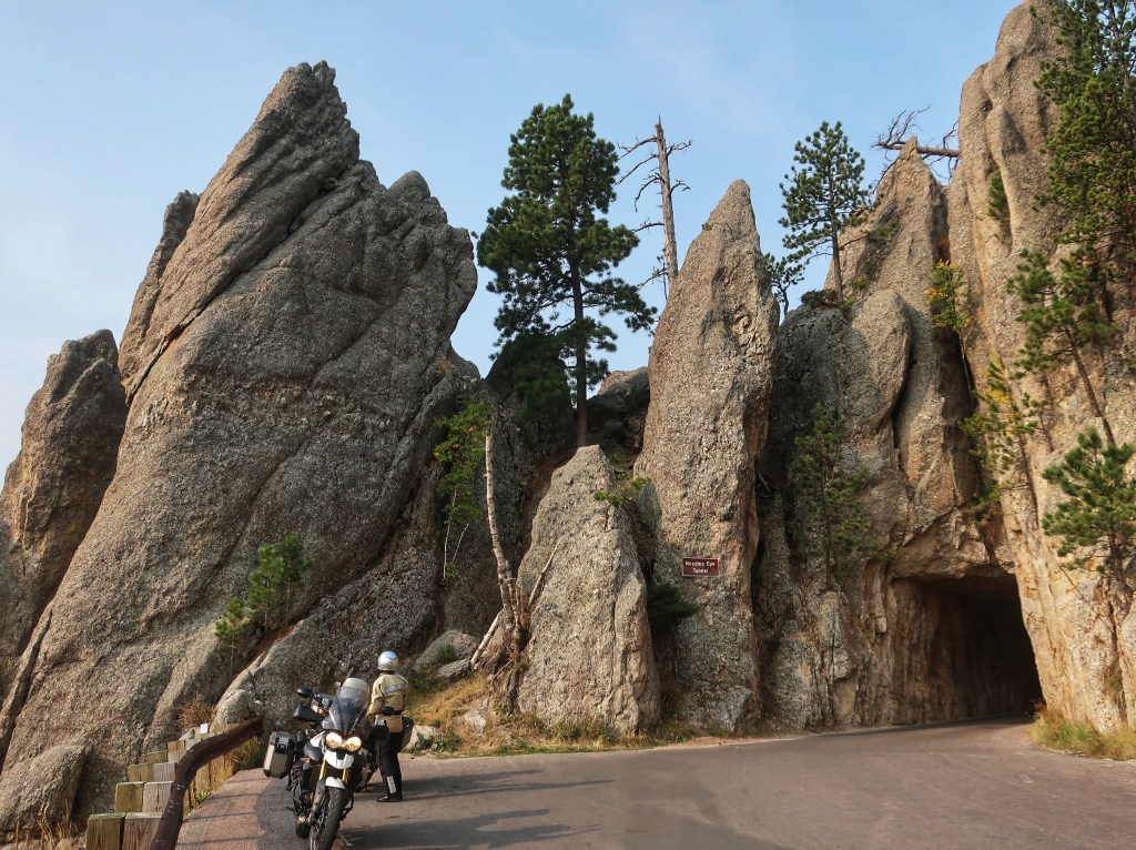
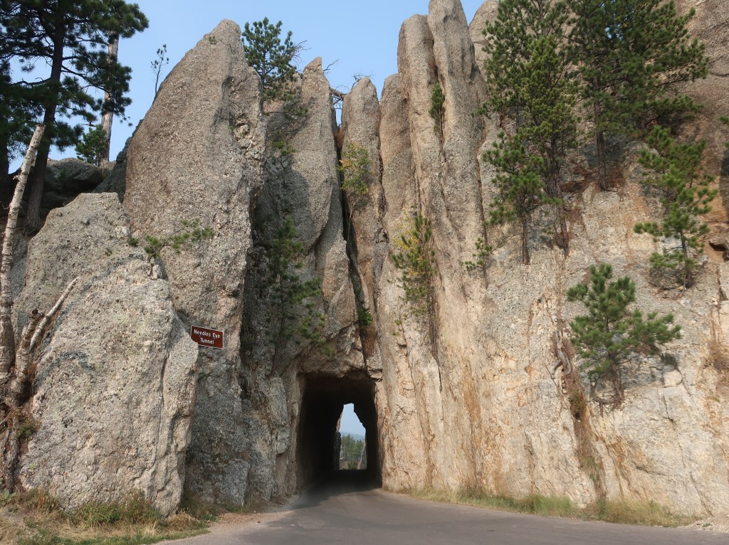
Went by Sylvan Lake and entered the park on the Needles Highway. The road snakes it’s way through the granite spires and rock formations covering this area. There are three tight one-lane tunnels to pass through thus “threading the eye of the needle”. I did break out the GoPro so I hope to be able to post some video later. The road is unbelievable!
Needles Highway.
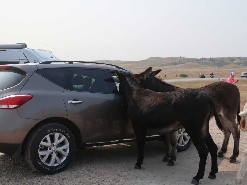
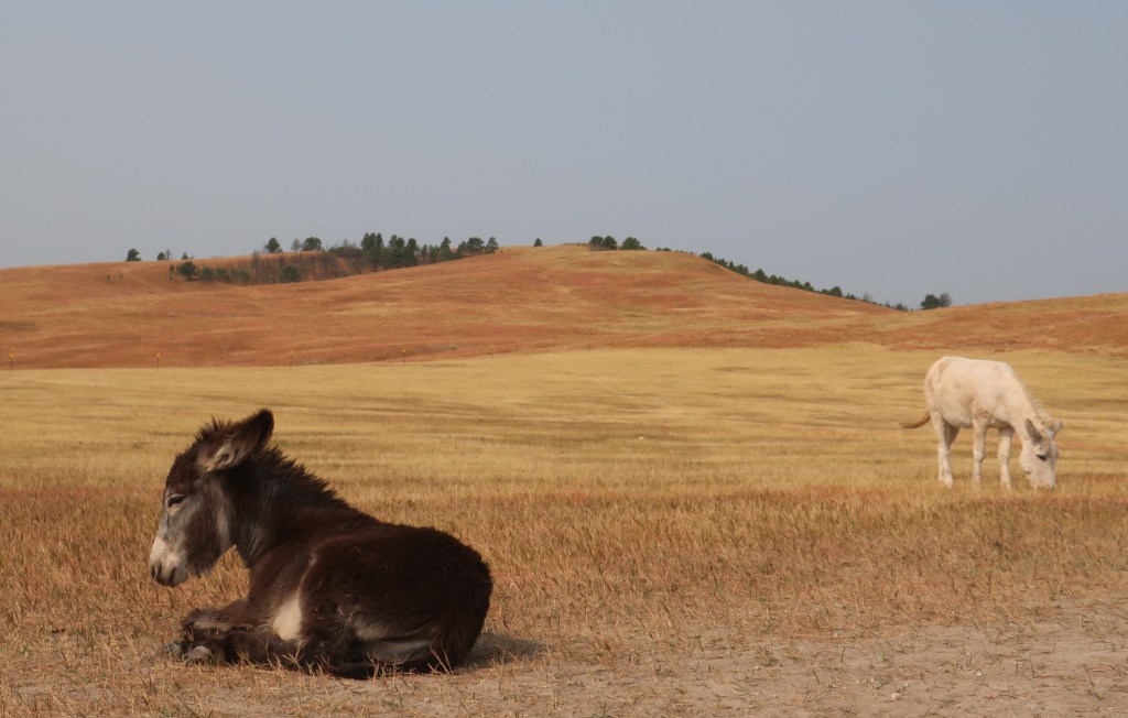
From Needles, we caught the wildlife loop through Custer State Park. Saw one of the buffalo herds, the wild burros (they actually aren’t very wild anymore), and pronghorn antelope. The burros actually we’re poking their heads in people’s cars looking for food. Two little ones were sacked out flat on the ground while people walked around them taking pictures. The buffalo herd was well off the road, but we have encountered lone bulls three times now on roads in the general park.
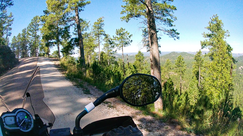
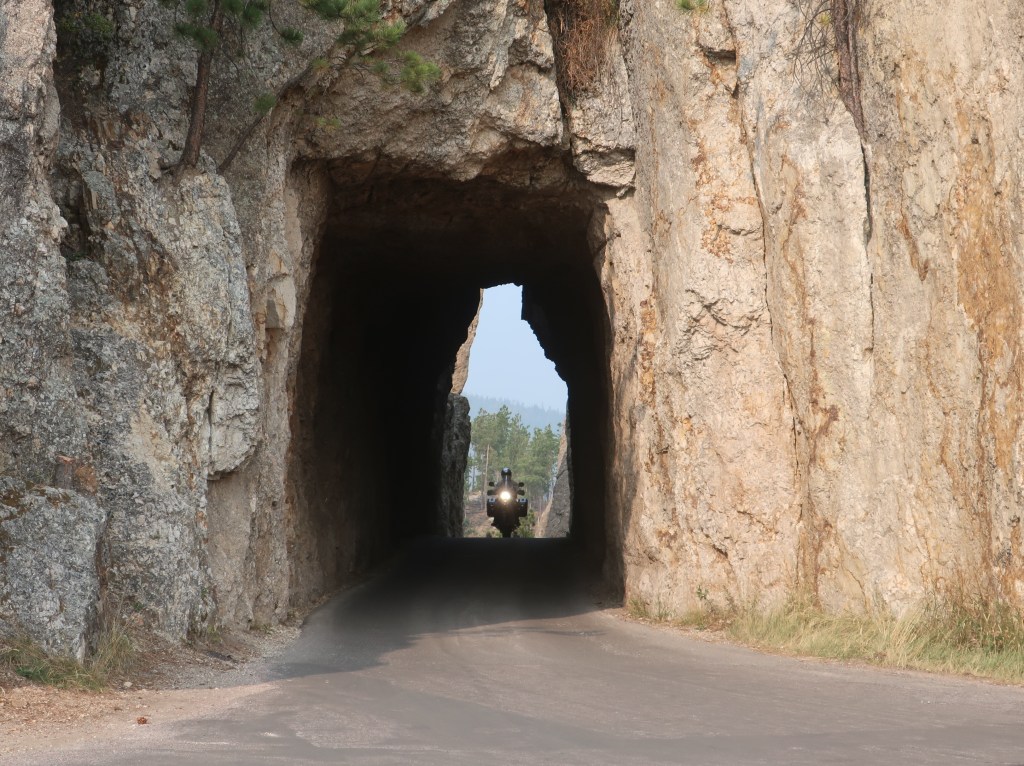
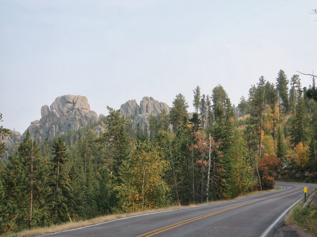
We ran over Iron Mountain Road, another fantastic road and I believe my favorite. It has a nice sinuous flow and a few tunnels of it’s own. Our most recent encounter with a bison bull came on this road. I swooped around a blind curve and was staring at one massive butt in the middle of my lane! Fortunately we had time to stop as I’m sure his wrath would have hurt worse than the initial impact. He gradually meandered off the opposite side and we eased on by. The road leaves the park and heads towards Mount Rushmore. You are looking straight on at the famous heads going through two of the three tunnels. The other thing Iron Mountain Road is famous for is the pigtail bridges. These are basically 360 degree spiral wood trussle bridges to drop the road elevation while disturbing the landscape as little as possible. I couldn’t safely get a picture of one so try Google if you are curious.
Iron Mountain Road framing Mount Rushmore.The backside doesn’t look at all like it appeared in Hitchcock’s North by Northwest.
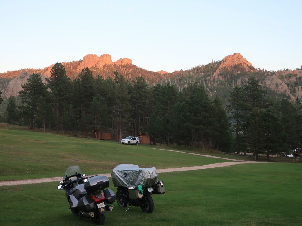
Made it back to camp early and enjoyed our final evening in the Black Hills. The Black Hills are not actually black. The name comes from the Lakota. Due to the thick growth of pine trees, the hills look very dark from a distance and in stark contrast to the surrounding landscape. Also, these are not really hills but mountains. Black Elk Peak has an elevation of 7,244 feet making it the highest point east of the Rockies.
The day started as the last couple, cool morning that ended in the 90’s. Don’s Strom showed 49 degrees when we rolled out of camp. Ran north past Pactola Lake and to the town of Leads. There’s a giant open gold mine in town. Operation was abandoned several years ago but the surprising thing is what the old mine tunnels are currently used for. Sanford Labs is conducting dark matter, neutrino properties, and gravitational wave experiments a mile beneath Leads. Scientist from all over the world come to this small Dakota town.
Pactola LakeThis thing is massive and we could not see the bottom.
We cut through Spearfish Canyon and then turned towards Wyoming. Western Wyoming may have Yellowstone and the Tetons, but the east side isn’t bad either. Our destination for the day was the centerpiece of Steven Spielberg’s Close Encounters of the Third Kind, Devil’s Tower. It is both impressive and bizarre. Unlike in the movie, there is no walking up the back side to reach the top and jam with the aliens. It is a very popular attraction for climbers though.
The dark spec just to the left side of the center tree top is the lower of the two climbers.These guys are nuts!
“Devil’s Tower” is an unfortunate name. The feature is very holy and sacred to several Native American tribes. It is referenced in the old stories of the oral tradition. The Lakota or Sioux called it Bear’s Tipi or lodge. In the Lakota language, “black bear” and “bad god” are very similar words. It is thought the current name given by European explorers is based on a misinterpretion. Devil’s Tower is also a very unique geological feature. No one knows exactly how it formed. The various theories generally involve the hardening of magma deep underground of a volcanic event. Supposedly, this tower of rock was much taller and deep below the Earth’s surface. Over eons of time, the softer surrounding dirt and rock has washed away leaving the tower standing. It’s 867 feet from the base to the summit and is still “growing” as the surrounding land continues to erode.
Wyoming valley.
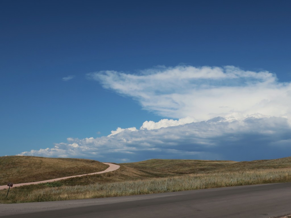
It was another spectacular day but most of my pictures were disappointing. The smoke from the western wildfires is creating a general haze over the area. On to Custer State Park tomorrow if we don’t freeze. Temps seem to be plummetting tonight.
Directing traffic at Devil’s Tower. This little guy held his ground and made people drive around him.
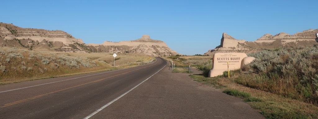
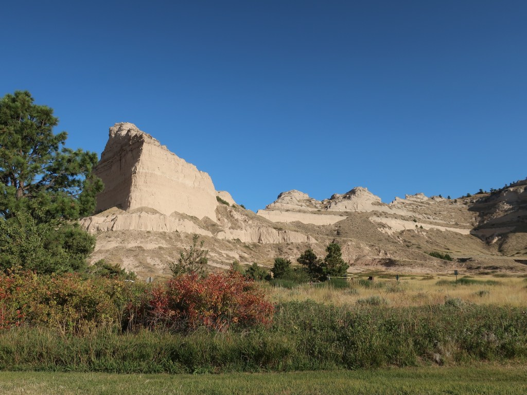
It was a stellar day! It was another brisk morning but we didn’t have far to go to reach the Scotts Bluff National Monument. We were both shocked at how stunning it was. Hard to believe we were still in Nebraska! We ended up spending the entire morning there. I did get some video footage of the decent from the summit road. I’ll try to get something posted to YouTube once we’re home and I have time.
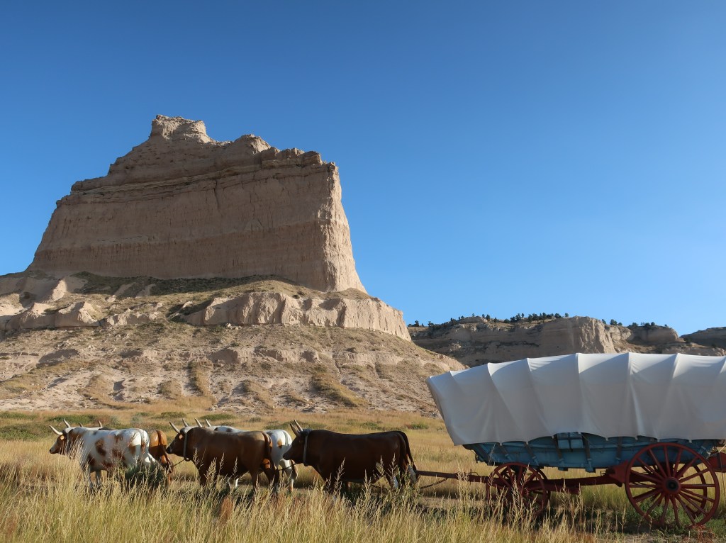
Life was hard for both people and livestock!
Towering 800 feet above the North Platte River, Scotts Bluff has been culturally and historically significant for centuries. First serving as a landmark for Native Americans and later as a pathmark for the hundreds of thousands of emigrants who traveled westward on the Oregon, California, and Mormon trails; as well as riders of the Pony Express.
Mule Deer
From Scotts Bluff, we turned north. Rode up past the Agate Fossil Beds National Monument and then on through the Oglala Grasslands at about 94 degrees. It’s just hard to comprehend just how vast and open the plains can be. Mile after mile of just rolling grassland as far as the eye can see. No buildings, no trees, just an occasional cattle-gated driveway disappearing into the distance. I like living in the country, but I can’t imagine living that secluded. And pioneers moving westward day-after-day, week-after-week, with a never changing landscape took tremendous fortitude.
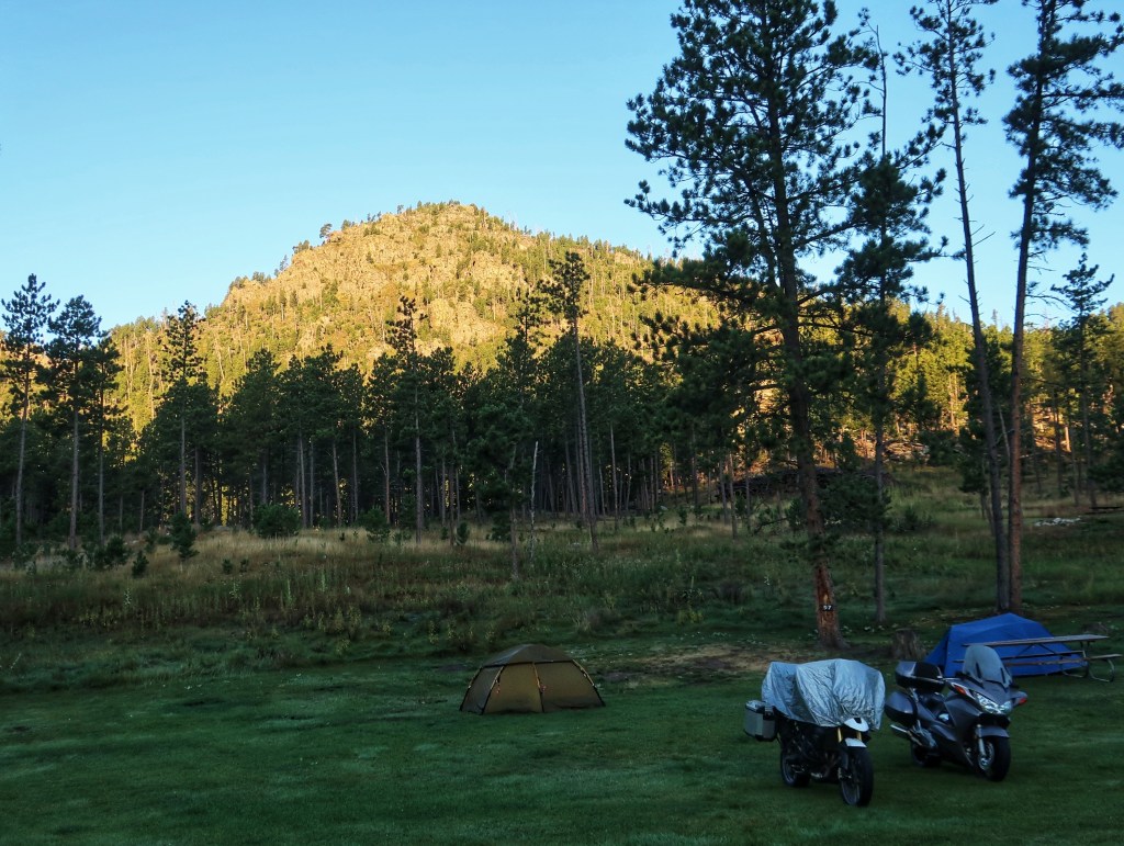
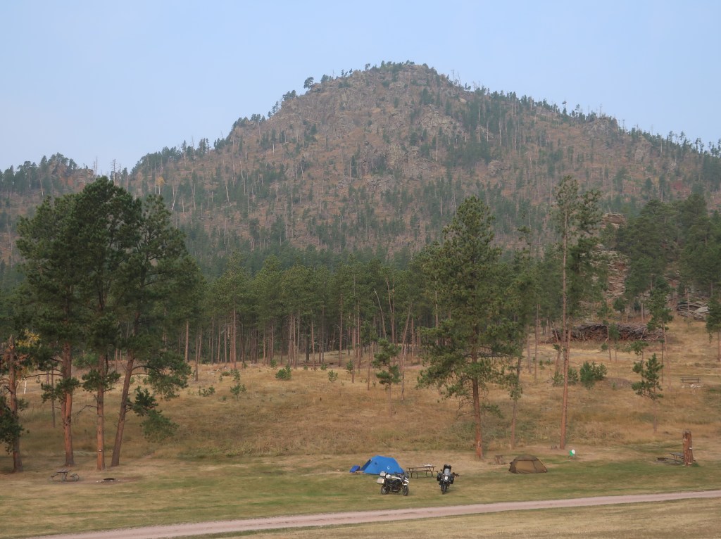
We did cross into the Black Hills this afternoon. Only had to dodge one bull buffalo standing on the edge of the road as we came through Custer State Park. Camped at Horsethief Campground near Hill City.
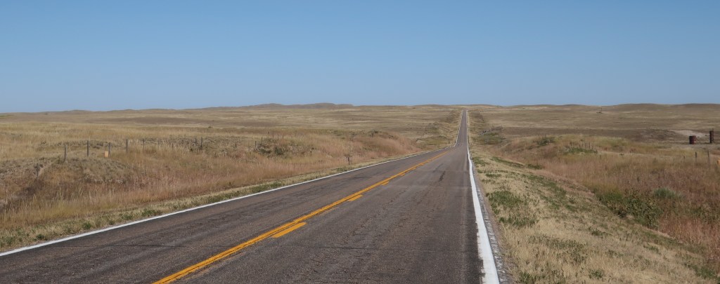
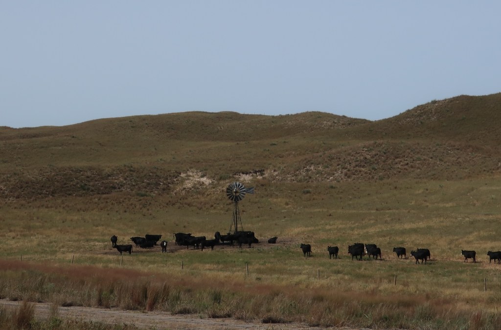
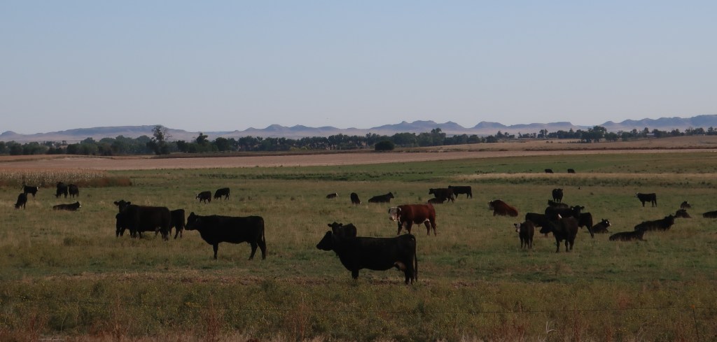
Welcome to Nebraska where the cows outnumber people with 23 million acres of rangeland and pastureland! Started out this morning at 51 degrees but ended the day around 90. Ran up I-24 for 50 some miles to Iowa. Overtook one tractor trailer and caught up to a second one just before our exit. We didn’t see any other vehicles on our side of the interstate that entire stretch! Left the interstate for good at Grand Island Nebraska and came across Highway 2 through the Sandhills.
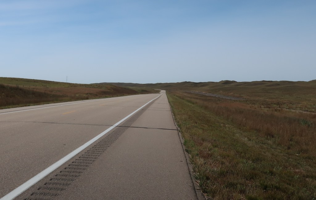
The Sandhills are impressive but proved difficult to photograph. There just weren’t any good pulloffs or overlooks. Definitely big sky country though. It’s just a very open and empty landscape. And traffic was virtually non-existent in the western half. Reminded us of the Trans-Labrador Highway. But there were lots of trains! They were everywhere.
The Nebraska Sandhills region is the largest grass-stabilized sand dunes in Western Hemisphere. 20,000 square miles or roughly one third of Nebraska. The Sandhills represent the largest remaining grassland ecosystem in the USA that is still fully intact for both flora and fauna. Formed after the last ice age when winds blew the loose sand deposited by retreating glaciers into dunes up to 400 feet high.
We finished out the day by dropping south to Scottsbluff. Over 1100 miles since leaving home. We’ll check out the monument in the morning then head north to South Dakota. We should be camped in Hill City SD tomorrow night.
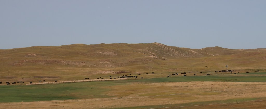
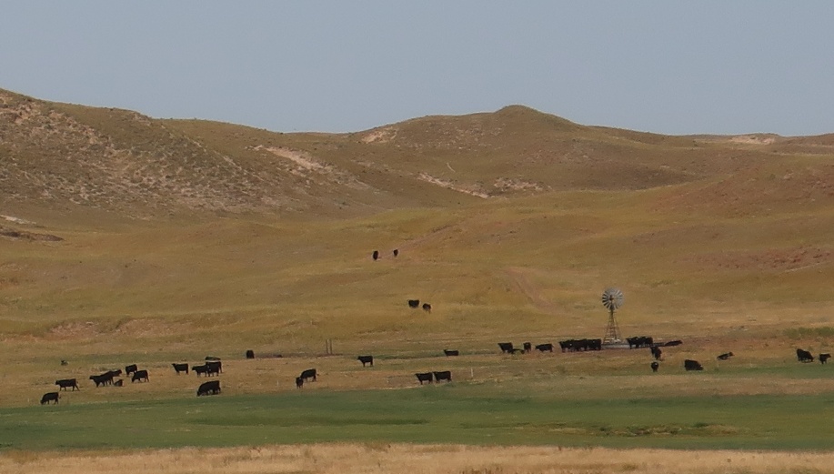
Did I mention there are a lot of cattle in Nebraska?I’m pretty sure that bugs outnumber people and cattle a million times over!
We are on the road again, this time heading west. Going west always seems better than east to me. Riding with the sun, you gain daylight every day. There’s something satisfying about traveling in the same direction for multiple days. For most of us, rarely are we more than a day’s travel from home. And the American West is just spectacular! The landscape varies so much and appears foreign and exotic to those of us living east of the Mississippi.
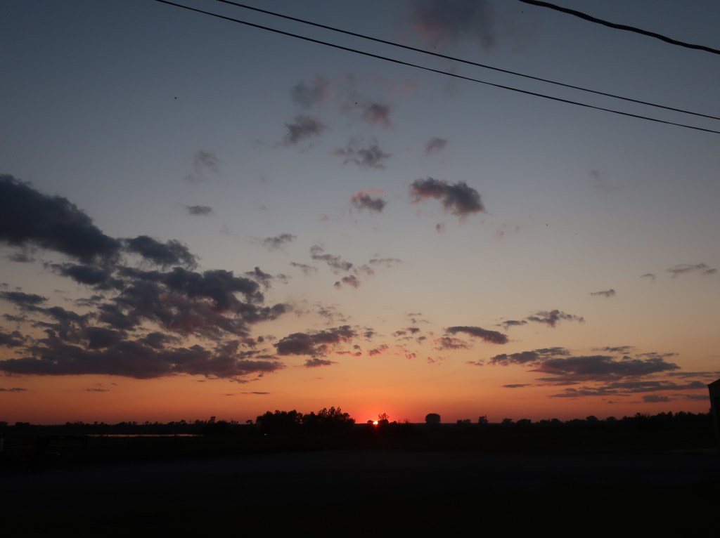
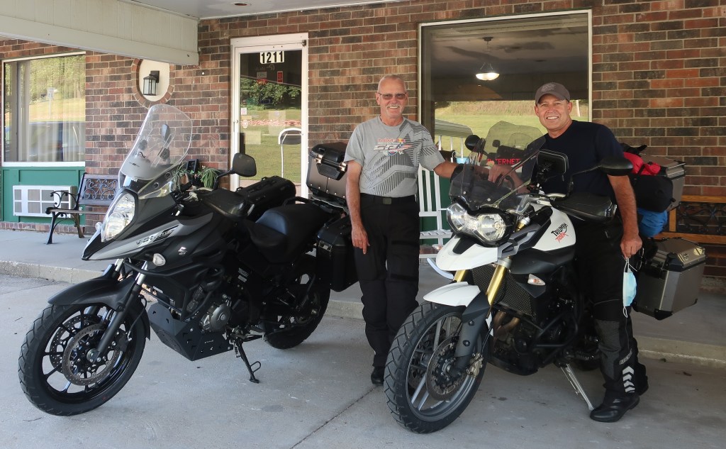
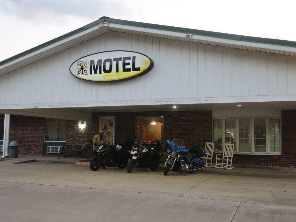
Today was just a travel day so no spectacular pictures. Left Southern Indiana in gloom and fog. Had a little rain around St Louis. Then the sky cleared for a great afternoon and evening. Holed up in Mound City Missouri at a very motorcycle-friendly hotel. We will be passing through the Sandhills of Nebraska tomorrow and hopefully end up around Scotts Bluff. Stay tuned. The pictures will get better! We will not be nearly as remote as last year so I hope to be able to update daily. I just hope the snow melts in the Black Hills by the time we get there.