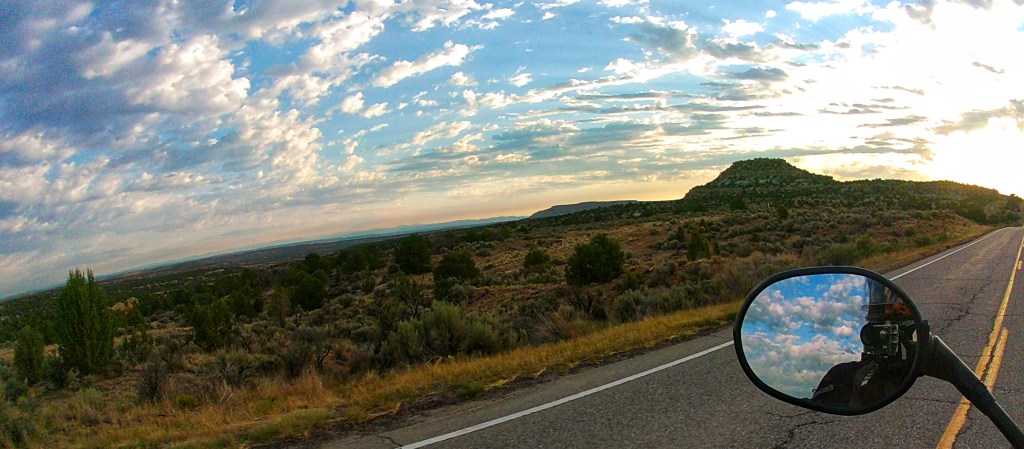
We had an early morning start trying to beat the heat and enjoyed our final day in the American Southwest. Northern New Mexico is very much desert in the west, lush mountains and meadows in the middle, and flat plains in the east.
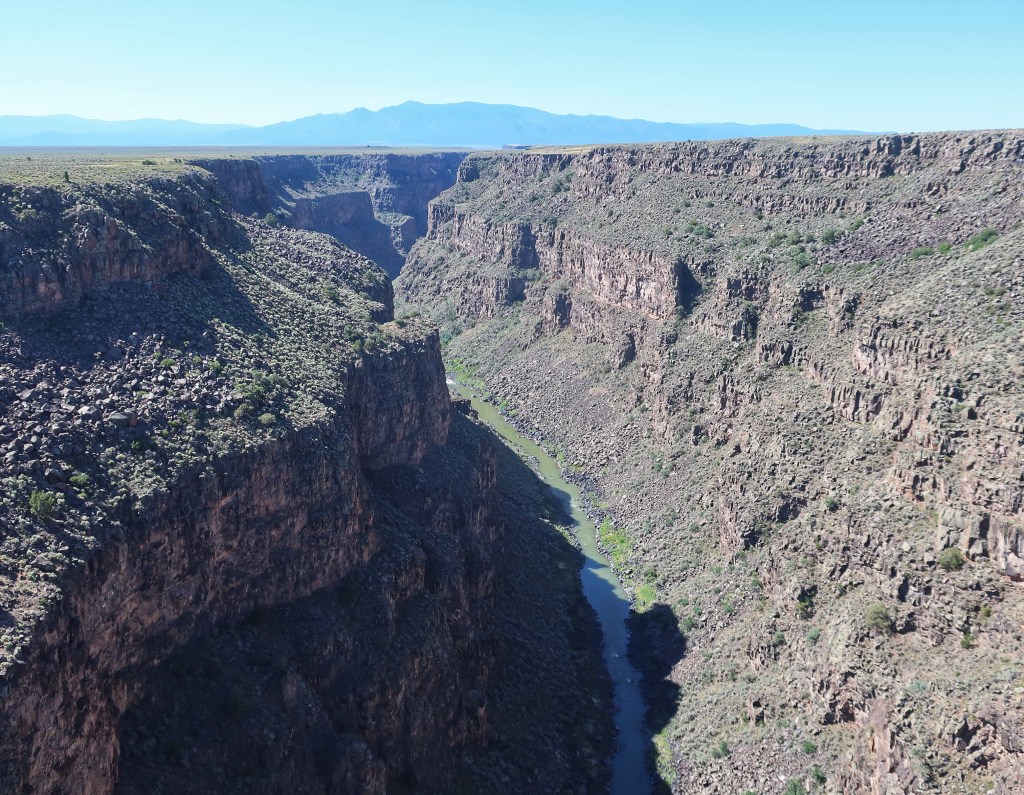
The Rio Grande Gorge just west of Taos. The bridge is 650 feet above the river and the 2nd highest bridge in the U.S. highway system.We saw 10,500 plus feet at one point and a temperature drop into the upper 40’s.Cimarron Canyon east of Eagles Nest.
We dropped below 5,000 feet by mid afternoon for the first time since Monday. The heat really came on then, as did a very nasty looking storm we managed to skirt coming out of Oklahoma into Kansas.
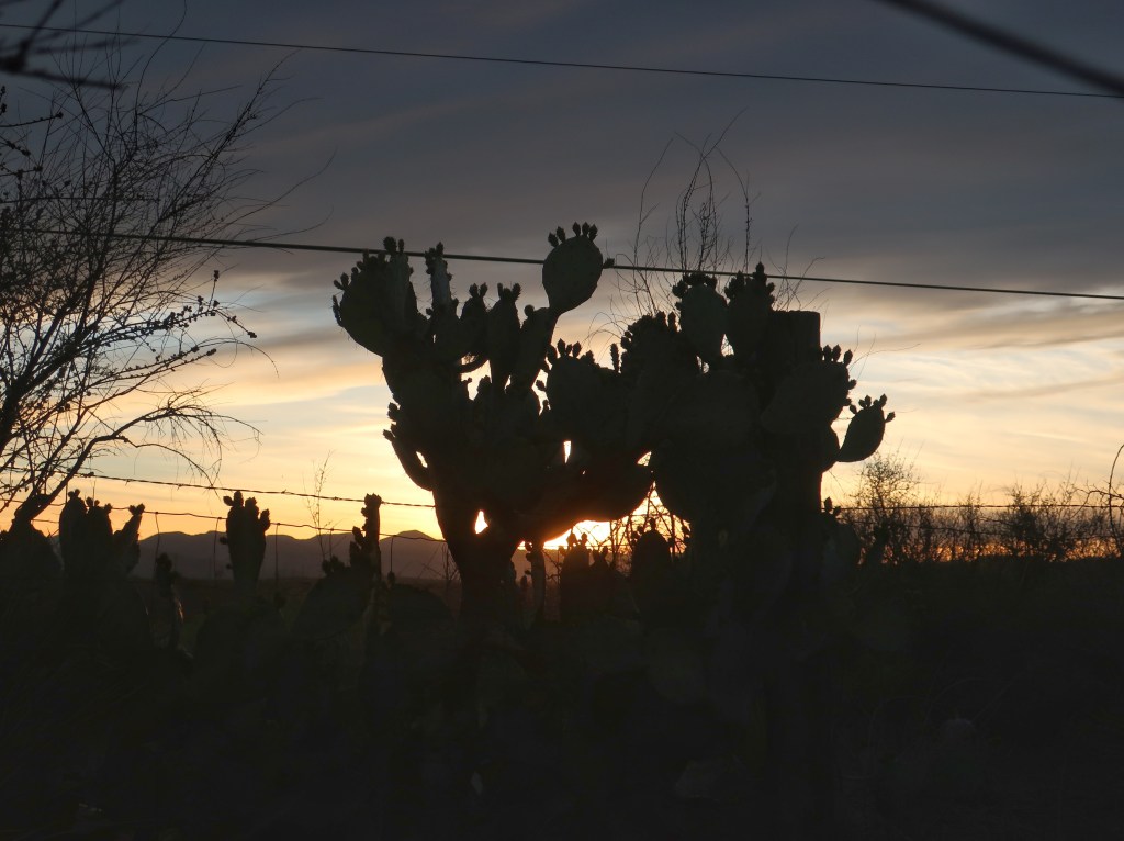
Sorry about the bugs on the lense. Photo by Jordan.
The next couple of days will just be a drone home in sweltering heat. So this is likely the last post other than a wrap up next week. Maybe I can add a few pictures from Jordan then who carries a much better camera. Thanks all for following.
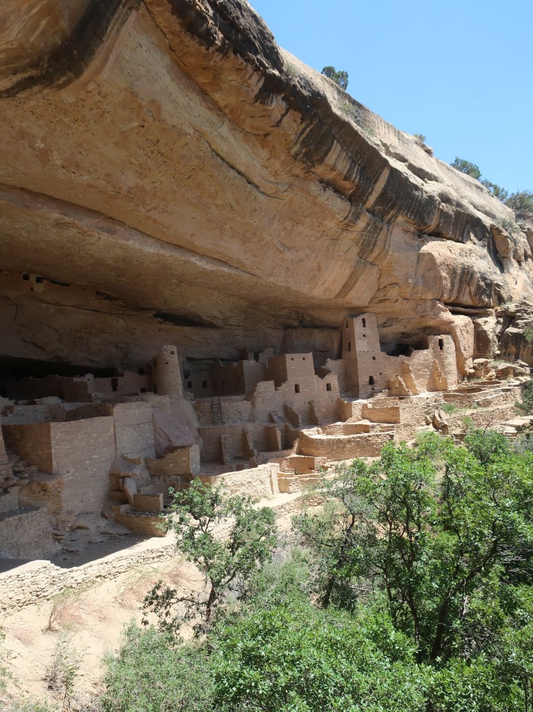
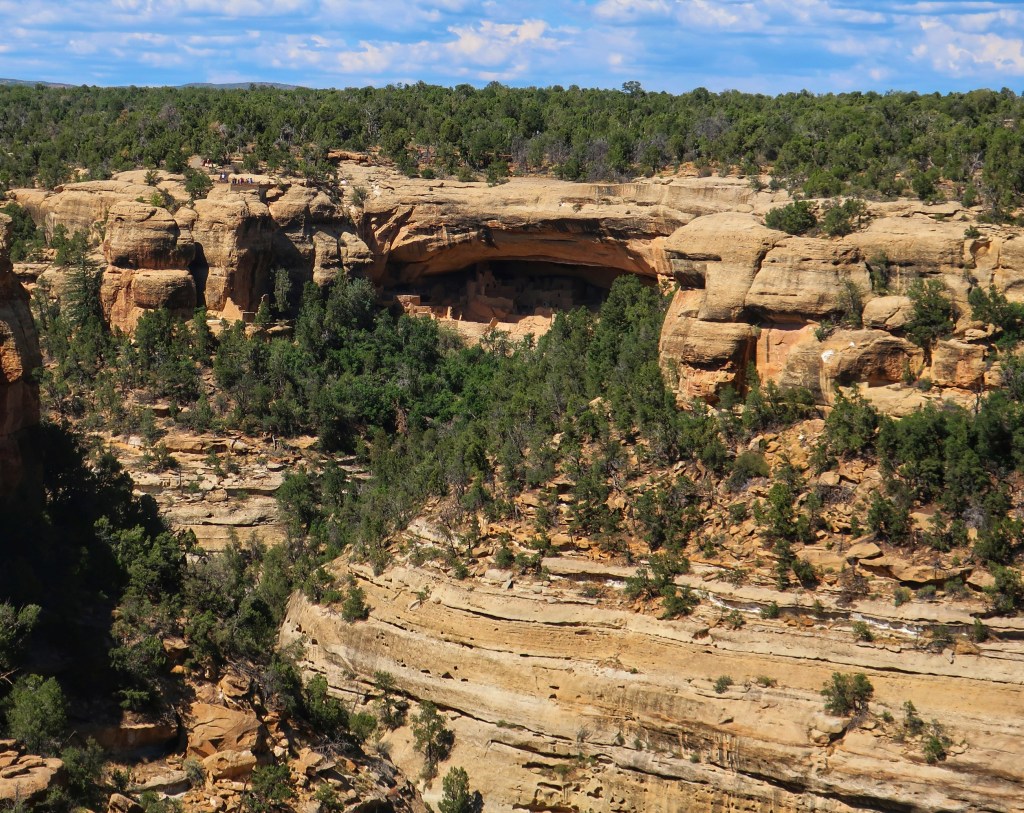
Cliff Palace. The largest Cliff dwelling in the world. It is believed that at least 24 families shared this site.
Mesa Verde National Park, I highly recommend it! This area wowed all of us today and it quickly became obvious that the few hours we had allotted was nowhere near enough time. The ancient Puebloans, or Anasazi, lived in the area over 700 years, from roughly 550 to 1300 AD. At it’s peak around 1200, approximately 40,000 people lived in the area. That’s more than today’s population in the county.
There are hundreds of Cliff structures in the park and thousands of various ruins. We didn’t know there were anywhere near that many. The people built on top the Mesa for hundreds of years before moving to building in the cliffs in 12th and 13th centuries. These sites were abandoned shortly after for unknown reasons that are still debated today.That’s Cliff Palace from a distance. Many of these ruins are quite high in the cliffs and the inhabitants carved hand and foot holds in the sandstone to climb to the top where they farmed corn, beans, and squash.And it’s not just the ruins that are amazing. The scale and beauty of this landscape just adds to the experience.The height of this Mesa is stunning. That’s the Rockies we came through in the distance.
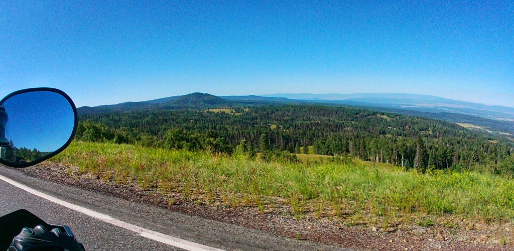
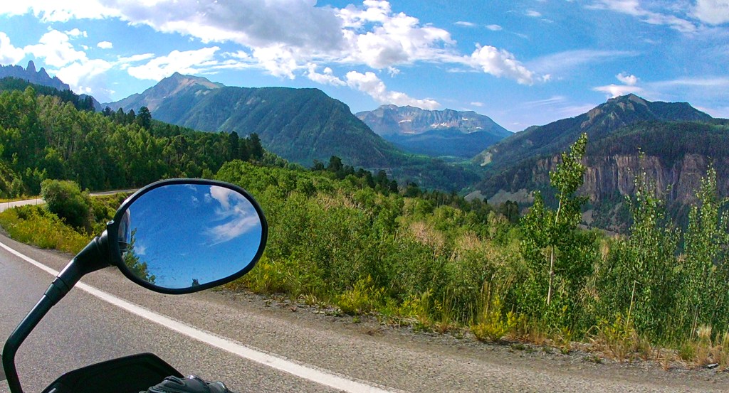
Our day started out quite cool at 43 degrees! We weren’t expecting temps that low. Anyway, after packing up tents and gear, we had a beautiful morning ride down the San Juan Skyway again. This time running it north to south.
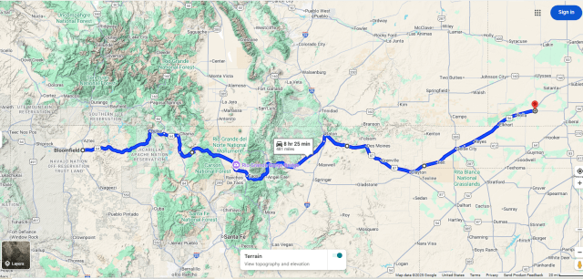
We ran pretty hard today and the heat and sun were pretty intense at Mesa Verde. After fuel and dinner. We dropped down into New Mexico for the night. Tomorrow we start heading back east to the heat and humidity.
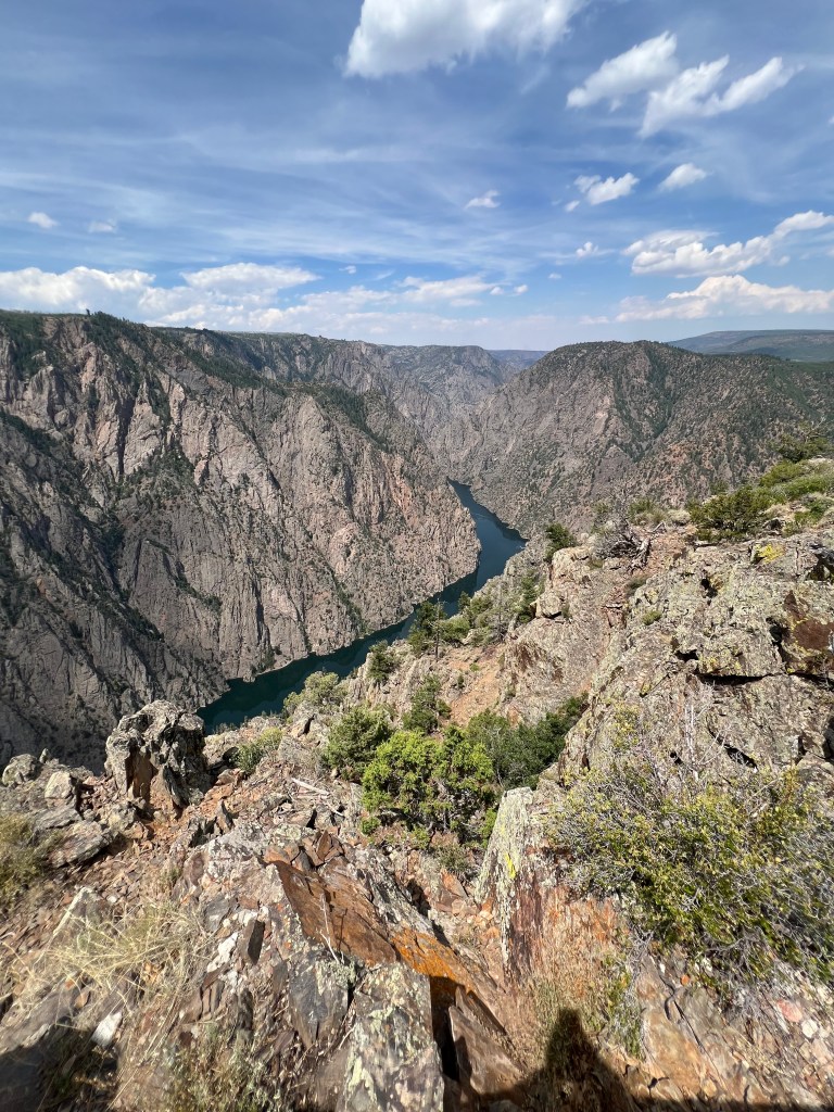
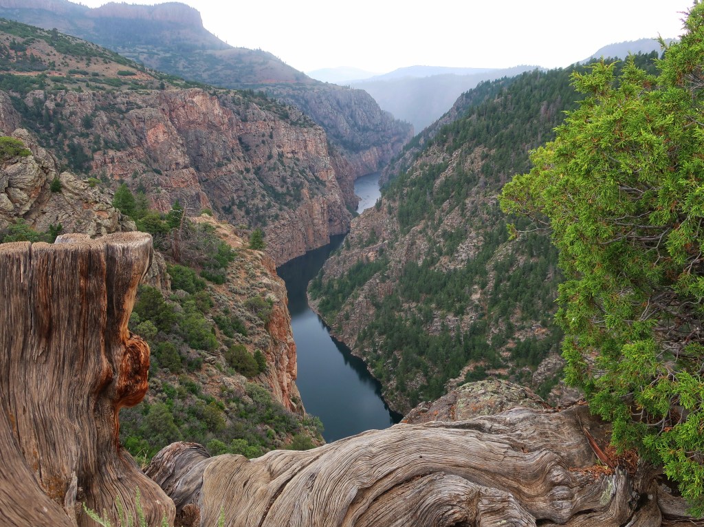
The day started clear and cool with temps just shy of 50. This was our “easy” day to ride less, do laundry, and start packing what we can. Since the Black Canyon of the Gunnison National Park is closed, we thought we would ride up Hwy 92 which runs on the north rim side. Turns out you can see the wider and less deep southern end of the canyon which is not in the park.
There was a definite smoke haze when we got closer to the canyon and it clouded up midday with some rain.
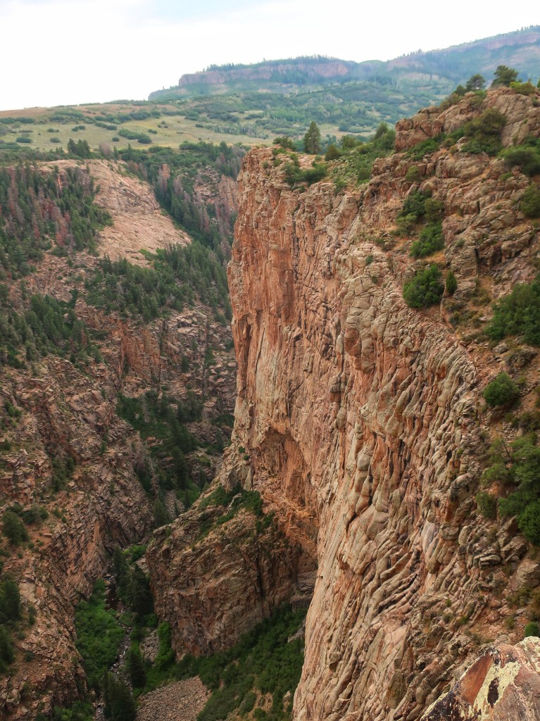
The Black Canyon is so named because its steepness makes it difficult for sunlight to penetrate into its depths. As a result, the canyon is often shrouded in shadow, causing the rocky walls to appear black. At its narrowest point the canyon is only 40 ft wide at the river. The walls range in height from 1800 to over 2700 feet with sheer vertical walls in places. The Statue of Liberty would be dwarfed if on the canyon floor.
The scale is hard to appreciate in photos. It is immense! And this isn’t even the tallest part of the canyon.
The Gunnison River drops an average of 34 feet per mile through the entire canyon, making it the 5th steepest mountain descent in North America. By comparison, the Colorado River drops an average of 7.5 feet per mile through the Grand Canyon. The greatest descent of the Gunnison River occurs within the park at Chasm View dropping 240 feet per mile. The extreme steepness and depth of the Black Canyon formed as the result of the Gunnison River carving the canyon, though several other geologic events had to occur in order to form the canyon as it is seen today.
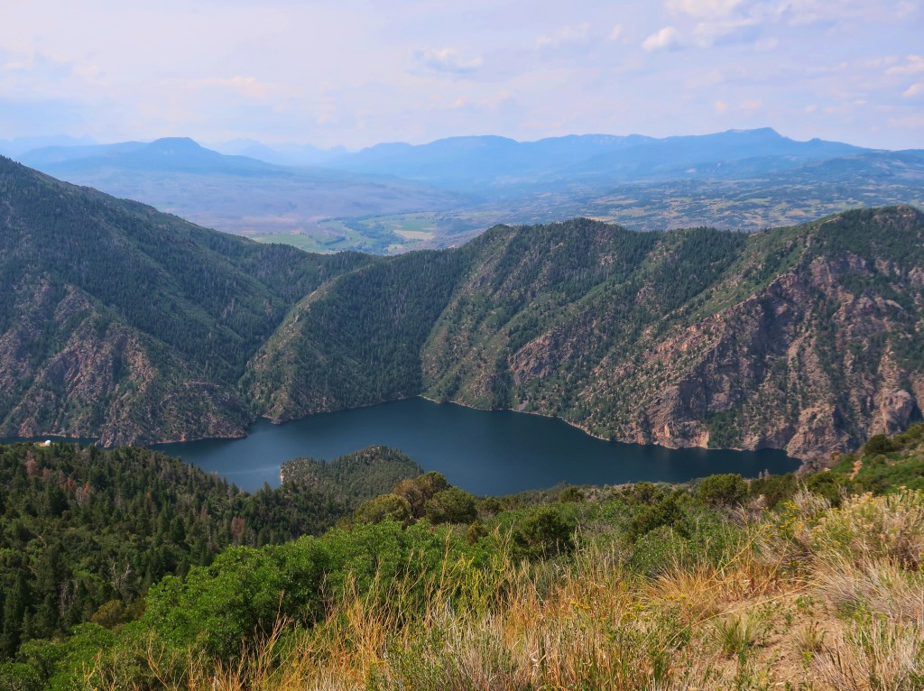
Part of the Blue Mesa Reservoir formed by damming the Gunnison River.
We had a good day although not what I originally planned. The smell of smoke was in the air at times and you could see a few dark pillars of smoke rising on the south rim. This fire was just an inconvenience for us. It will be impacting the local communities for years to come.
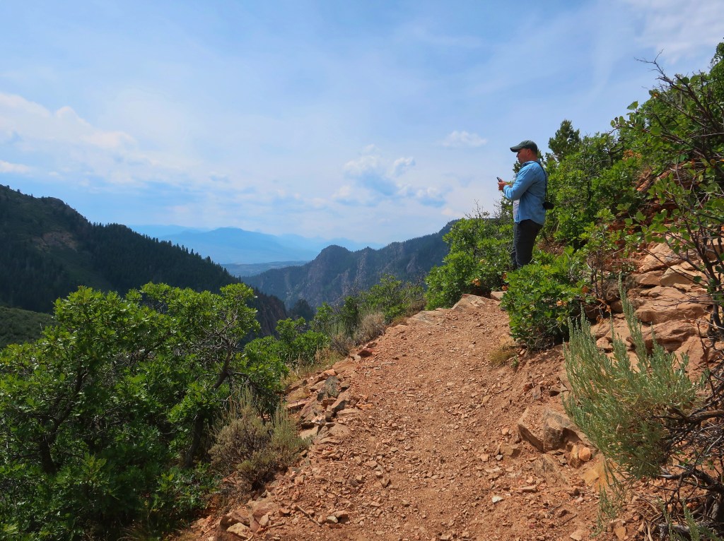
Got to enjoy a hike with my nephew today although it turned out a little more strenuous than I anticipated.
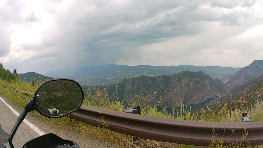
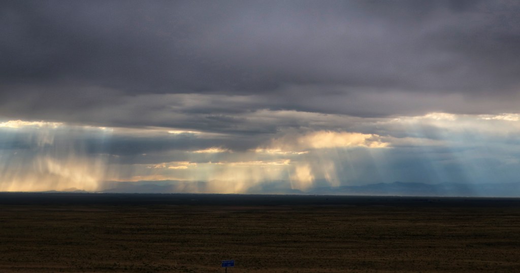
So, if you want to know what an approaching storm looks like in the mountains, this is it. You can often see the margins of the storm as well as where the sheets of rain are falling. In the American East, we only see small portions of a storm. The western sky is big! I couldn’t begin to tell you how many miles are visible.
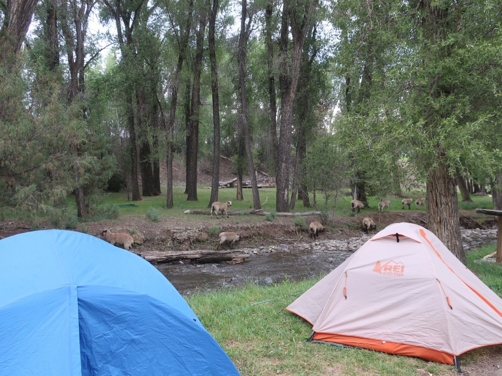
Our neighboring sheep flock have their own bridge to cross the stream.
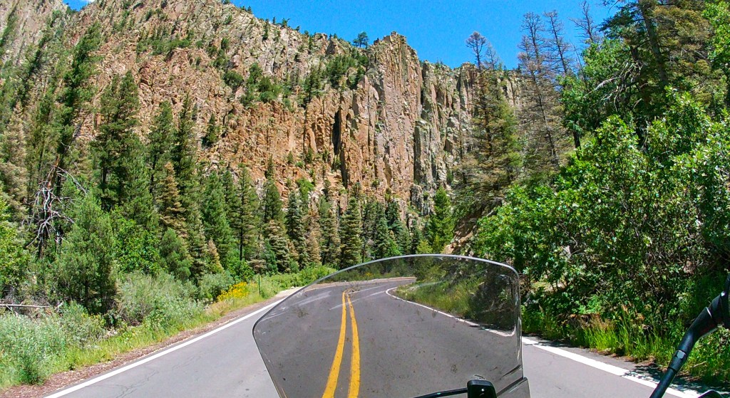
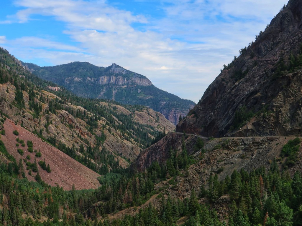
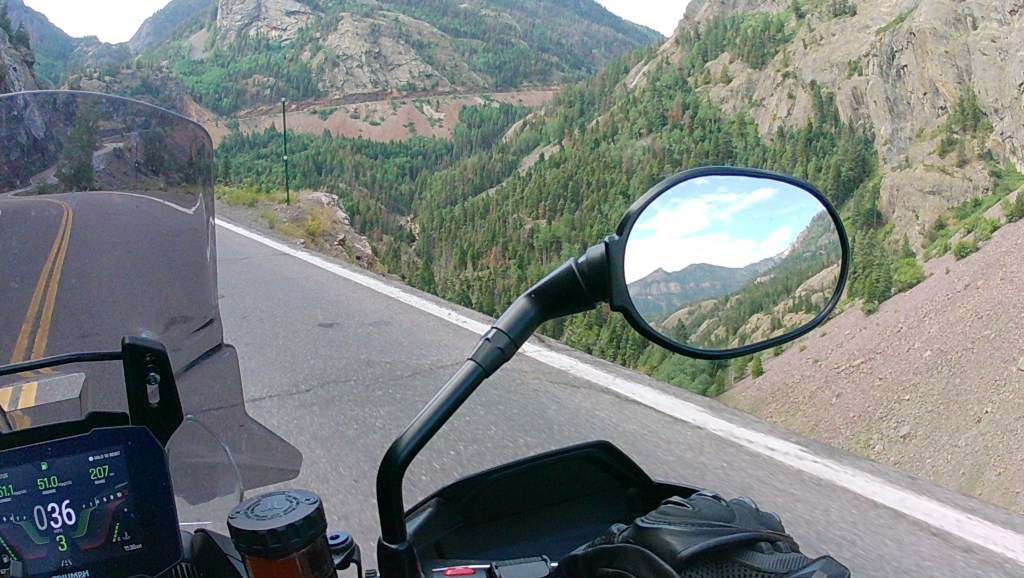
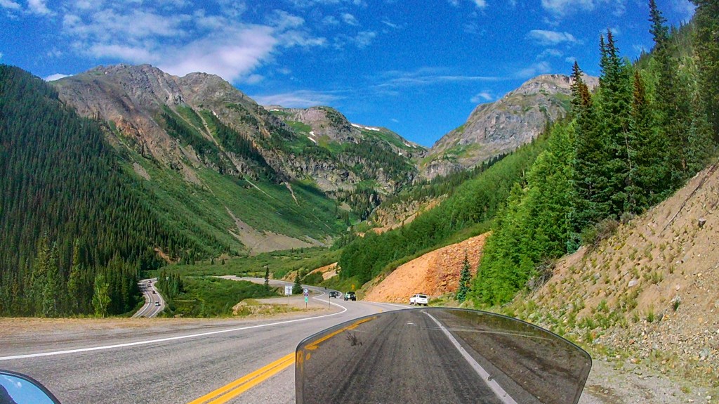
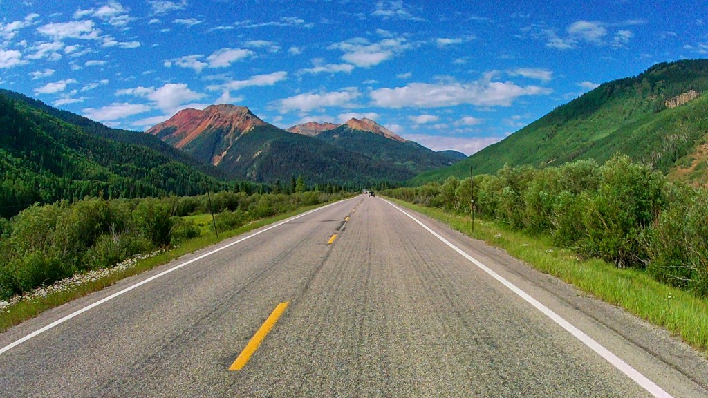
The tablet is back up and running! Stellar day! Absolutely stunning and a little terrifying too. Ran Hwy 550 from Montrose to Durango this morning. And returned in the afternoon on the San Juan Skyway.
Highway 550 between Ouray and Durango is often referred to as The Million Dollar Highway. The true Million Dollar Highway is actually the 25 mile stretch that travels between the small towns of Silverton and Ouray in Southwest Colorado. The highest point is 11,018 feet at the peak of Red Mountain Pass, in the San Juan Mountain Range. The Million Dollar Highway was originally constructed as a toll road by Otto Mears, who oversaw the building of many narrow gauge railroads, in the 1880s. Then, in the 1920s, the road underwent construction again, paving the path to the road as it is today.
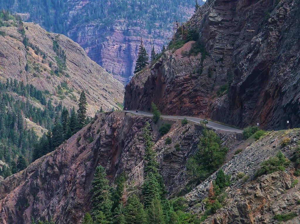
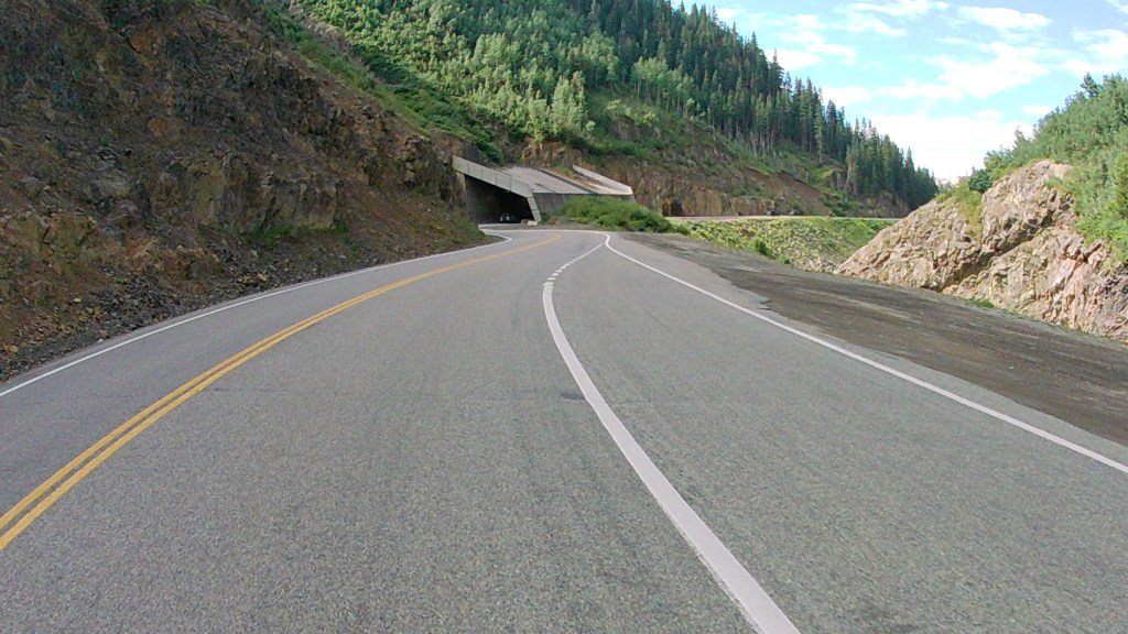
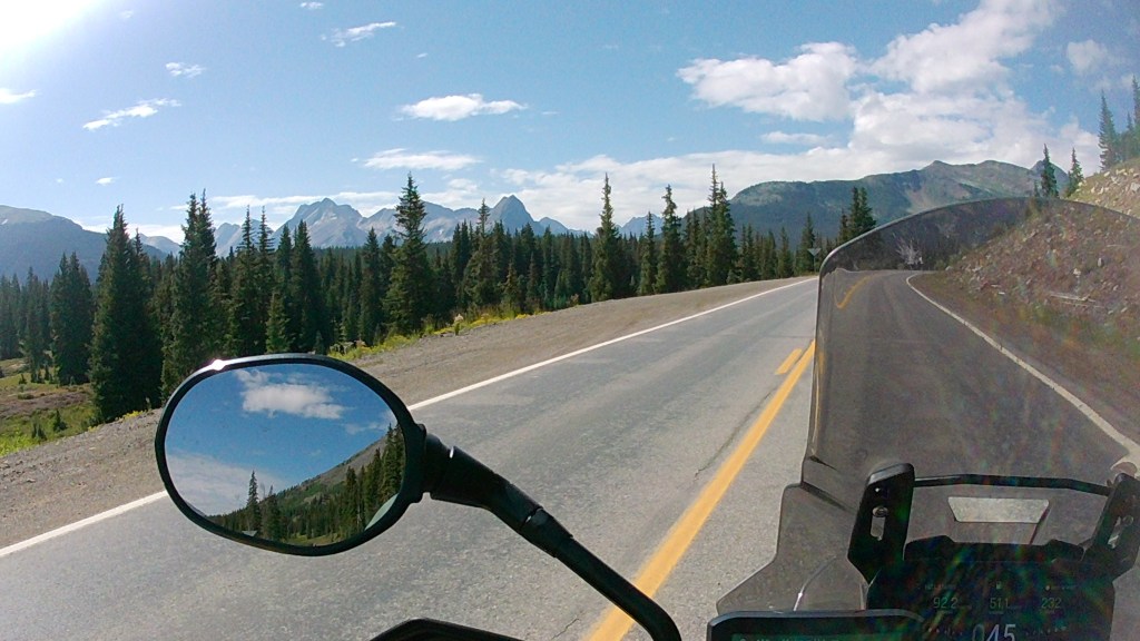
Wish this was a picture of Don and Jordan, but it’s not. A lot of motorcycles make this loop. Actually I believe we met a few of them twice as we ran it in opposite directions.DO NOT CROSS THE WHITE LINE!That is an avalanche tunnel.Lots of old mine ruins in this area. Some still standing, some not, and some restored to varying degrees.The road has gotten a lot busier than the last time I rode it.
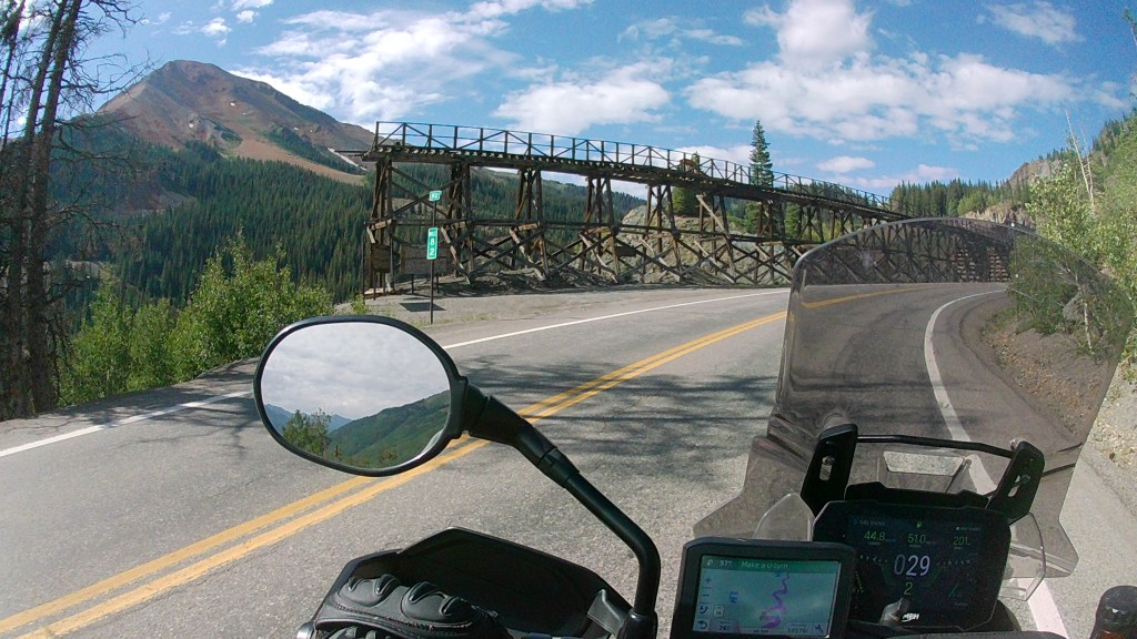
I would highly recommend this road if you enjoy scenic drives. If heights bother you, they say to travel the Million south to north, but honestly, not sure it makes much of a difference either direction. They have improved the road over the years and the speed limit has dropped on the worst sections, so it really isn’t bad. And now on to the San Juan….
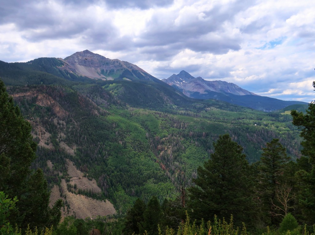
The San Juan Skyway.
Today, as the last couple, has been “sensory overload”! Only got sprinkled on a little for a change though. Tomorrow should be an easy day and hope to see a little of the Black Canyon of the Gunnison despite the national park closure due to the wildfire.
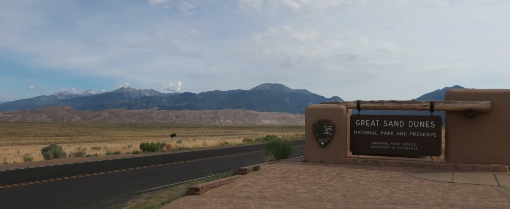
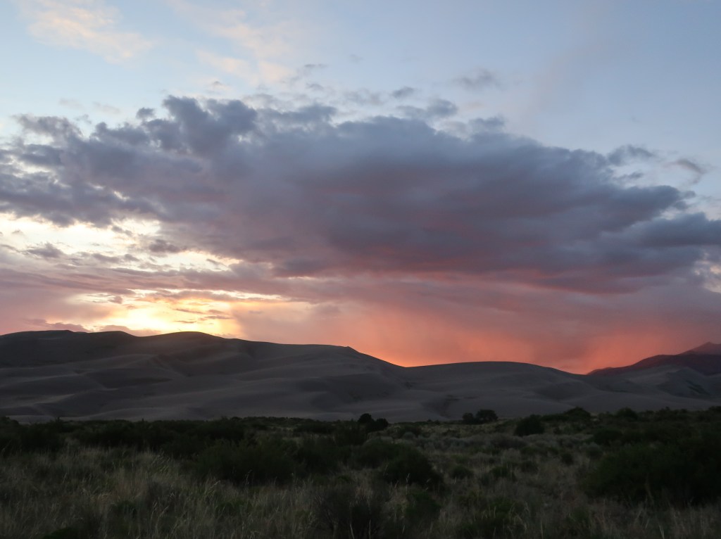
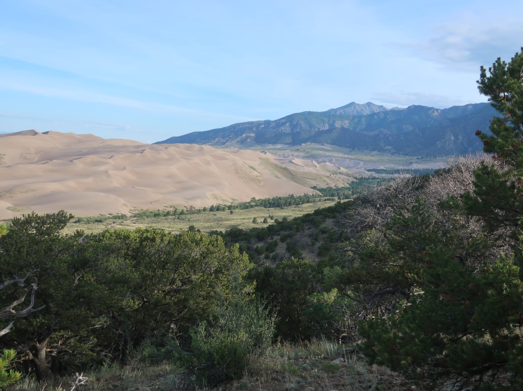
After a stormy start to our visit, the weather did clear just before sunset. Approaching these dunes, they just look so out of place and you wonder how in world did they get here.
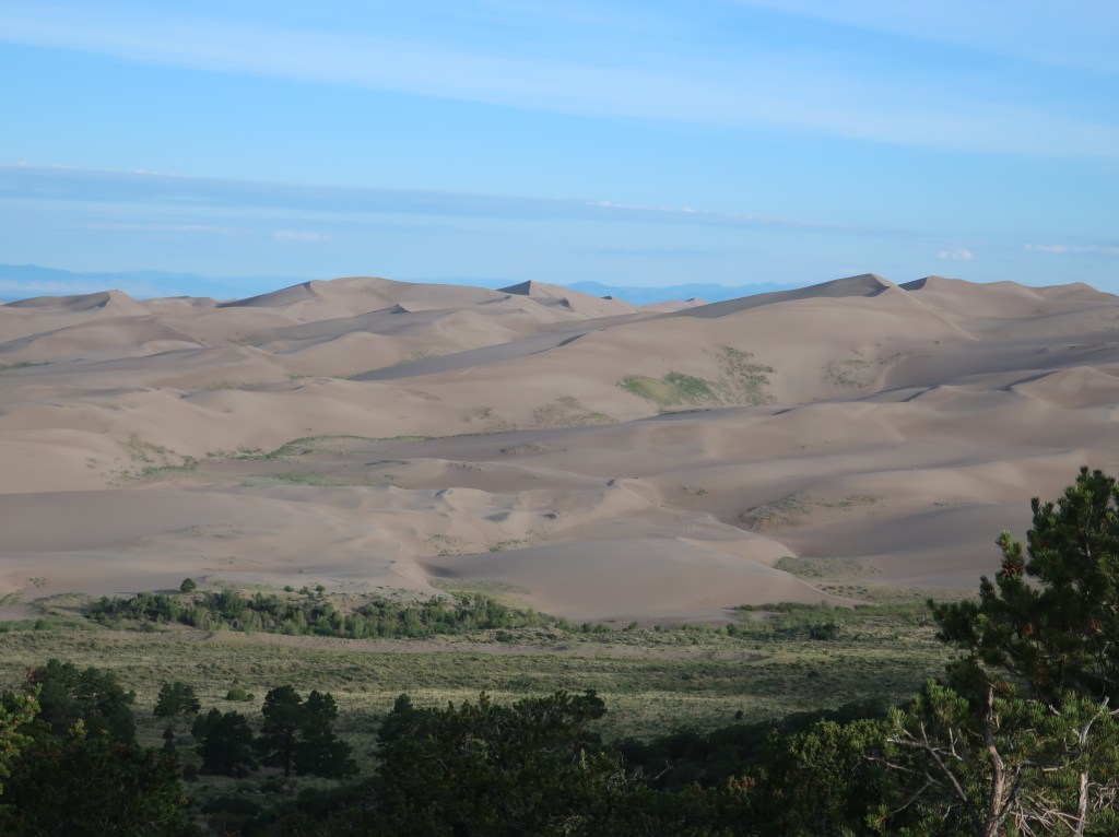
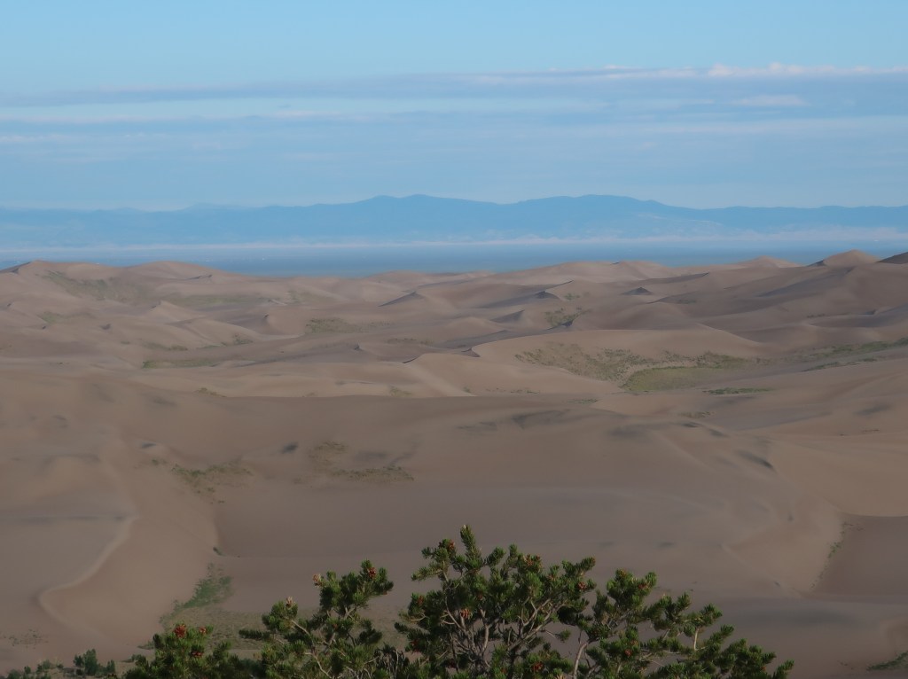
The park contains the tallest and widest sand dunes in North America, rising to a maximum height of 750 feet from the floor of the San Luis Valley on the western base of the Sangre de Cristo Range. The dunes cover an area of about 30 square miles.
Jordan got up before daylight this morning and hiked to the top. Evidently their size seems much bigger up close.
Sediments from the surrounding mountains filled the valley over time. After lakes within the valley receded, exposed sand was blown by the predominant southwest winds toward the Sangre de Cristos, eventually forming the dune field over an estimated tens of thousands of years. Sand that was left behind after the lakes receded blew with the predominant southwest winds toward a low curve in the Sangre de Cristo Range. The wind funnels toward three mountain passes—Mosca, Medano, and Music Passes—and the sand accumulates in this natural pocket.
This mule deer doe had two fawns with her but they were faster than my camera.
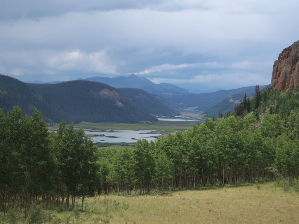
After spending most of the morning at the dunes, we packed up camp and ran hwy 149 towards Cimarron. We hit heavy rain as we crested an almost 12,000 foot pass. Temperature dropped to 50. But what a gorgeous ride when it wasn’t raining. Just can’t describe the mountains, streams, and canyons we saw this afternoon. But below is just a small sampling…
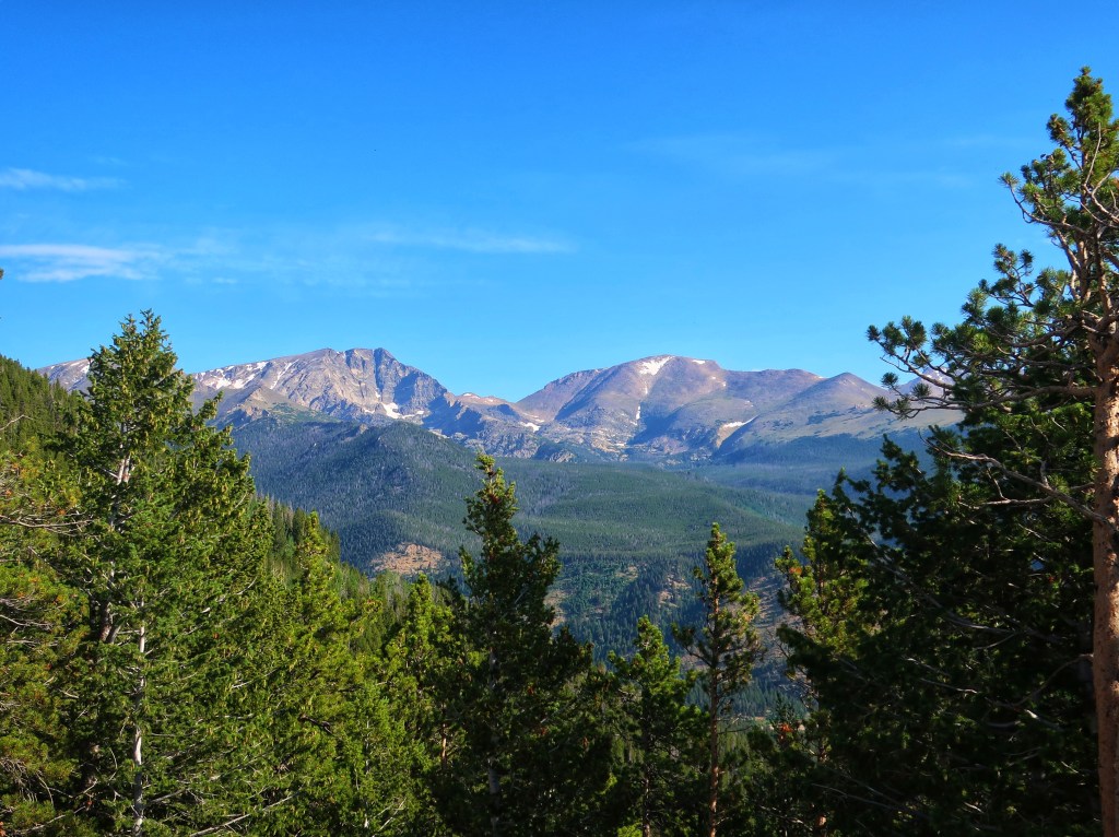
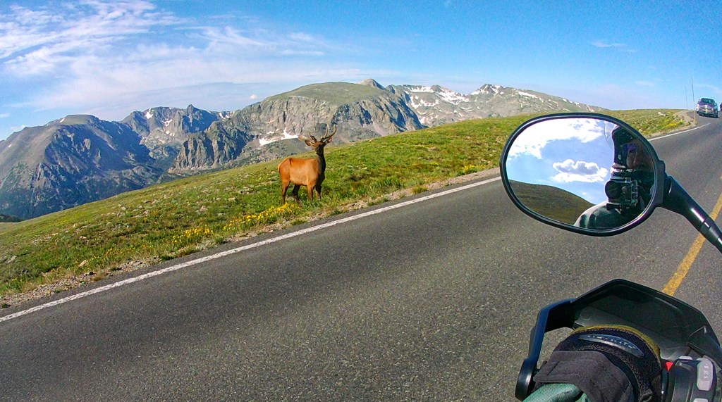
This morning was beautiful! Hwy 34 runs through a narrow canyon between Loveland and Estes Park. It is amazing but I didn’t have the helmet camera on yet. Got into RMNP without any issues but traffic did pick up quickly. The overlooks have become crowded to the point that sometimes there’s not a spot to be had. We mostly just kept moving and taking in the scenery. Pictures never do justice anyway.
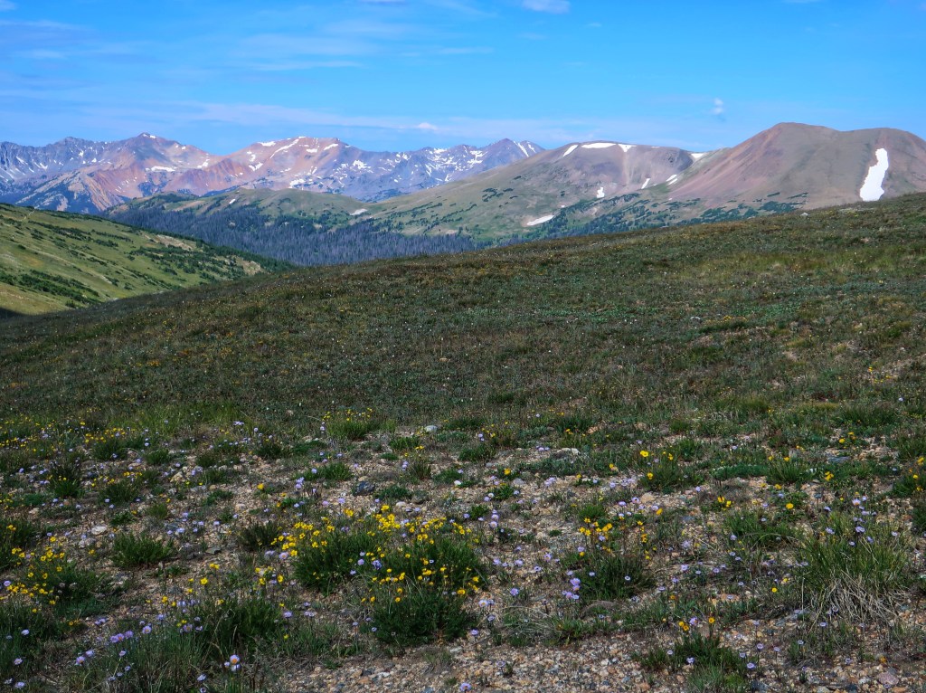
Wildflowers of the tundra.
Trail Ridge Road, aka Highway 34, is the highest continuous paved road in North America topping out 12,183 feet.
Rocky Mountain National Park was established by Congress in 1915. It encompasses 265,807 acres or 415 square miles! RMNP has 72 peaks over 12,000 feet! Yes,72! Nearly a third of the park is above treeline at 11,400 feet. Longs Peak s the highest at 14,259 feet.
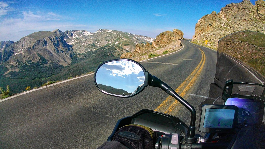
Life doesn’t get much better. Rocky Mountain National Park and two friends in the mirrors.
After seeing a moose cow and calf crossing a deep stream (sorry no place to stop for a photo), we exited the park on the west side and dropped south to the Great Sand Dunes. And yes, we did get to ride in more rain again today.
Rain and rays of sun as we came through the San Louis Valley approaching the sand dunes.
We have survived Kansas, at least going out. We were fortunate enough to be just north of the storms this morning. And really loving hwy 36. Almost no traffic, 65 mph speed limit, and just enough small towns for gas and food without slowing you down. It was hot though. Saw 95 in Kansas, but Nebraska and eastern Colorado registered 100 degrees! Another 500 plus mile day, right at 1200 miles since Friday evening.
Penny’s Diner was our breakfast stop. You can see the storm just south of us.
So tomorrow the good stuff will start. I kinda look at Kansas as a rite of passage…if you want to motorcycle in the Rockies, you must first prove yourself by crossing Kansas in the heat and the storms.
Good night from Loveland Colorado. Tomorrow should be spectacular!
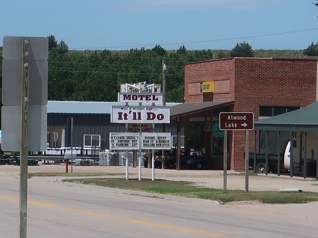
Just an amusing motel in Kansas. We didn’t stay there!
Well, it’s that time of year again and Don and l are on the road heading west to Colorado. This year, my nephew, Jordan, is with us. This will be his first trip with us west of the Ozarks.
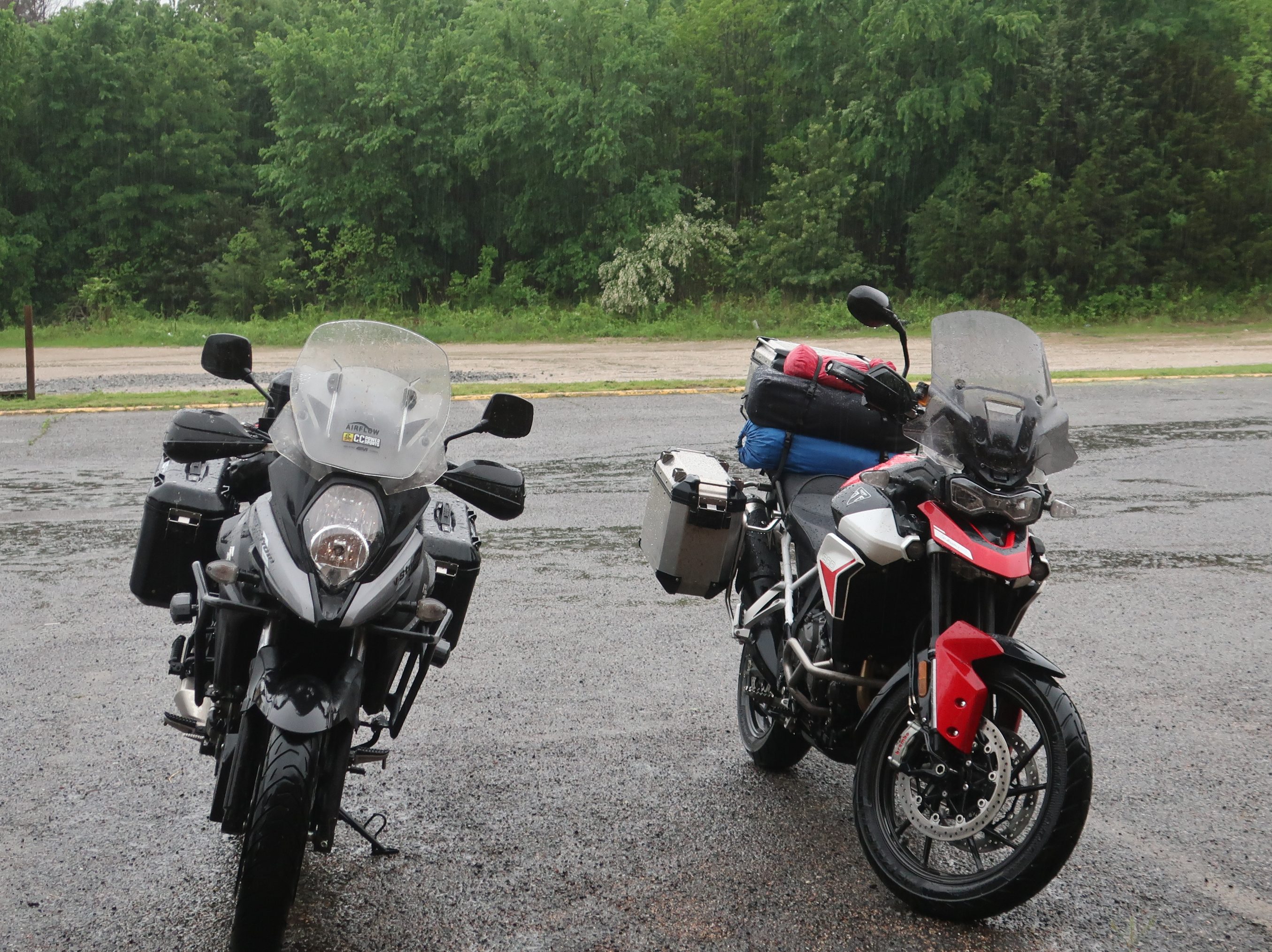
Ready for launch, T minus 10 hours and counting.
The itinerary changed a bit last week when lightning started a wildfire on the south rim of the Black Canyon of the Gunnison. The national park lost most of its structures and is closed indefinitely. We will be camping just south of the canyon which they say is not impacted. At any rate, it was too late to make alternative plans, so we are hoping for the best. We do plan on hitting Rocky Mountain National Park, Great Sand Dunes National Park, the San Juan Skyway/Million Dollar Highway, Mesa Verde National Park, and drop down into New Mexico to start our return trip.
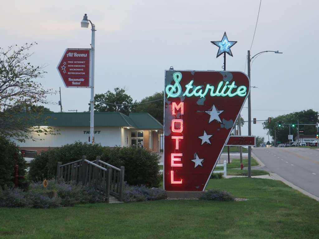
The Starlite Motel is a throwback that’s hard to find these days.
We left Jordan’s place in Indianapolis this morning and are holed up in Seneca, Kansas. It was a long, hard day with rain virtually across our entire route through Illinois. May be the longest we have been stuck in extremely heavy rain and sometimes wind. Cars were pulling over, but on a bike, you’re stuck in it anyway so you just keep moving as best you can. Generally, you can break through the storm front and things will ease up. Just didn’t happen that way today. Some days just have to be endured.
It’s on to Loveland, Colorado tomorrow and Rocky Mountain on Monday. I’ll post when I can but not sure about reception at the campgrounds.
We woke to thunder and lightning. And then the rain started. The Talimena Scenic Drive will have to wait yet again. The lower half of Oklahoma and Arkansas was socked in for the day, so we headed north. We broke out of the rain in about an hour and eventually had a little blue sky at times. Ran up to Muskogee and turned east. Gotta love Oklahoma names! Had a nice ride and ended up in Salem Arkansas for the night. No pictures so this is probably the last post for the trip. We’ll be home tomorrow evening. Great trip for us. The Austin MotoGP and Big Bend National Park have been on our wish last for many years. Big Bend and River Road should be on your’s too.
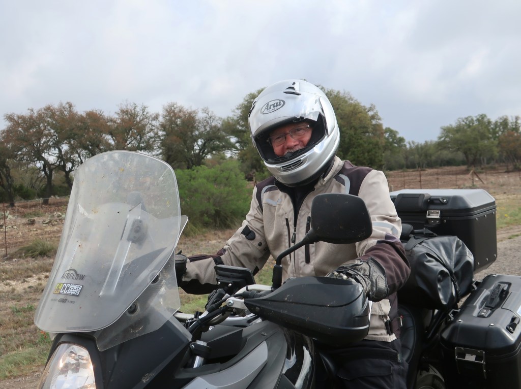
Don in his element!
This is probably it for this year. Well for the blog at least. But we are in the early stages of discussing another epic multi week trip possibly next year, similar in scale to the Newfoundland trip of 2019. Thanks for following.
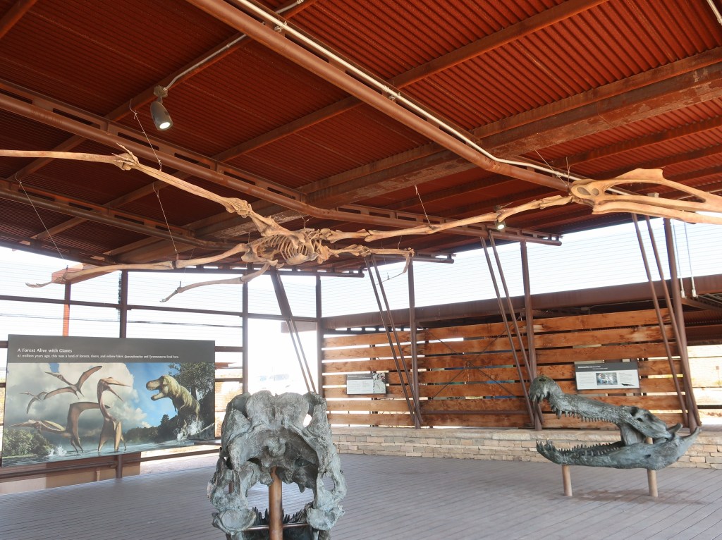
Well, we left Odessa this morning 45 degrees cooler than when we arrived last night. It was a bit of a shock. After several days in the 90’s, we were in the 50’s for much of the day. Took most of the day to get out of Texas too. It is a big state! We are in Atoka Oklahoma tonight. This was just a cloudy and blustery travel day, so no pictures. We did visit a fossil exhibit at Big Bend and I’ll put those up if you’re interested. Talimena Scenic Drive and the Ozarks are on the agenda for tomorrow, but weather is not sounding good. We’ll see how it goes. Until tomorrow.
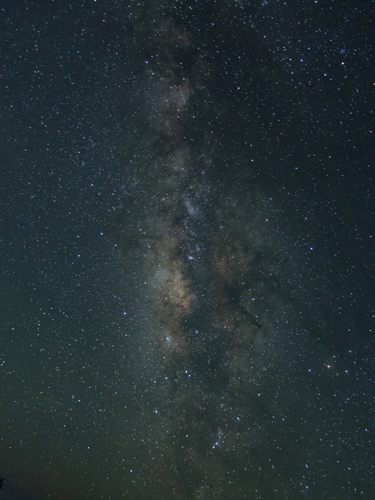
Finally had a little clear night sky! Best view of the Milky Way I may have ever seen. The International Space Station flew across too.
We actually had clear skies this morning for the first time in Texas. Cooled off quite a bit too. We packed up camp and ran through Big Bend again. The helmet cam shots are mostly from yesterday.
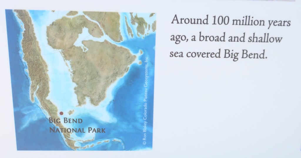
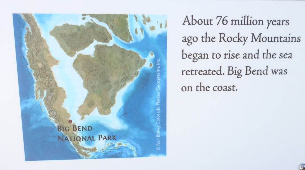
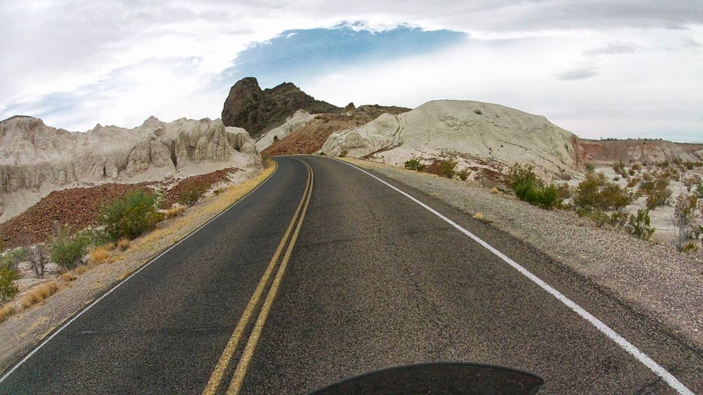
This is from Wednesday on the way up to Chisos Basin.The geology changes as you travel across the park.
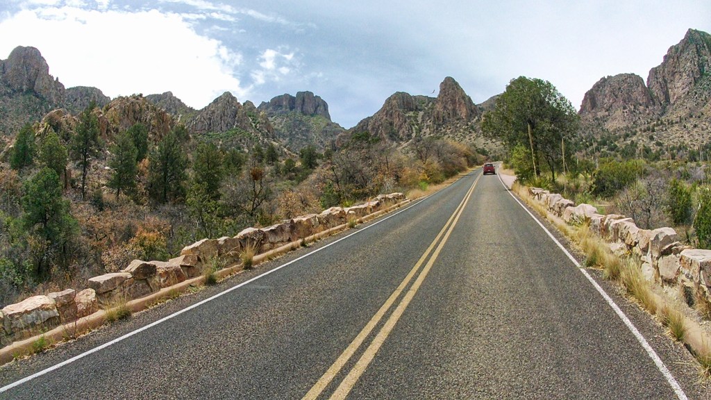
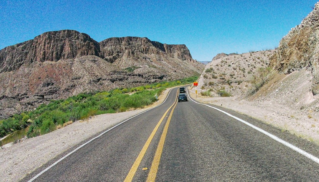
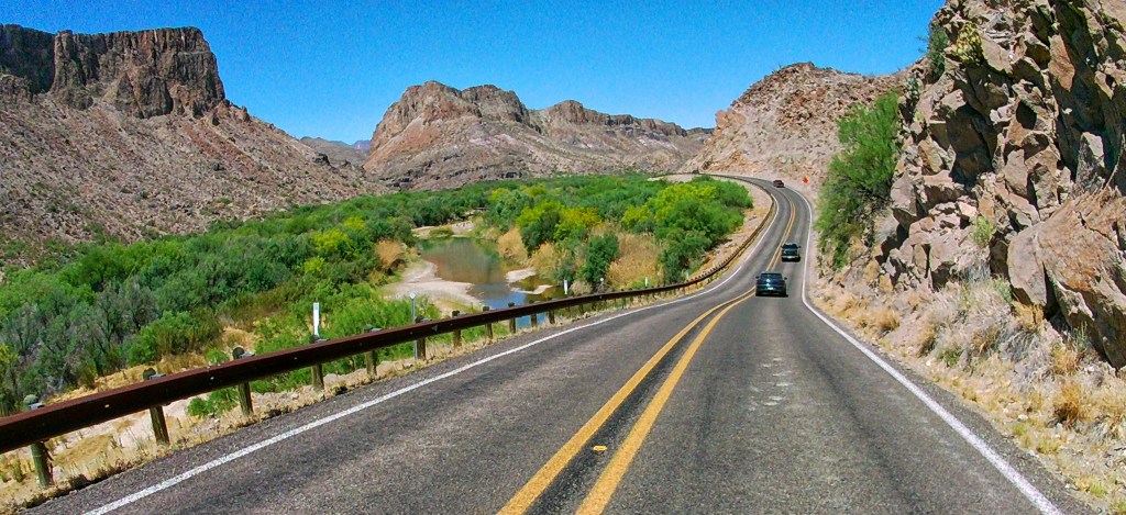
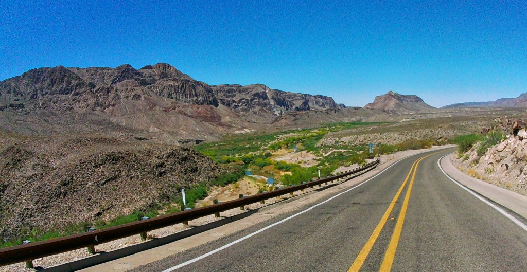
We finally left through the western gate of Big Bend and headed west through Study Butte and Terlingua. Terlingua is famous as an old ghost town. Touristy too with a lot of lodging/camping options. I’m glad we stayed in Marathon (Alpine is supposed to be good too). Terlingua was incredibly barren, dusty, and hot. Actually pretty much the rest of our day was spent in the upper 90’s. It’s just about impossible to stay adequately hydrated on a bike in that heat. Once you pass through the town of Lajitas, you begin The River Road portion of 170. And it is stunning!
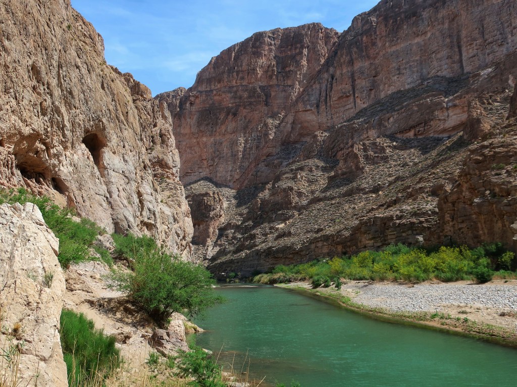
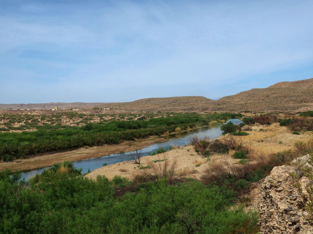
The road runs along the Rio Grande. All the green in these pictures is the river bottom. A lot of the spectacular scenery is actually Mexico. The road undulates up and down. Earlier someone told us the road was an absolute rollercoaster. It really does have some of the steepest long hills, and especially the drops, of any road I’ve ridden. Parts made me a little nervous which rarely happens. But it is a great road and heavily traveled by sightseers so speeds tend to be slow. It is a must do if you ever make it to the area. I just wouldn’t try it in a motorhome.
This view is just after passing through a high canyon. Based on traffic disappearing, I think most people turn around shortly after this point.
We followed 170 to Presidio and then turned north. The Fort Davis area looked intriguing and reminded me of the Black Hills. That would be worth a visit too. Anyway, the land soon flattened out and we hit the oil fields along I-20. After the last few days, the ugliness made me a little nauseated (suppose it could have been heat and dehydration too). We are in Odessa Texas tonight and I can’t wait to get out!
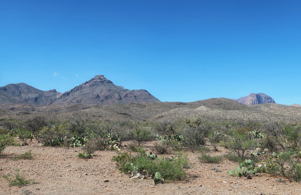
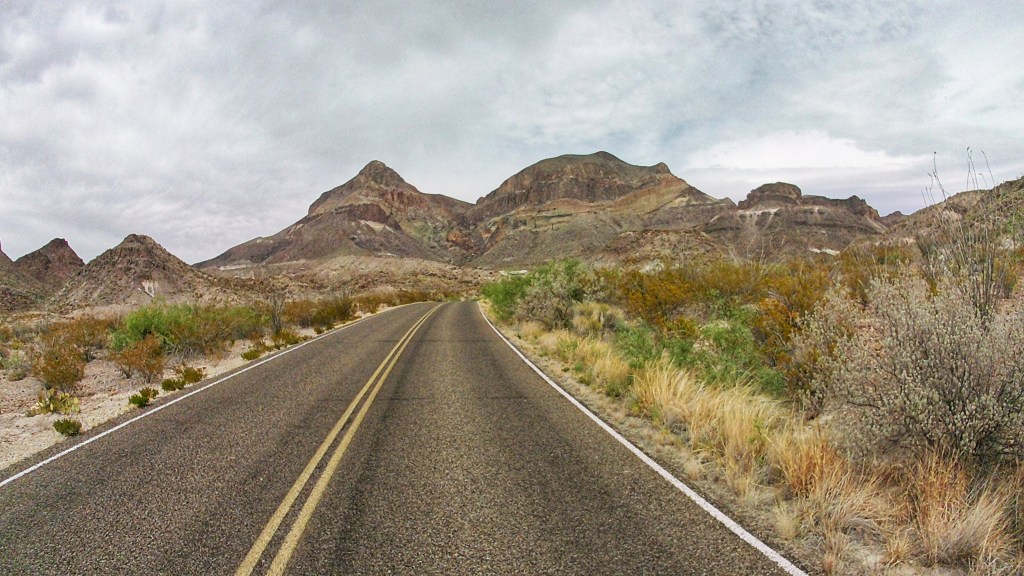
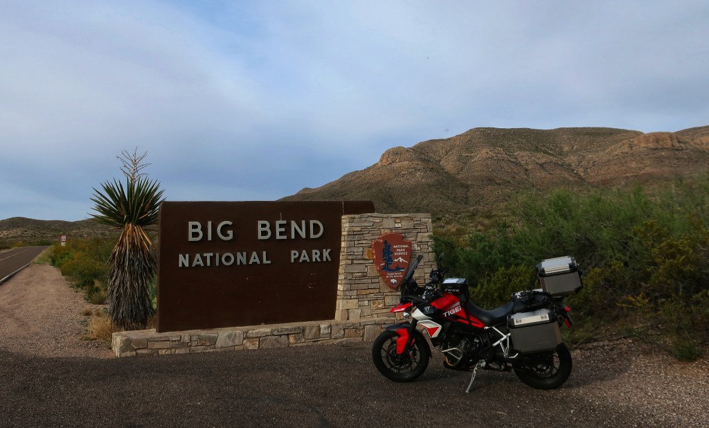
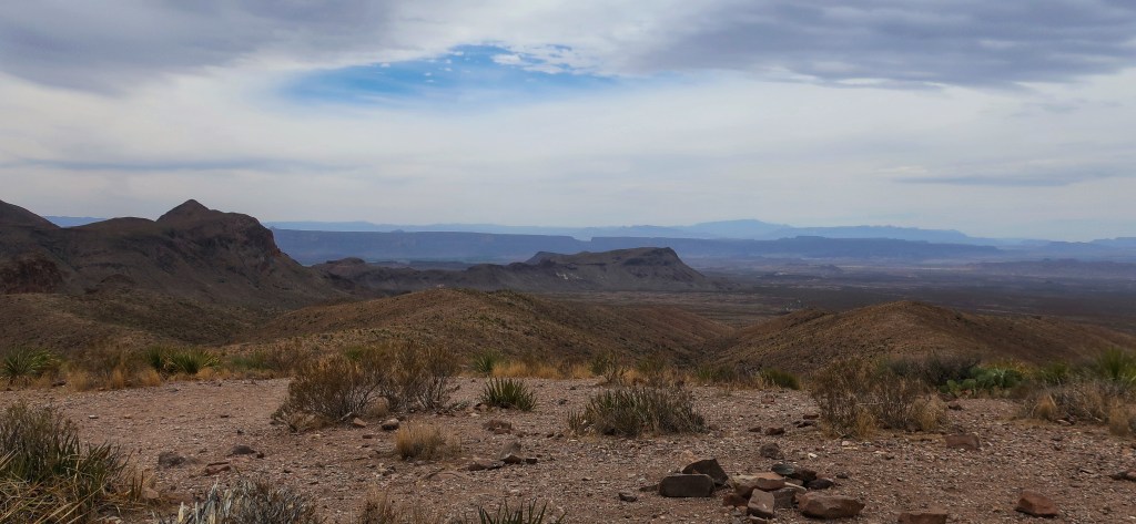
Big Bend National Park is awesome! And huge! And remote! And hot! 801,163 acres and it seems even larger because you’re overlooking into the same remote area of Mexico. We spent the entire day in the park. I still have a hard time wrapping my head around the elevation of the west. We have been between 2500 and 3500 feet most of the day. The highest I saw on the GPS was 5500 ft. Emory Peak tops out at 7,825 ft. Texas has mountains! Who knew??? Well, I didn’t anyway. Even Texas has higher mountains than we do in the east.
Chisos Basin campground. This was the highest road today.
I took a lot of pictures today with the helmet camera, but like a dummy, the SD card is still in the camera and covered up on the bike. It’s late and I’m beat, so those will have to wait until tomorrow night. These are from the little Canon PowerShot. Most of the day was kinda overcast and hazy, so the colors don’t show well. Seems like after a spectacular day, the pictures are always a little bit of a letdown.
Boquillas Canyon and the Rio Grande. Bit of a hike but worth the effort. U.S. on the left and Mexico on the right. This entire area is so rugged and remote, I don’t think illegal crossings are much of an issue in this entire area. Very few people could actual survive long in this environment without services available.This is Boquillas Crossing. If you do want to cross legally, this is it. The cluster of buildings on the left is the Mexican village of Boquillas. If you bring your passport, you can hire locals to row you across the river and you can have lunch and shop for handmade pottery and such in a quaint Mexican village. This is legit…the US park service and border patrol oversee it. So, if you visit Big Bend, do bring your passport unlike Don and I.
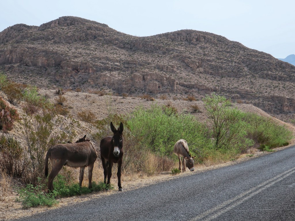
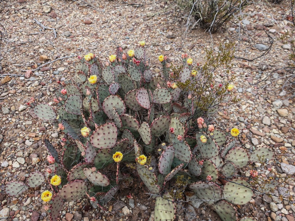
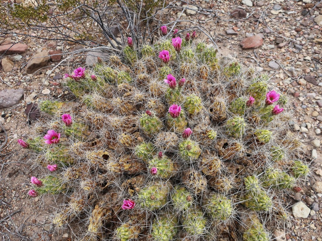
This place really is spectacular and worth a visit. If you like to hike, plan on a few days here. If you are driving and sightseeing with maybe an occasional short hike, two days might be enough. At any rate, don’t visit in the summer. October through April is the ticket. I saw 94 degrees today. Low humidity but that sun is seriously intense. A lot of cacti in bloom. I thought we saw wild burros and horses today. Turns out these are not actually wild but feral livestock that wanders in from Mexico. I guess there is a little illegal crossing after all.
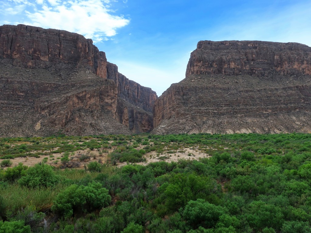
Do you see the notch in the dark cliff located in the center of the photo? That is Santa Elena Canyon and 14 miles away.And this is Santa Elena Canyon close up. It is 8 miles long and 1500 feet deep. The true scale of the American west just can’t be appreciated in pictures.
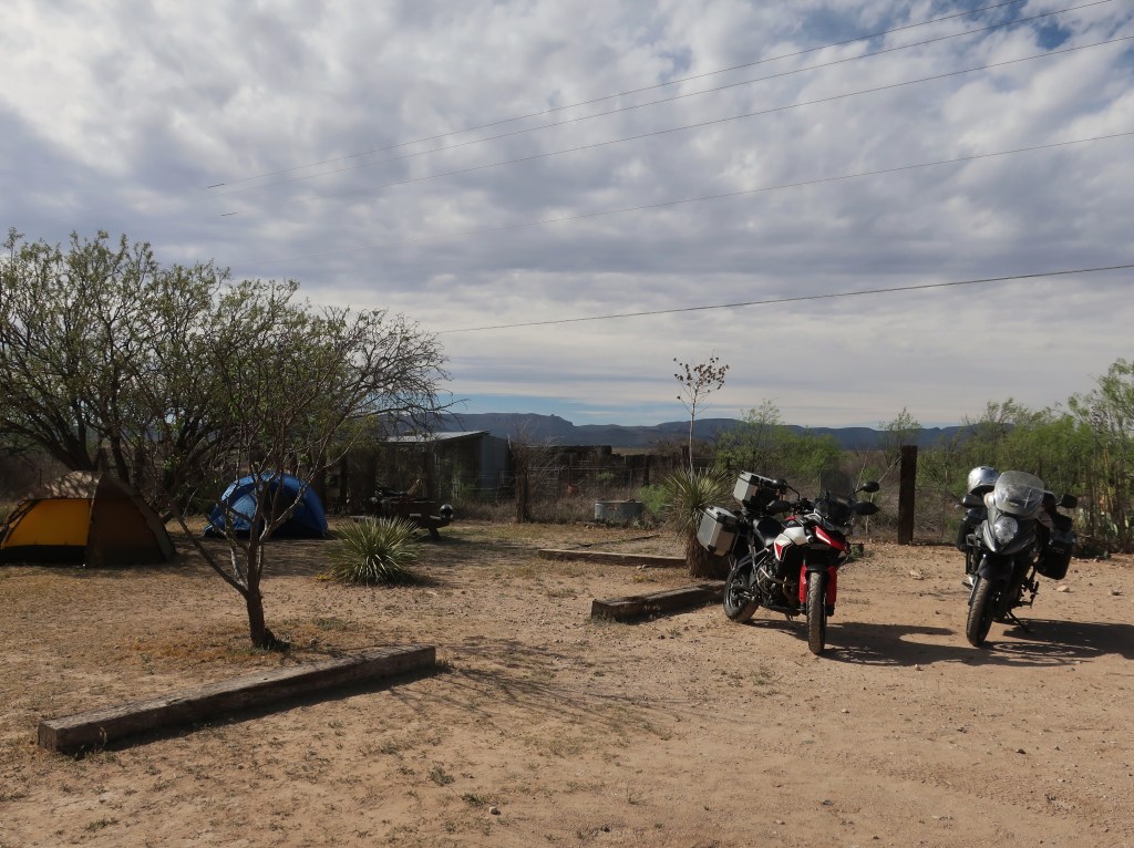
We pack up camp in the morning and will drop back into Big Bend once more and then catch FM170 west along the Rio Grande which is supposed to be a spectacular road. We eventually loop around and start back east into civilization. I’m not quite ready.
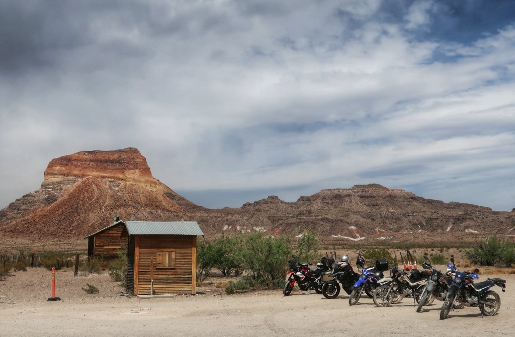
A lot of road bikes here, but also a lot of dual sport bikes as well. This place has hundreds of miles of gravel and dirt roads.
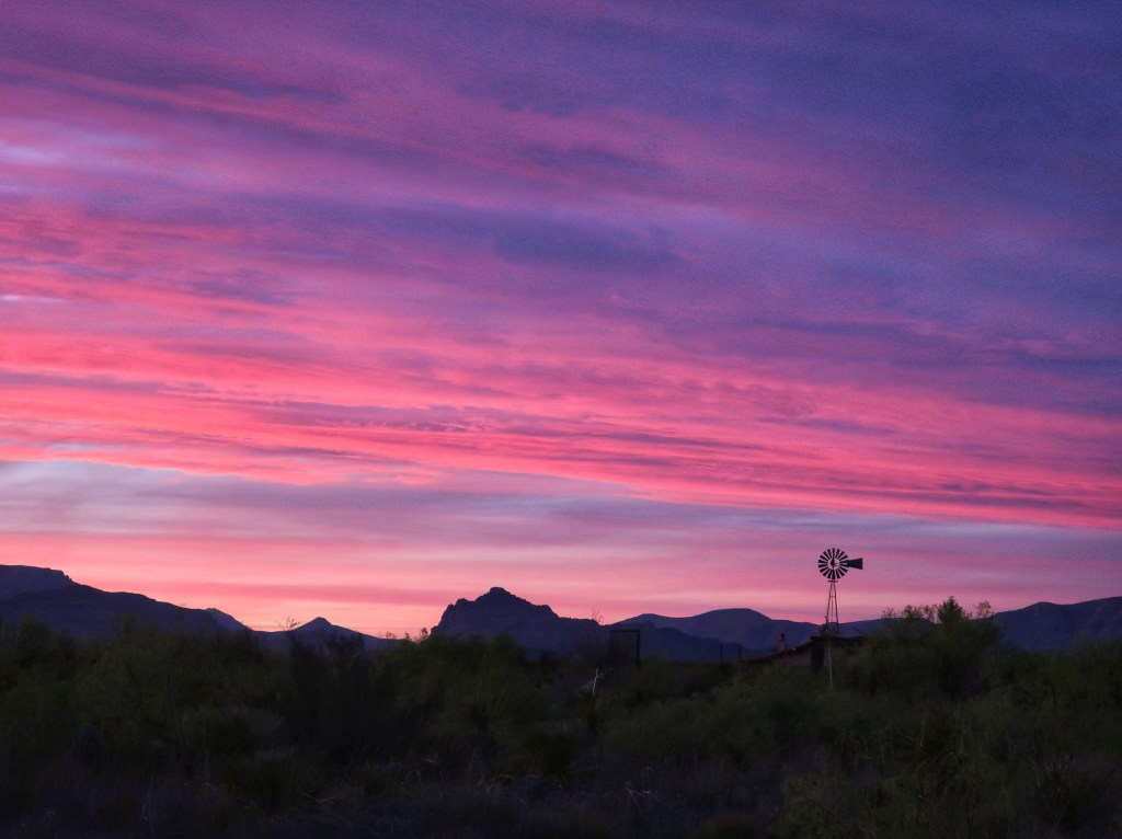
Between the haze and the moon, I didn’t get any star pictures this trip but I did get some of the sunset. Good night from Marathon.
We had a great travel day. It rained overnight and was foggy and misting when we pulled out but the day was beautiful by noon. Did see more flowers today as we left the hill country. Soon the landscape flattened out and trees and grass largely disappeared. This is how I always pictured south Texas. Headed south to the border town of Del Rio, grabbed lunch and headed west. Went through my first border patrol inspection without crossing a border. Looked like all highways leading away from the border had check stations.
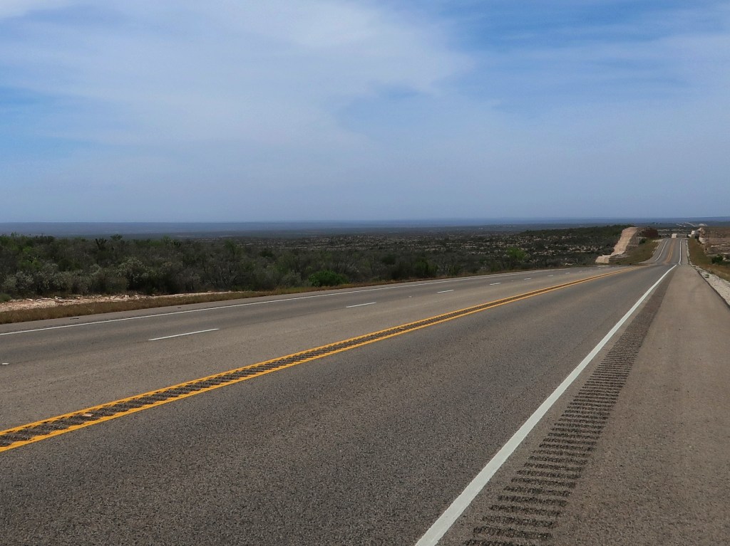
Flat, scrubby, empty land comprised the majority of our day. I actually really enjoyed it. This landscape just seems so foreign and rarely do you get to experience such vast emptiness in today’s world.
Traffic was almost non-existent as were the towns. Our longest stretch between towns was 115 miles, but most were slightly under 100. Don and I both agreed that this was probably the most remote area we have traveled through since crossing the Trans-Labrador Highway in 2019. Most towns had a single gas station and we didn’t pass up any chance to top off the tanks. Running 75-80 mph with headwinds dropped our fuel mileage into the upper 30’s at times.
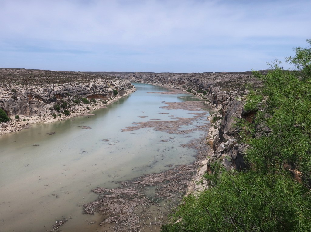
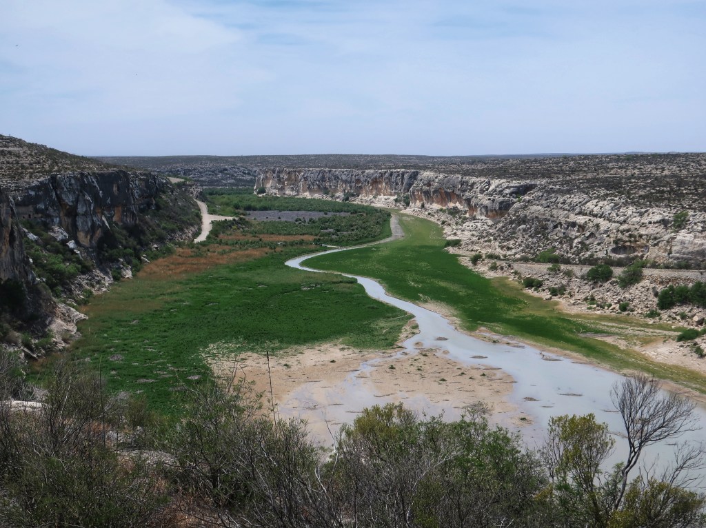
Pecos River again but looking south from the opening picture. It’s hard to appreciate the scale.
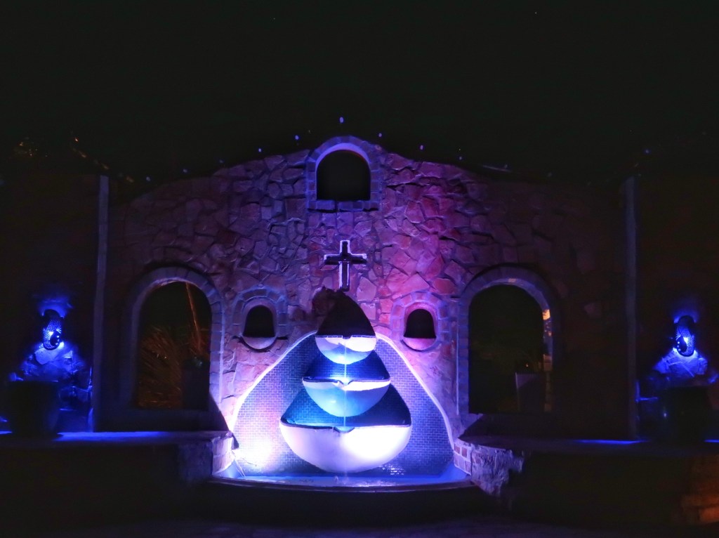
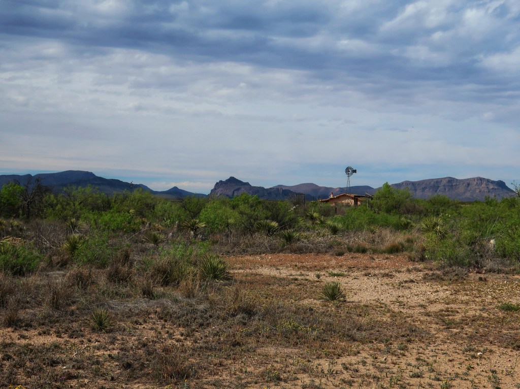
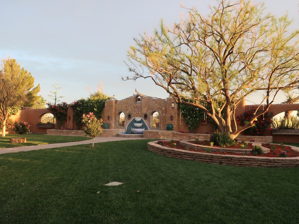
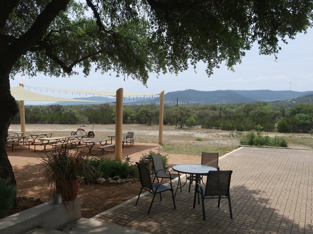
The land really started changing again as we continued west. Buttes and mountains started appearing and this area is actually pretty. Reminds me of parts of Arizona and Utah. We made it to the campground and it may be one of my all-time favorites. Beautiful grounds with a incredible courtyard with adobe walls and a fountain. Also had a small cantina on-site. Ate and did laundry without ever having to get back on the bikes. This place has a night sky viewing area too with a couple of small domed observatories and two buildings with retractable roofs housing more telescopes. Somewhat overcast tonight but I hope to get a few night sky pictures.
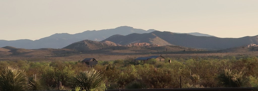
This is actually looking southwest from our campground but pretty typical of the last hour of our ride today.
We are about 70 miles north of Big Bend and we are very anxious to see it tomorrow.
This is the view from our tents. I love camping.Campground courtyard.
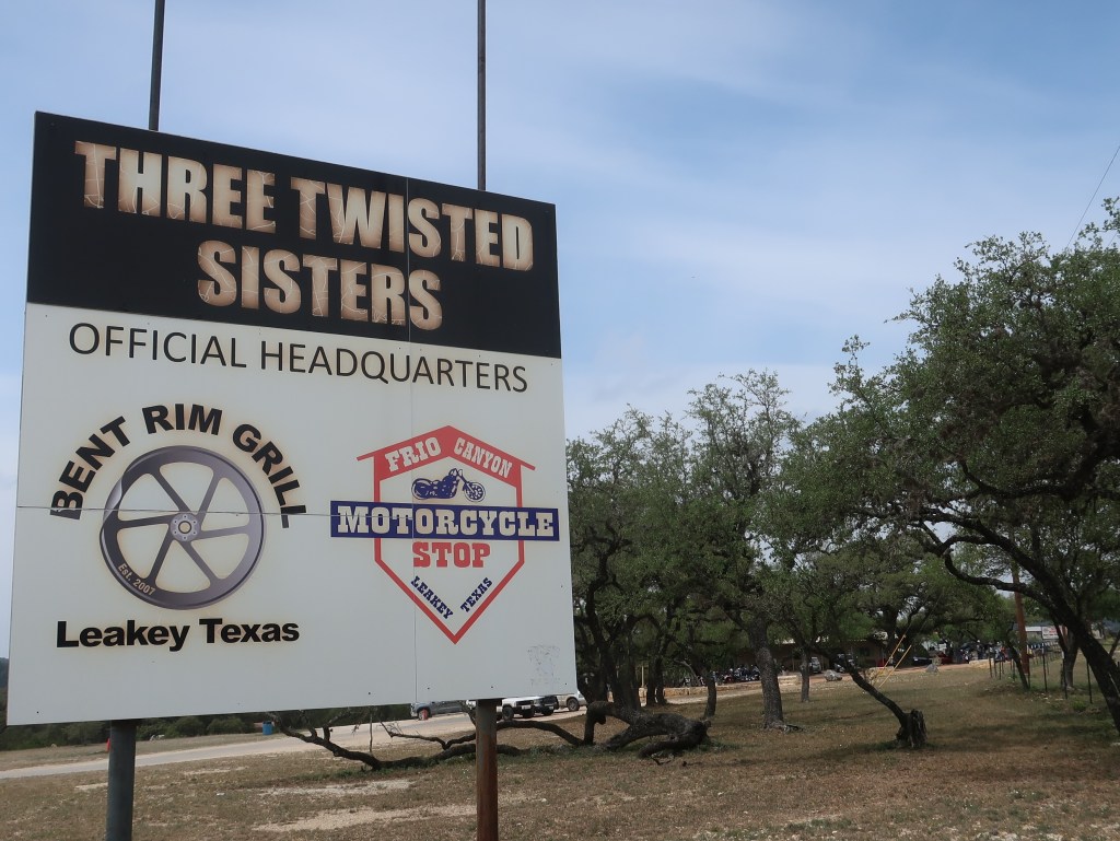
Our lunch stop at The Bent Rim Grill in Leakey Texas. This area is big with motorcyclists.
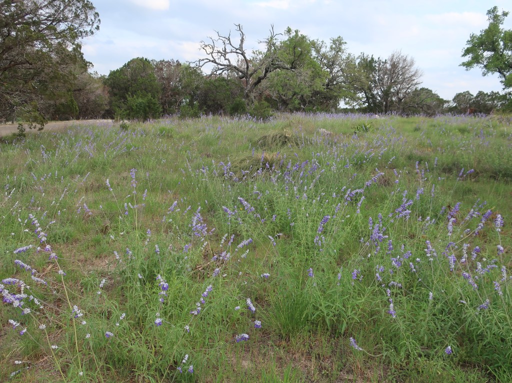
We made it to the famous Texas Hill Country today and our overwhelming opinion is “meh”. It is pretty in places but definitely much more arid. Trees are scrubby looking and the grass is thin. There are wildflowers but we didn’t see any stunning blankets of them. It is more rugged and mountainous than I expected. I thought it would just be rolling hills like southern Indiana and central Kentucky. In all fairness, we were not in the more popular tourist part of it. We didn’t see vineyards, museums, and shops. We just saw ranches and dry river beds. Also had our first ride through open range this trip. There were cows along the road but no longhorns. There are quite a few elk farms around here too.
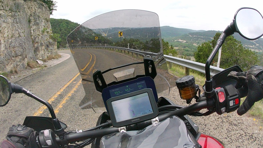
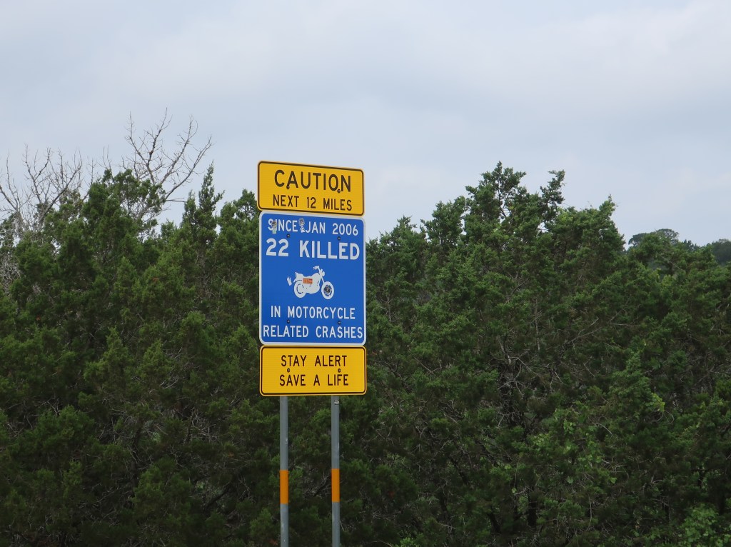
The area is well known in the motorcycle community, especially the Twisted or Three Sisters…that’s highways 335, 336, and 337. We made the loop today. Parts are definitely challenging but much of it is not except for the road surface. Not sure how to describe it other than rough and impossible to read firm surface from loose. It was somewhat unsettling. Appalachia and even southeastern Ohio have much more fun roads.
The roads were challenging in places and sometimes narrow. The area has a lot of canyons. And look at the asphalt! Just couldn’t tell gravel, sand, or blacktop.
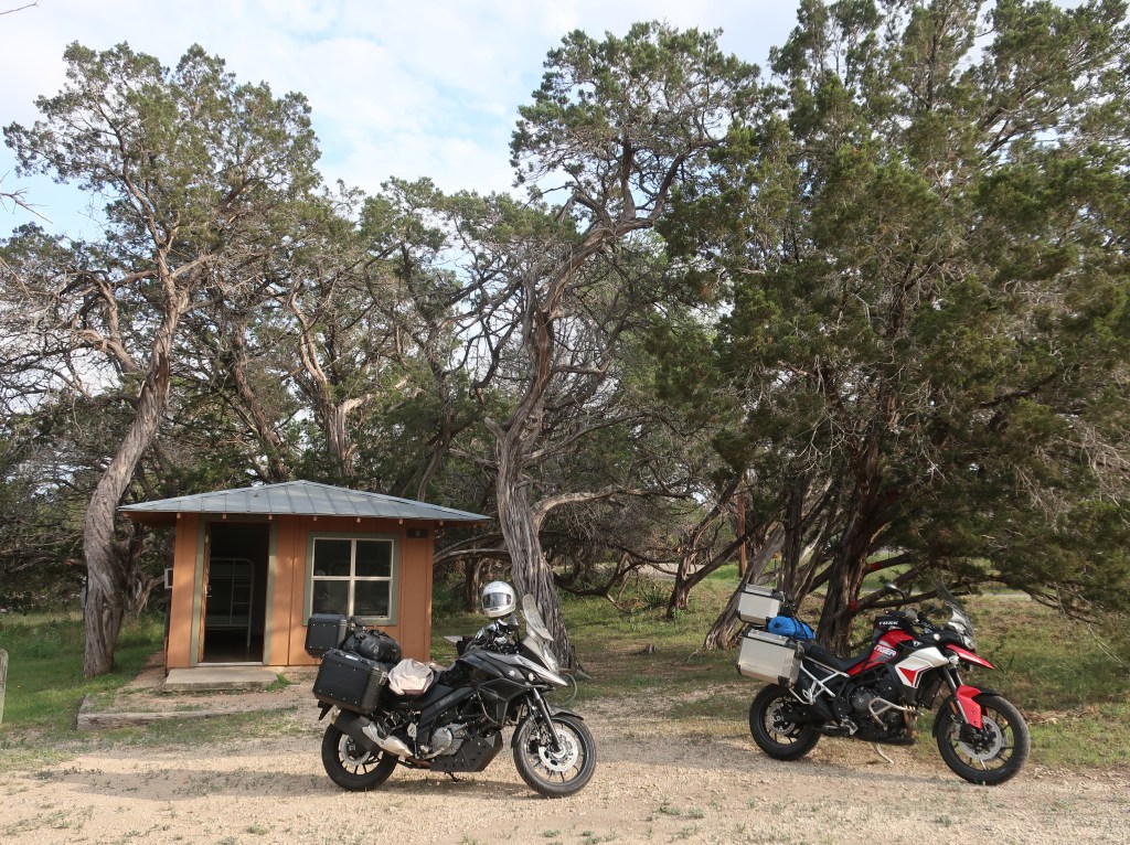
We are in a little park just outside Kerrville tonight. Opted for a little camping cabin so we didn’t have to mess with tents for only one night. Off to the Big Bend area tomorrow.
The Texas Hill Country is a geographic region of Central and South Texas, forming the southeast part of the Edwards Plateau. Given its location, climate, terrain, and vegetation, the Hill Country can be considered the border between the American Southeast and Southwest. The region is notable for its karst topography and tall rugged hills of limestone or granite. Many of the hills rise to a height of 400–500 ft above the surrounding plains and valleys.
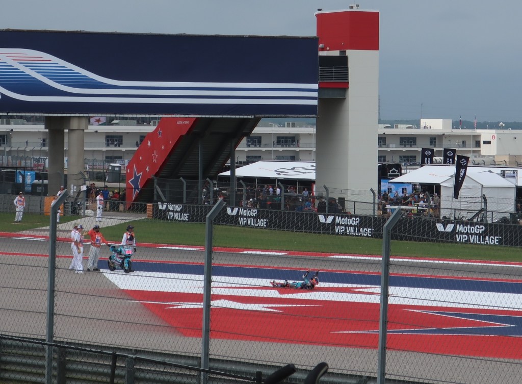
Sadly, not the only one of these we saw today on the Three Sisters. That’s also why I quickly put the helmet cam away…too distracting. These roads are not the most technical but still not to be taken lightly.
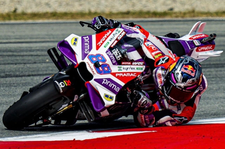
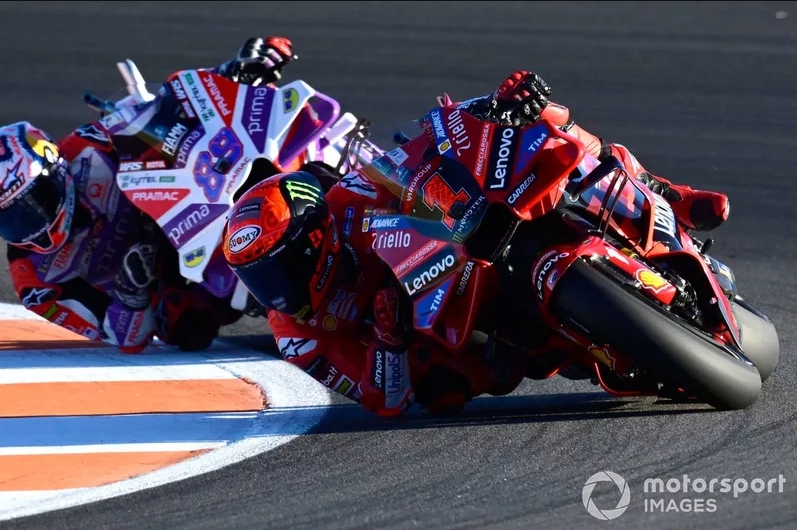
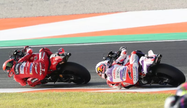
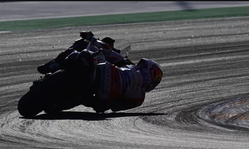
This is MotoGP! Multimillion dollar prototype motorcycles; riders paid millions to race these 350 pound and 260 horse power machines; running over 220 mph and up to 68 degrees of lean; dragging knees, elbows, and the occasional shoulder in recent years; racing within feet, inches, and sometimes less as elbows and carbon fiber flies. MotoGP is a festival of speed, sound, and color. A traveling circus racing 21 tracks in 17 countries in 2024.
There are no scheduled pit stops other than during rain in which case they are allowed to pit and jump onto their backup bike already fitted with rain tires. Like all European based racing, they run rain or shine.
This is the 75th year for MotoGP. When I was growing up, the Japanese manufacturers dominated and the US had several multi-year champions. Honda and Yamaha are the only Japanese bikes still in MotoGP. In recent years, the series is dominated by the European brands of Ducati, KTM, and Aprilia. GasGas entered this year. BMW is coming next year. Triumph does not field a MotoGP team but they are the sole engine supplier for the Moto 2 class which are required to run the same spec motor across all manufacturers.
These guys are very fit but the average racer runs a heart rate around 170 for the entire race. MotoGP races are typically 50 minutes.
The motorcycles themselves are not the only high tech equipment on the track. Racing leathers have evolved to. They are kangaroo hide which is more abrasion resistant but lighter than cow hide. The hump on the back originally started for improved aerodynamics behind the helmets. Now they house sophisticated electronics which controls an airbag system in the suits. It also measures all kinds of telemetry the rider is subjected to on or off (crashing) the bike. The airbag will reset as most racers will return to the race after a crash if the bike isn’t damaged.
Some race fans were more intrigued by the wildflowers than the action on the track.
I probably should have explained that Friday and Saturday activities lead up to the Sunday race day. And we had a great day! First half was cool and breezy but it really warmed up for the afternoon. Took our camp chairs today as we found out yesterday that Texas ground is hard.
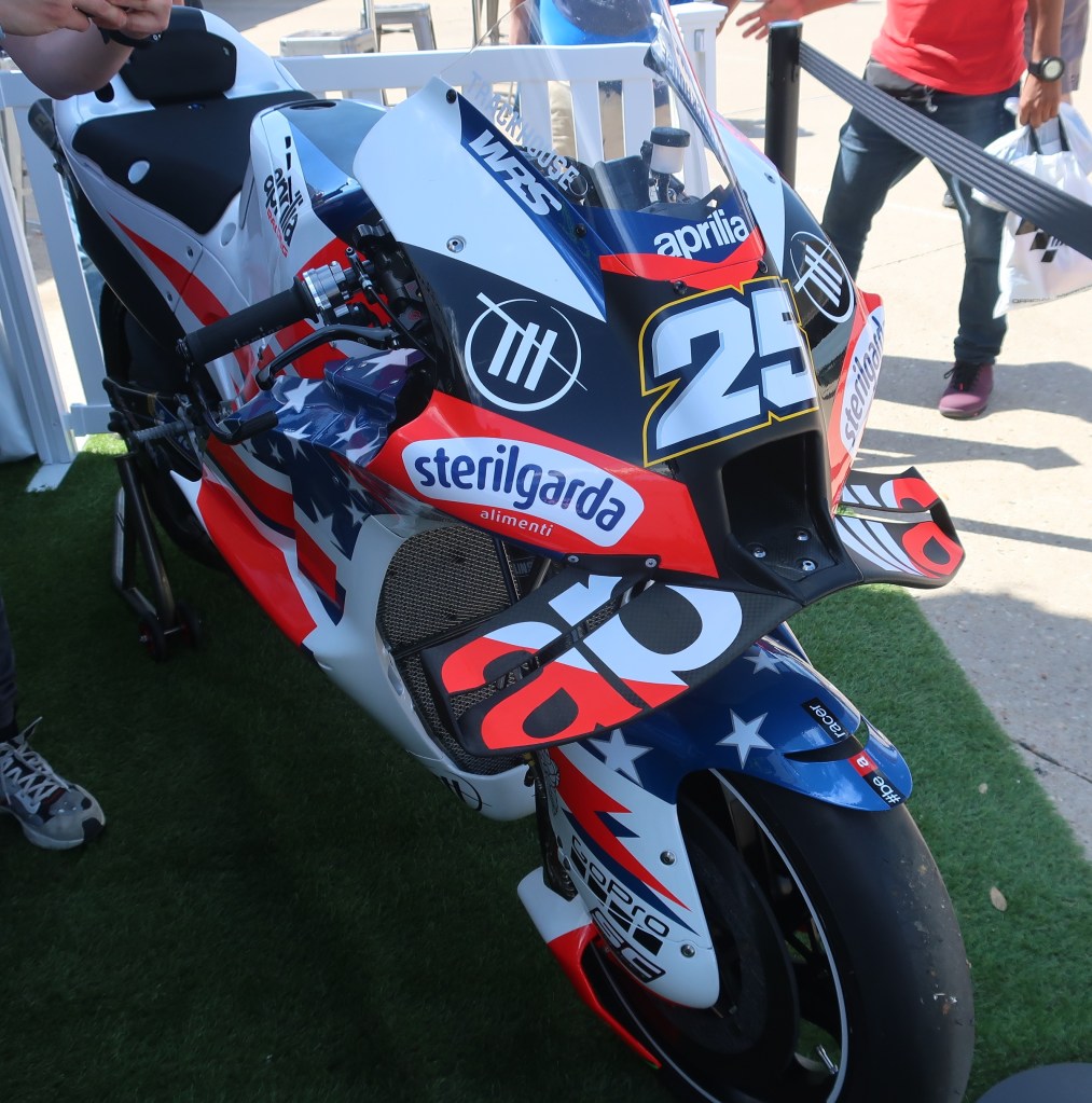
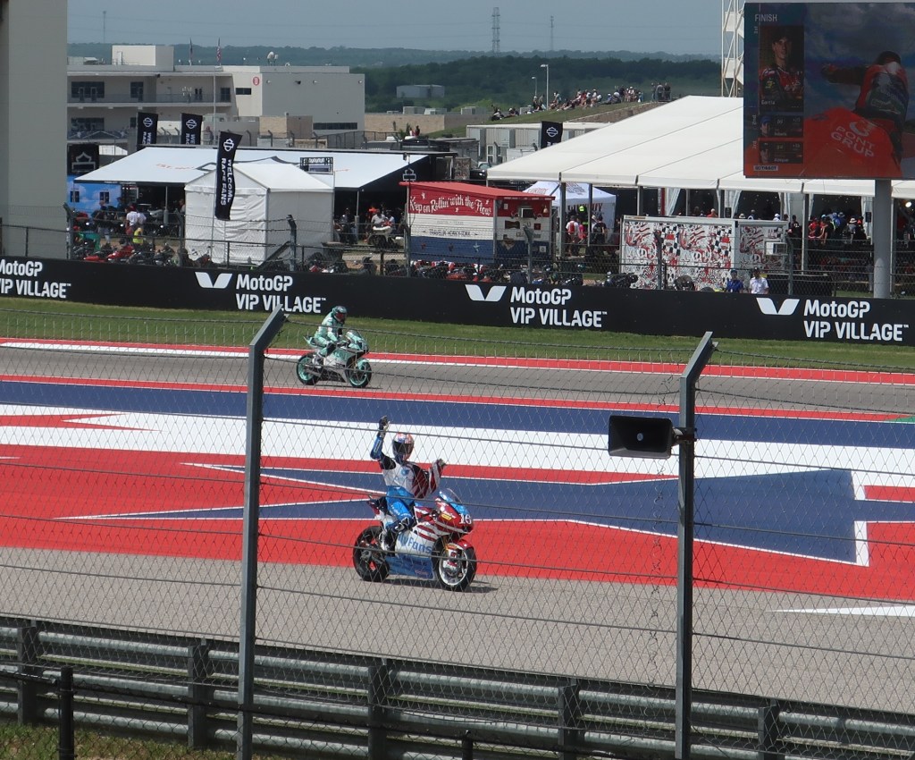
Check out the wings the Aprilia is sporting. This is a new satellite factory team based in the U.S. Trackhouse Racing is in Tennessee and runs in NASCAR. They are fielding a MotoGP team this year.Joe Roberts from California placed 2nd in Moto 2 and is also 2nd in the championship at the moment. We’re hoping he will eventually make it to the premiere MotoGP class so we have an American to cheer for.Some victory celebrations are stranger than others. This is the Moto 3 winner. Moto 3 are smaller 250cc single cylinder (thumpers) machines but still capable of 150 mph.
We have really enjoyed our time at Circuit of the Americas and thrilled to finally make another MotoGP weekend. The time really flew by. We are back on the road tomorrow and heading into the Texas Hill Country. We’ll be camping the next few nights but I think I will have reception to continue posting. Until tomorrow.
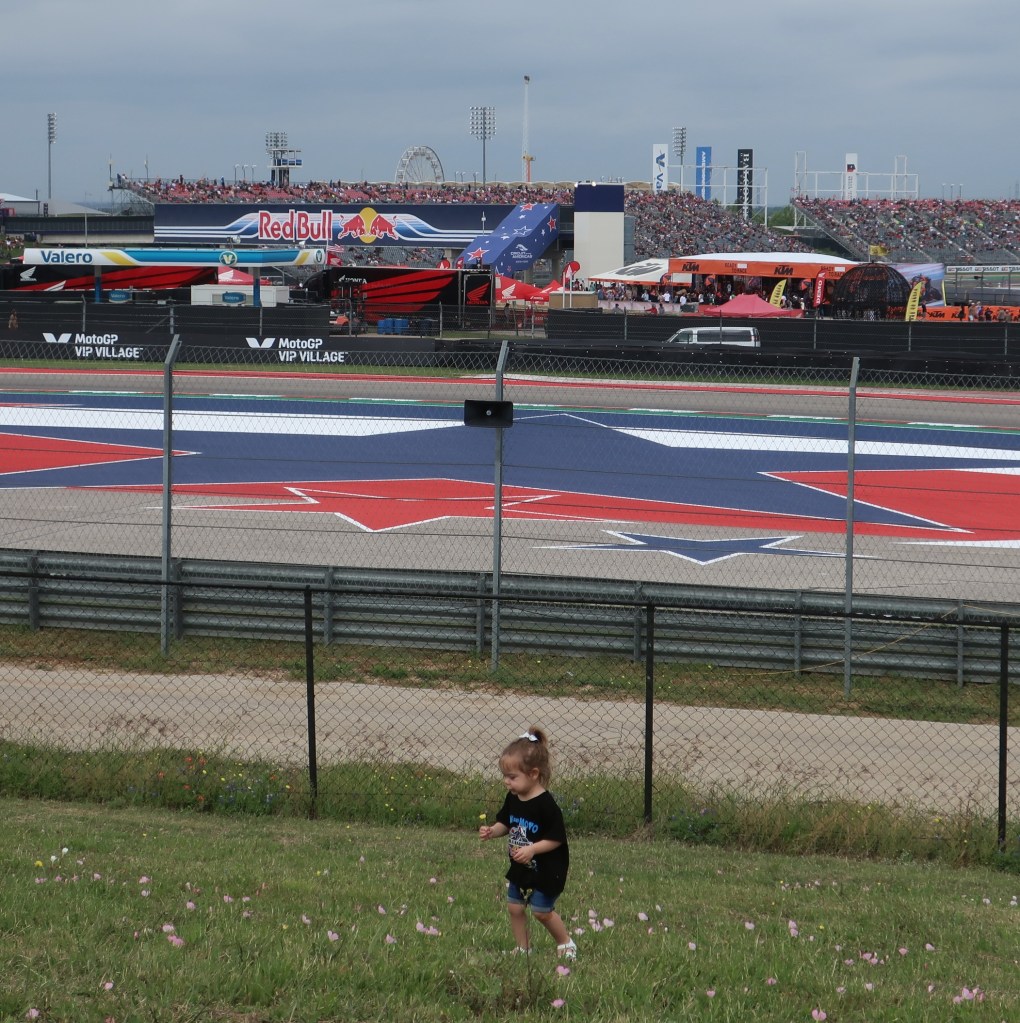
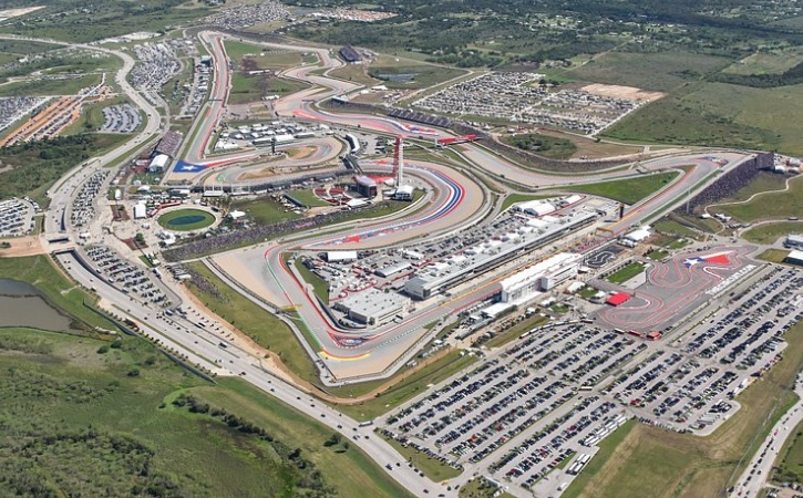
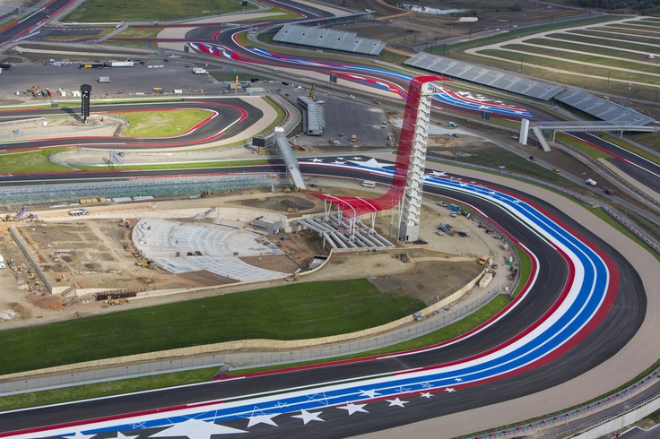
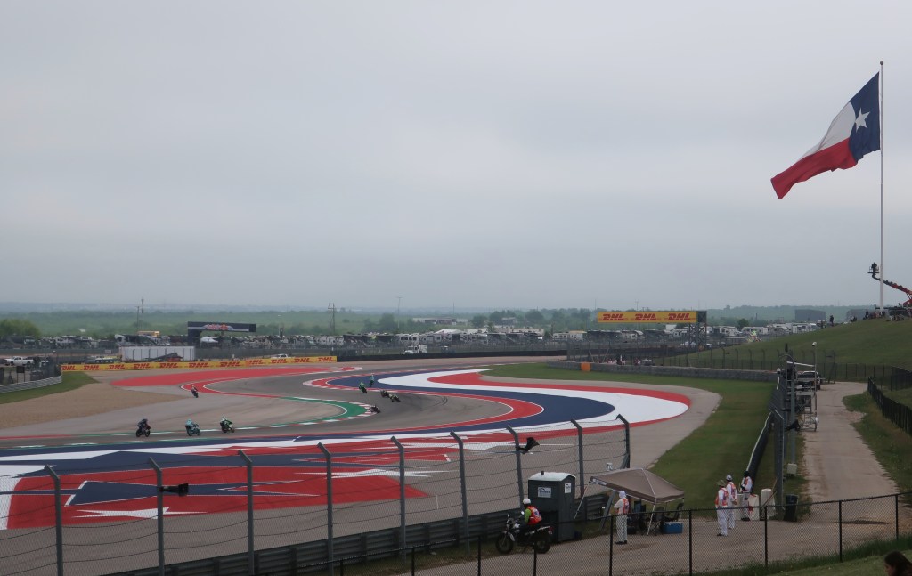
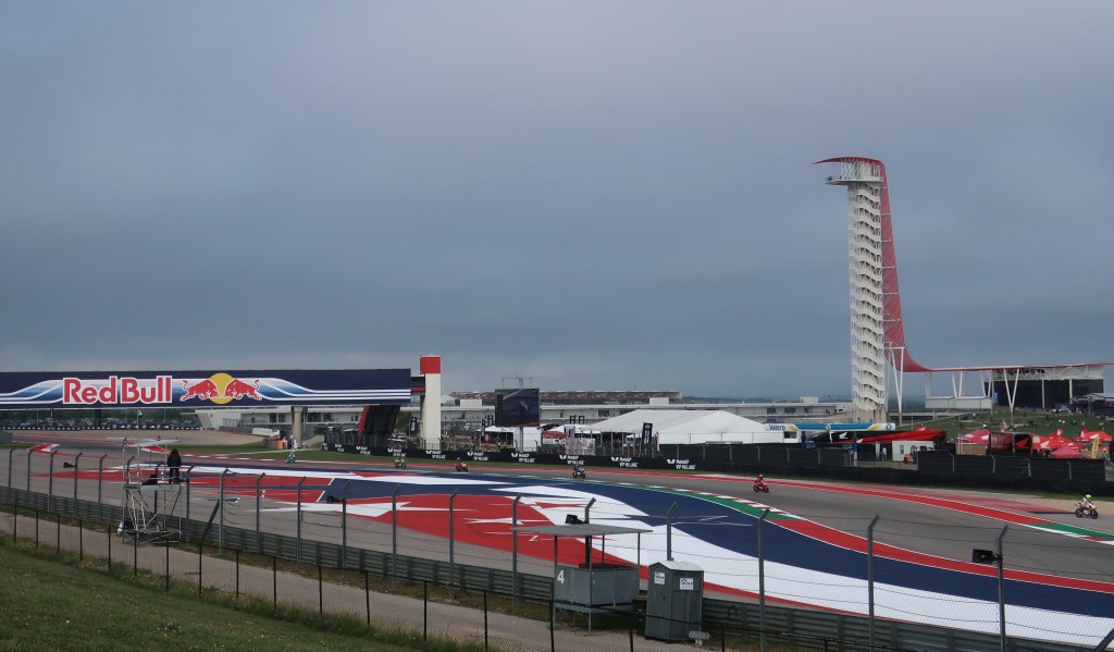
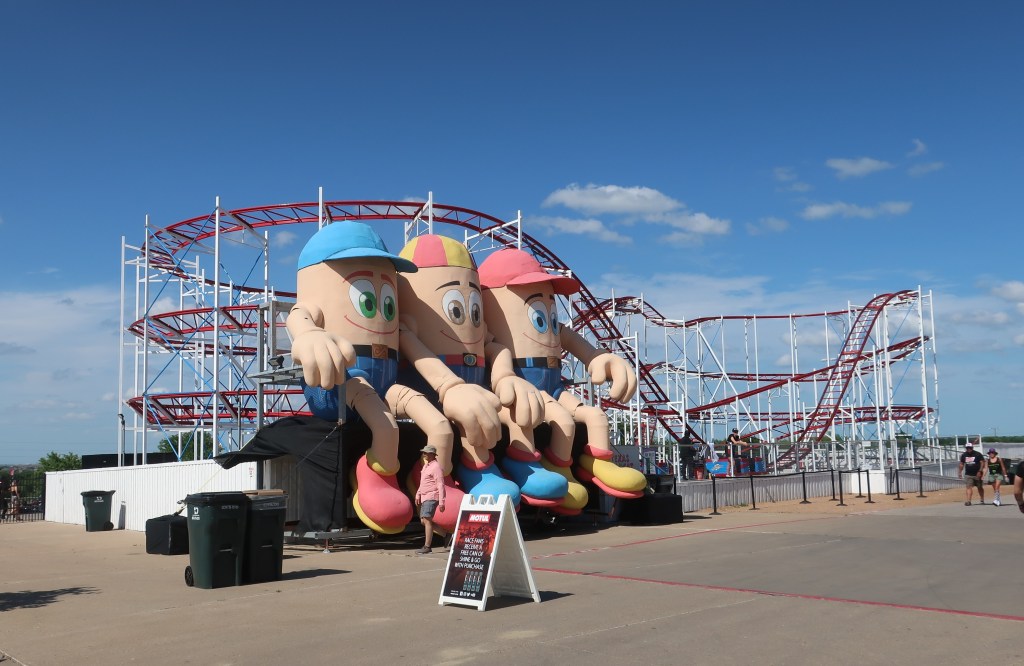
Circuit of The Americas is the only purpose-built facility in the United States designed to host the premier motorsports championships in the world, including Formula 1, MotoGP, Indycar, and NASCAR. Set on 1,500 acres in the rolling hills just outside Downtown Austin. At its heart is a 3.41-mile racetrack with 20 turns and significant elevation change. There’s also a go cart track out front and several amusement park type rides. They put on quite the spectacle!
Race tracks have become very colorful all around the world. This photo is from 2012 while under construction.
Don and I made our 9th MotoGP event! The Indianapolis Motor Speedway hosted a round for 8 years using an infield road course track. We loved Indy, but it really didn’t work well. The riders hated it and it eventually didn’t meet the safety requirements for MotoGP and Formula 1. MotoGP requires a lot of run off space. Riders frequently hit the ground but serious injury isn’t common provided there’s room to slide without hitting anything solid. Paved area is important as gravel traps are great at stopping cars and sliding bikes, but riders tend to tumble in the gravel and injury is much more likely.
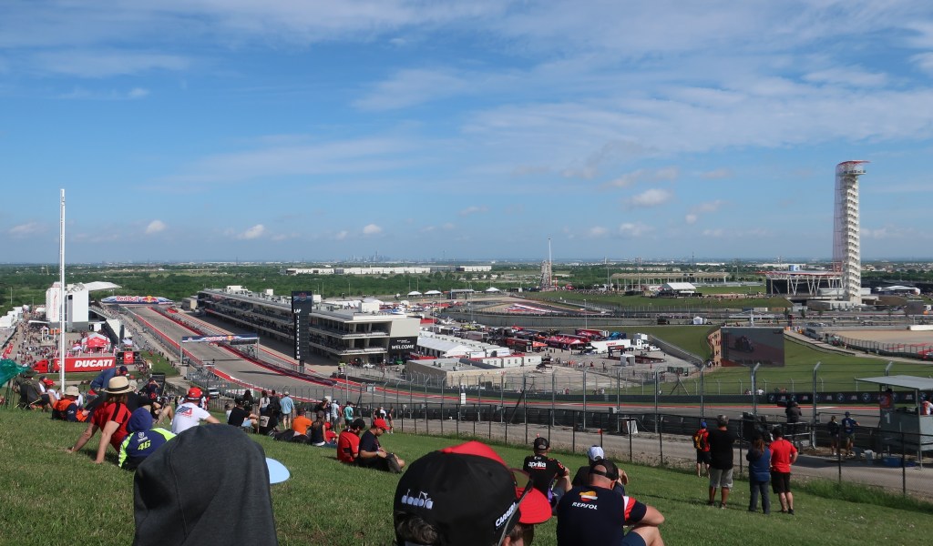
The amount of elevation change around the track surprised us. Doesn’t look like much in the picture or on TV, but this is a pretty big hill with a hairpin turn at the top.First practice of the day. The skyline of Austin became visible in the background as the clouds cleared.
And for those of you unfamiliar with MotoGP, top speeds at COTA are over 220 mph! Faster than Formula 1 at this track although F1 cars do turn significantly faster lap times thanks to a lot of rubber to grip through the turns. And lean angles are hard to believe, but we’ll leave that for tomorrow.
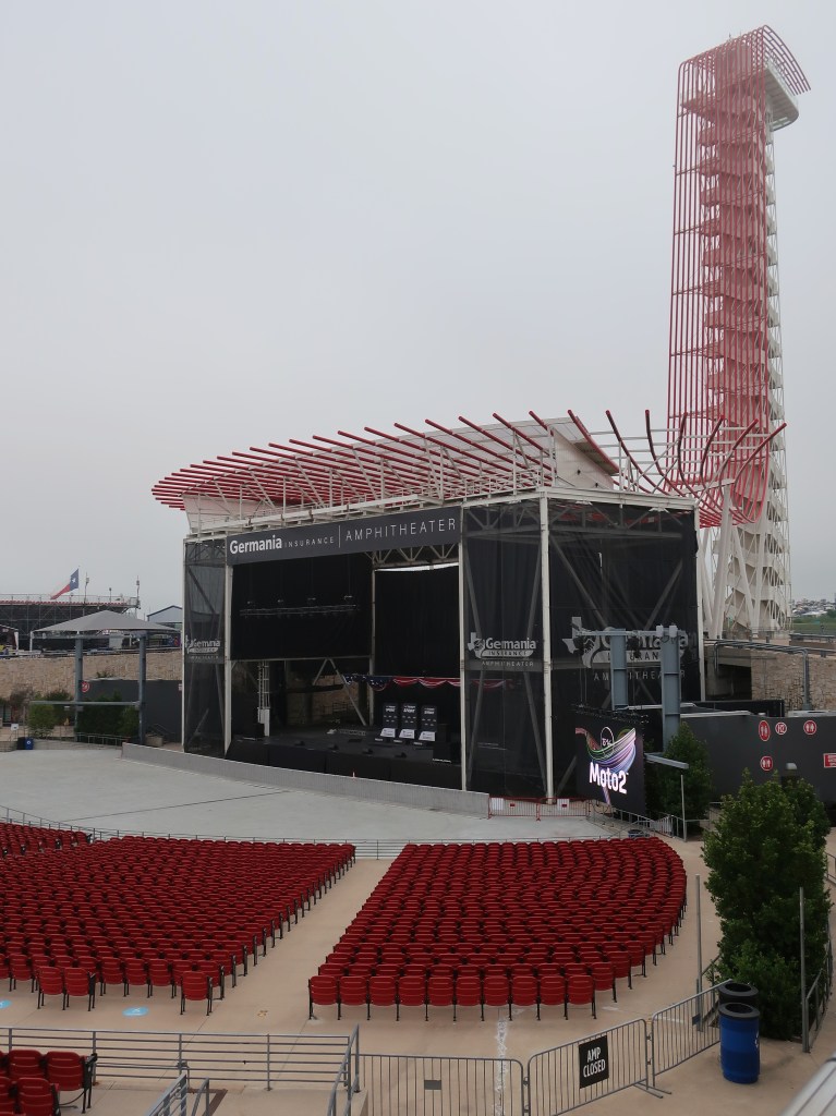
The observation tower is 251 feet tall with the deck itself 22 stories above the track.
We are sunbaked and absolutely worn out from walking. Can’t wait for tomorrow! Good night.
Amphitheater on the back side of the tower. The day started as very overcast but did clear. We were some of the first ones in this morning.
We are in Elgin, Texas tonight just east of Austin. It’s been a beautiful day with sunny skies and low 80’s. It did start out in the low 40’s though. Heated seats and cruise control are things I never thought were needed on a motorcycle, but I’m really starting to like those features, along with the quick-shifter and electronically adjustable suspension.
Beasts of burden
We have spent most of the day in Texas and we are both surprised how green and lush eastern Texas is. Trees, pastures, and cattle. Big ranches and huge ranches. And sometimes a lot of traffic. Despite all the beautiful scenery, l still didn’t get any pictures today. The big divided highways were very busy and the small two-lanes didn’t have shoulders but still had the 70 mph speed limits.
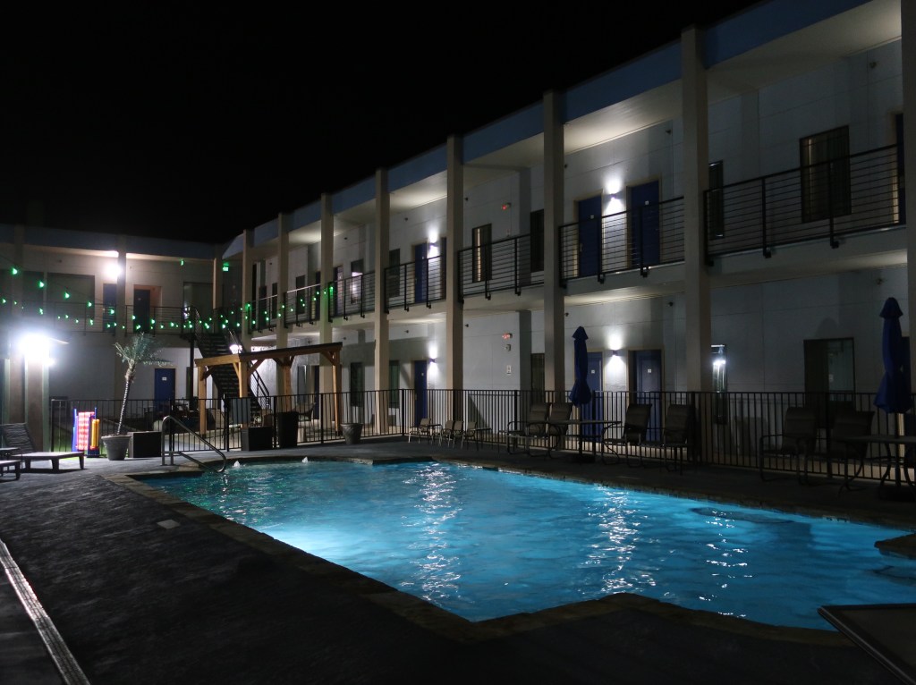
Our home for the next 3 days. Pretty fancy digs for us. Usually we don’t stay in hotels with a pool. Or, if there is one, it’s full of leaves and graffiti, not water😄
This blog will be a little different the next couple of days. It will be predominantly motorcycle content and not scenic travel…that will resume Monday with the hill country. You can tune out or not. MotoGP is incredible if you don’t know much about it. TBS network will carry Sunday’s race live mid-afternoon if you’re interested. TV hardly does it justice as is probably true of all motorsports. The speed and the sound just has to be experienced in person.
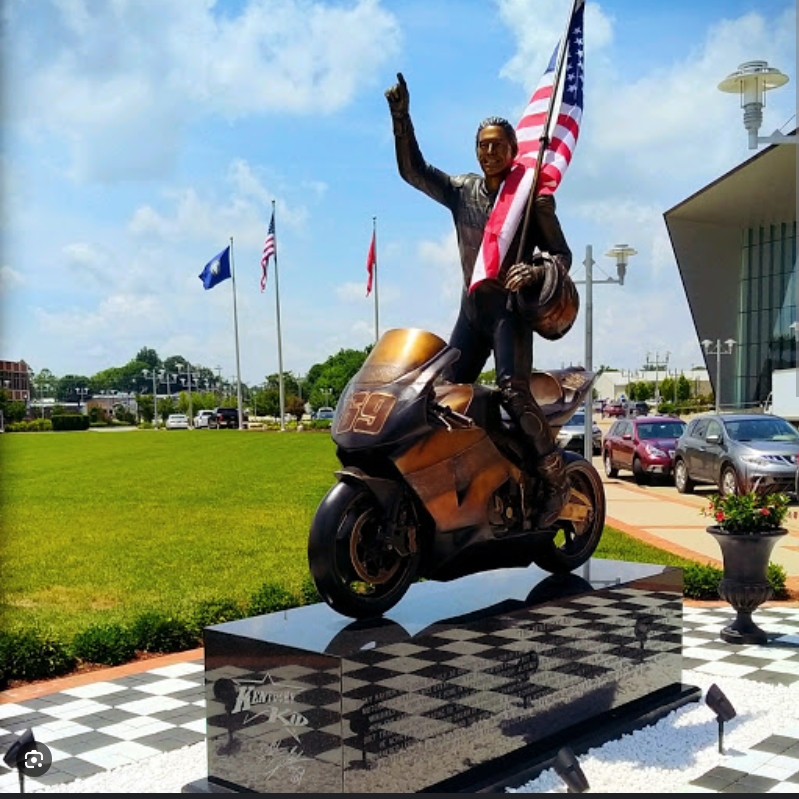
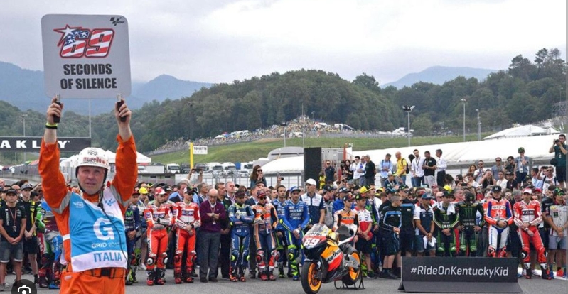
Nicky Hayden, The Kentucky Kid, winning his first MotoGP race and then the MotoGP championship in 2006. The only American to do so in a long time. There has not been an American rider in the premiere class for many years.
Sadly Nicky passed away in 2017 after being hit by a car while riding his bicycle between races in Italy. He ran #69 like his father because you could always read the number rather he was upright on the track or upsidedown in the gravel trap. This memorial is in his hometown of Owensboro, Kentucky. Don and I visit once or twice a year as one of our day rides.
If Texas were its own country, it would be the 40th largest in land area. With an area of 268,820sqmi, Texas is second only to Alaska’s landmass. Texas also has the fastest average legal speed at 78.3 mph. In a stretch of toll road located between Austin and San Antonio, the speed limit is 85 mph.
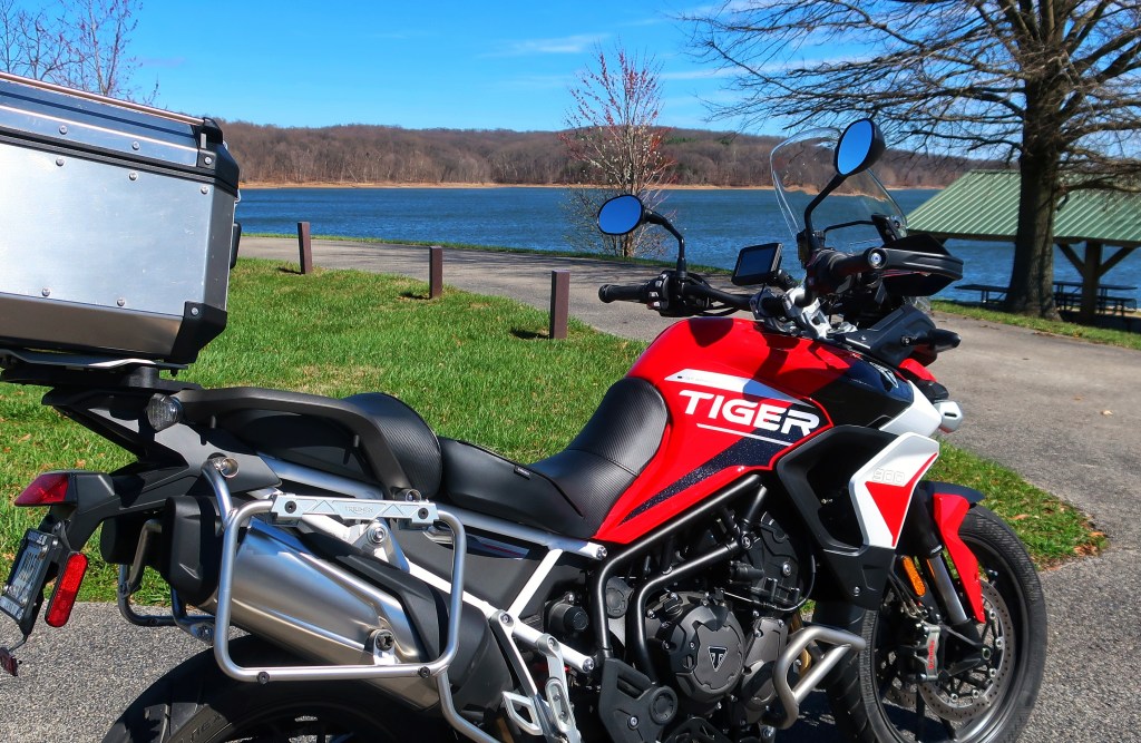
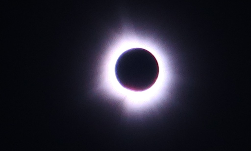
Hello everyone and welcome to 2024! Don and I are both doing well and looking forward to a new year of riding. I did buy myself a retirement/Christmas gift late December. I upgraded my old Tiger 800 to a 2024 Tiger 900 GT Aragon Edition with all the bells and whistles. I haven’t had a chance to put many miles on it yet, but the next 11 days should remedy that (which I’ll get to in a minute). Hope many of you had the chance to see the eclipse this week. Don, Dianne, Shelly, and I spent the day in French Lick Indiana at my mother’s for the event. It was spectacular. The difference between 99.9 percent coverage and totality was shocking. Try to make one if you get the chance.
Today, we are on our way to the big state of Texas for a few firsts for us. First up is the MotoGP race at the Circuit of the Americas track in Austin. Don and I have long talked about attending since it started in 2013. MotoGP is the Formula 1 equivalent of the motorcycle world. The pinnacle of two-wheeled racing. This is the only round of MotoGP series held in the U.S. Next stop will be the Texas Hill Country, famous for wildflowers and curvy roads. Then on to Big Bend National Park along the border in southwest Texas. This is supposed to be a spectacular area and we have dreamed about seeing it for many years. We hope to catch the Talimena Scenic Drive in Oklahoma and on through the Arkansas Ozarks on the way home. Midwest weather can be especially sketchy this time of year but we’re hoping for the best.
We left home in steady rain but ran out of it in about an hour. Temperatures dipped a bit but we eventually hit sunny skies and a lot of wind. The cross wind was the biggest challenge today. We are no strangers to wind as those of you who have followed this blog for a few years know. But between the higher speed limits and open country, Arkansas was rough. Covered about 600 miles today and holed up in Malvern Arkansas for the night.
Sorry, l didn’t take any pictures today to post. I’ll do better.
Arkansas is the only U.S. state that produces diamonds. In addition to hot springs, the state has over 600,000 acres of lakes.
I know we’re off to a slow start, but Big Bend should be spectacular so please stay tuned.
Don and I are both home safe and sound. We’re beat and the bikes are filthy. It wasn’t the trip we planned but a good trip nonetheless. And it turned out to be a worthwhile detour for Don and Aunt Marilyn. We’ll try again for Colorado in the next year or two.
For Sale: Like new Honda ST 1300, immaculate, gently ridden by 70 year old man, babied, always garaged, never seen rain.😁
Thanks all for following and sorry it was a repeat. Plus I didn’t have any fun and interesting facts to add since we didn’t end up at the places I researched. But hang in, we are trying to put together another epic multiple week trip in the future. We are off to our beloved Appalachian mountains of North Carolina in October and that will just about wrap up the good riding weather. Until next year.